Download
1 / 55
550 likes | 554 Views
This research project aims to evaluate the accuracy of digital road map databases to meet the requirements of road user charge systems. The goal is to recommend a cost-effective approach to improve the content and quality of GIS road maps, addressing various errors and minimizing limitations in GIS applications.

E N D
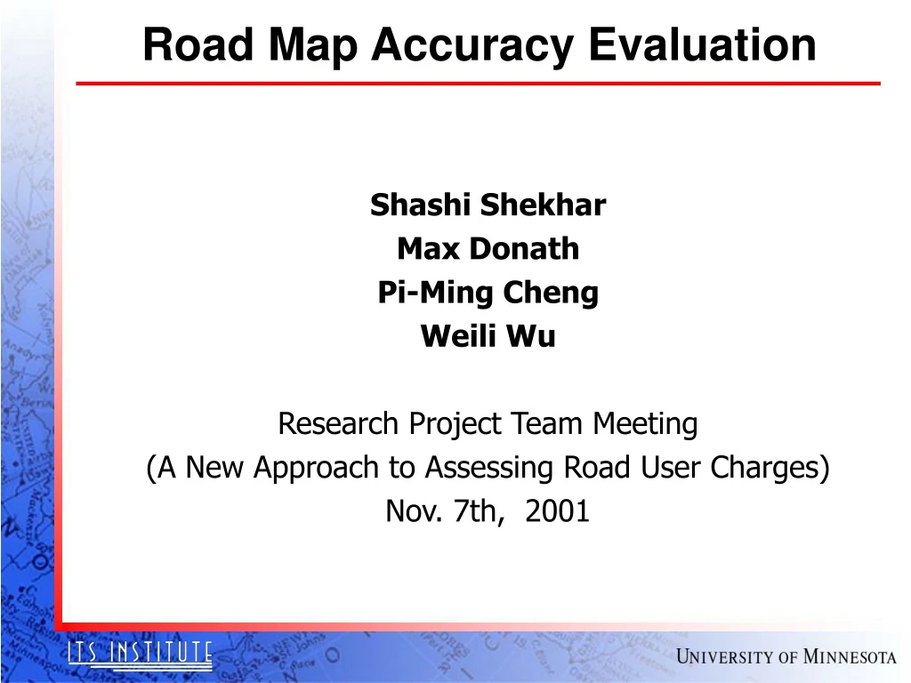
Road Map Accuracy Evaluation Shashi Shekhar Max Donath Pi-Ming Cheng Weili Wu Research Project Team Meeting (A New Approach to Assessing Road User Charges) Nov. 7th, 2001
Motivation • Evaluation of digital road map databases • To meet requirements of road user charge system: accuracy, coverage • Recommend a cost-effective approach • Develop the content and quality requirements • For digital GIS road maps • Each GIS dataset can contain various errors • Failure to control and manage error • Limit or invalidate GIS applications
Example Requirements • TIGER Accuracy Improvement Project (11/2/2001) • Target Date - 2010 • Goals: Correctly place a mobile GPS-equipped computer • On correct side of street 100 percent of the time • In correct relationship to legal boundaries 100 percent of time
Example Requirement 2 • Source: Forkenbrock, Hanley, Tech. Paper 4 (Nov. 2001), • GPS Accuracy Isues Related to the New Approach to Assessing Road User Charges • Applications: • Assessing road user charges • Congestion pricing, lane pricing • Roadmap wish list • Positions - lanes, roads • Attributes - classification, political jurisdiction • Accuracy wish-list • Positional accuracy - 1-2 meter for lanes, 30 meter for roads • Assumes - Road separation less than 30 m is rare. • “Can current GPS ... and GIS road files promise 30 m accuracy?”
Understanding Requirements • Which map accuracy? • Positional accuracy - horizontal, vertical • Other - attribute accuracy - not specified • What is positional accuracy (e.g. 30m) ? • Worst case => error is always < 30m • Statistical, e.g. median, 90th-percentile • What is the positional accuracy budget for roadmaps? • = Total positional accuracy budget - GPS accuracy budget • Less than 30 m • GPS accuracy depends on location, weather, … • Roadmap accuracy should be higher where GPS accuracy is lower!
Close Road Pair • Separation may be << 30 meter
Outline • Motivation • Background • Accuracy of Spatial Database • Related Work • Map accuracy standards • Accuracy Assessment Methodologies • Our Approach • Framework • Preliminary results • Challenges
Roadmap Sources • Sources for navigable digital road maps • Public sector • State: e.g., State DOT base map • Federal: TIGER file, USGS • Private • Navigable maps: Tele Atlas, NavTek, GDT, PC Miler • Cartographic: AAA, Rand McNally
Road Map Components • Position • latitude, longitude, altitude for intersections, shape points • center line for road segments • Attributes • Route attribute (name, type) • Topology • Route segment (direction, type, restrictions) • Routing attributes (intersections, turn restrictions) • Not widely available • position of lanes, political jurisdiction
Definitions • Accuracy • Closeness of estimates to true values • (or values accepted to be true) • the accuracy of the database may have little relationship to the accuracy of products computed from the database • Precision • number of decimal places (significant digits) in a measurement • Common practice: • round down 1 decimal place below measurement precision
Components of Map Accuracy • Source: Chrisman • “Spatial data are of limited accuracy, inaccurate to some degree, the important questions are: How to measure accuracy? How to track the way errors are propagated through GIS operations?” • Components of Data Quality: • positional accuracy • attribute accuracy • logical consistency • completeness • lineage
Positional Accuracy - Definition • The closeness of location (coordinates) information to the true position • Measures of positional accuracy • Paper map - one line width or 0.5 mm • About 12 m on 1:24,000, or 125 m on 1:250,000 maps • RMS error • 90th percentile, 95th percentile • Components of positional accuracy • Horizontal, Vertical
Framework to test positional accuracy • Compare with a reference of higher accuracy source • find a larger scale map • use the Global Positioning System (GPS) • use raw survey data • Use internal evidence • Indications of inaccuracy: • Unclosed polygons, lines which overshoot or undershoot junctions • A measure of positional accuracy: • The sizes of gaps, overshoots and undershoots • Compute accuracy from knowledge of the errors • By different sources, e.g • 1 mm in source document • 0.5 mm in map registration for digitizing • 0.2 mm in digitizing
Attribute Accuracy • The closeness of attribute values to their true value • Measures depend on nature of the data • measurement error for continuous attributes (surfaces) • e.g. elevation accurate to 1 m • categorical attributes such as classified polygons • gross errors, such as a polygon classified as A when it should have been B, • e.g. land use is shopping center instead of golf course • Framework to test attribute accuracy • Create a a misclassification matrix: • Ideally, all points lie on the diagonal of the matrix
Logical Consistency • Internal consistency of the data structure • Particularly applies to topological consistency • Examples: • Is the database consistent with its definitions? • If there are polygons, do they close? • Is there exactly one label within each polygon? • Are there nodes wherever arcs cross, or do arcs sometimes cross w/o forming nodes? • Do road-segments meet at intersections?
Completeness • The degree to which the data exhausts the universe of possible items • Up to date Vs. Complete • Examples: • Are all possible objects included within the database? • Does the digital map cover all new developed area?
Lineage • A record of the data sources and of the operations which created the database • Examples: • How was it digitized, from what documents? • When was the data collected? • What agency collected the data? • What steps were used to process the data?
Problem Definition: • Given: • A GIS roadmap dataset and a Gold Standard • Definition of accuracy • Find: Spatial Accuracy of the given GIS dataset • Objectives: Fair, reliable, tamper-proof, low cost • Constraints: Gold-standard accuracy is better than GIS dataset accuracy
Outline • Motivation • Background • Accuracy of Spatial Database • Related Work • Map accuracy standards • Accuracy Assessment Methodologies • Our Approach • Framework • Preliminary results • Challenges
Related Work • Standards • Interpreting Reported Accuracies • Tools and Methodologies
Accuracy Standards • 1947 US National Map Accuracy Standards (NMAS) • 90% of the tested points have errors < threshold • Threshold = 1/30 inch for scale > 1:20,000 • Threshold = 1/50 inch for scale < 1:20,000 • Q? "How far out are the 10%?" "Where are the 10%?" • e.g. all of the 10% point off by several inches and are in one road • Am. Soc. for Photogram. And Remote Sensing (ASPRS) • 3 different thresholds (class A, B, C) for each scales • Dozen scales or so • US National Standard for Spatial Data Accuracy (NSSDA) • 95 percent of points have errors < threshold • Relates to RMS error for normal distribution • British Standard • RMS error
Etak Accuracy Assessment • June 1999 Announcement (www.etak.com/News/newmap.html) • Claims: Conforms to National Map Accuracy Standards (NMAS) • 70% of US Population (1.6 Million miles) at 1:24,000 scale • Another 25% of US Population at 1:100,000 scale • Geo-coding - 98% match rate • Interpretation 1 • NMAS requires 90th percentile of error = 1/50 inch • 40 feet (12.2 meters) at 1:24,000 scale • 166 feet (51 meters) at 1:100,000 scale • Interpretation 2 • 70% population = Metropolitan areas • Another 25% population = Small towns • TIGER has 8.5 Million miles of roads • Roads corrected are about 1/5th of TIGER roads!
TIGER file Accuracy Assessment • http://www.census.gov/geo/www/tiger/ • Report: John S. Liadis, TIGER Operations Branch , Geography Division • Findings: • Tested 6800 points across 8 sites, multiple sources • Mean error = 281 feet (about 90 meters) • Median error = 166 feet (about 50 meters) • Errors vary across locations (median from 30m to 160m) • Errors vary across sources (median from 32m to 350m) • 90th percentile errors (NMAS) are much worse! • 110m - 400m across different sources
GPS TIGER Accuracy Assessment Tool • GPS TIGER Accuracy Analysis Tools (GTAAT) • Calculates the distance and azimuth difference • Between the GPS collected point and the equivalent TIGER point • Indicated Accuracy of some Popular Digital Map • Statistics approach • Visualization approach • Goals for TIGER Accuracy Improvement Project (11/2/2001) • Correctly place a mobile GPS-equipped computer • On correct side of street 100 percent of the time • In correct relationship to legal boundaries 100 percent of time
GPS Tracks Vs. Road Maps • Visualization Approach Tiger-based Map USGS Digital Map
GTAAT Report: GPS Data Cleaning • Post process collected GPS coordinates • Selective availability of the GPS signal • GPS satellite clock error • Ephemeris data error • Tropospheric delay • Unmodeled ionospheric delay • Differential corrections in post processing • Remove common error • Both the reference and remote receivers • Do not correct multi-path or receiver noise • Trimble’s Pathfinder Office 2.51 Software used • Require downloading data from a GPS base station • A local station is available
GTAAT: GPS Source/Operation Collected GPS anchor points by Sources or Update Operation (Red number: source code not used in the source-by-source analysis)
GTAAT: Ranking of road map quality • Median variance by source: • median distance difference of operations(or source) of GPS and TIGER feature
Accuracy Assessment in Road Map • GTAAT Statistics Approach • Test site: Windham County, VT (50025) • Result of distance by census
Accuracy Assessment in Road Map (2) • GTAAT Statistics Analysis: Site-by-Site Comparison • Test site: Maricopa County, AZ (04013) • Result of distance by tract
Limitation of Related Works • Limited to positional accuracy and lineage • Did not evaluate attribute accuracy, completeness • Position accuracy measure is limited • No separation of lateral and longitudinal error • lateral error affect road determination • longitudinal error may be administrative zone determination • Not scalabile to road network • Point to point comparison is limited and slow • Did not model GPS accuracy • GPS accuracy = f (location, weather)
Outline • Motivation • Background • Accuracy of Spatial Database • Related Work • Map accuracy standards • Accuracy Assessment Methodologies • Our Approach • Framework • Preliminary results • Challenges
Our Approach • Evaluate total system (GPS + roadmap) • Road classification accuracy • Evaluate road map component • Positional accuracy • Attribute accuracy
Road Classification • Garmin error circle on USA toposheet maps (Source: Garmin) • Risk of incorrect map matching
Road Classification Accuracy Road classification depends on: • Positional accuracy, Attribute accuracy, Completeness Road Classification Accuracy Measures: • Miles – misclassification • Number of road pair closer than threshold (30m) • Probability of mis-classifying road for a GPS reading
Methodology Digital road map data Gather gold Standard value (e.g., site field Survey, Aerial images) Assess mis- classification accuracy Statistical analysis Site selection for mis-classification accuracy Visualization tool
Positional Accuracy • Lateral accuracy • Definition: Perpendicular (RMS) distance from GPS reading to center line of road in road map. • Longitudinal accuracy • Definition: horizontal distance from GPS reading to corresponding Geodetic point. Comment: Lateral error is more important when closest road is parallel Longitudinal error is important for other case
Positional Accuracy Measures • Point-based: • Input – pairs of corresponding points on road map and gold standard • Output – RMS (distance between pairs) • Comment – scalability to large road networks; - need to stop GPS vehicles at geodetic points - expensive and dangerous • Line-string based: • Lateral error – RMS (shortest distance of GPS reading to center line of corresponding roads)
Methodology Digital road map data Site selection 1 Subsets of road maps Assess positional accuracy Statistical analysis Gather GPS track by driving vehicle GPS logs Visualization tools Overlay of road map and gold standard
Attribute Accuracy & Completeness • Interesting Attributes: • Economic attributes - administration zone(s), congestion zones • Route attribute - name, type, time restrictions • Route segment - direction, type (e.g. bridge), restrictions • Routing attributes - intersections, turn restrictions • Definition of Attribute Accuracy: • Pr[Value of an attribute for given road segment is correct] • Definition of Completeness: • Pr[a road’s segment is in digital map] • Pr[attribute value is not defined for a road segment] • Scope: • Small sample
Methodology Digital road map data Site selection for Attribute accuracy Gather Gold Standard values (e.g., site field Survey, aerial image) Assess attribute accuracy and completeness Statistical And visualization Site selection for completeness
Core Activities • Acquire digital road maps • Select test sites • Gather gold standard data for test site • GPS tracks, Surveys, etc. • Complete subsets of road maps for test sites • Compute accuracy measures • Statistical analysis • Visualization
Progress • Acquire digital road maps • Obtain Basemap (1997, 1999) from Mn/DOT • Purchasing two counties (Hennepin and St. Louis) from Etak/Tele Atlas • Gather gold standard data for test site • Acquired a sample GPS track from field survey • Visualization • Develop Java based map access software • Read digital map sources and GPS data • Display overlay of these two sources • Visualize error
Map Acquisition • Etak/Tele Atlas map for Twin Cities (7 county metropolitan area)
Example Test Site • Blue line = Highway 7 • Red Square = area of interest in next few slides • Western suburbs south of lake Minnetonka
JRG GPS tracks Vs. Roadmap GPS Track for Hwy 7 East Bound GPS Track for Hwy 7 West Bound
Trimble GPS tracks Vs. Roadmap GPS Track for Hwy 7 East Bound GPS Track for Hwy 7 West Bound
Comparing GPS tracks GPS Tracks for Hwy 7 East Bound GPS Tracks for Hwy 7 West Bound