Download
1 / 11
120 likes | 229 Views
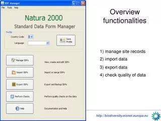
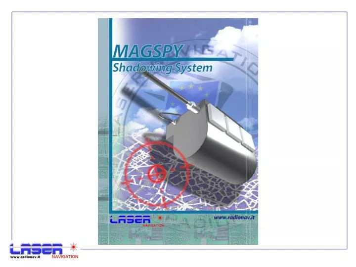
FUNCTIONALITIES. The Shadowing System is an Hardware and Software integrated system for the support to the shadowing activity and surveillance of men and vehicles.

E N D
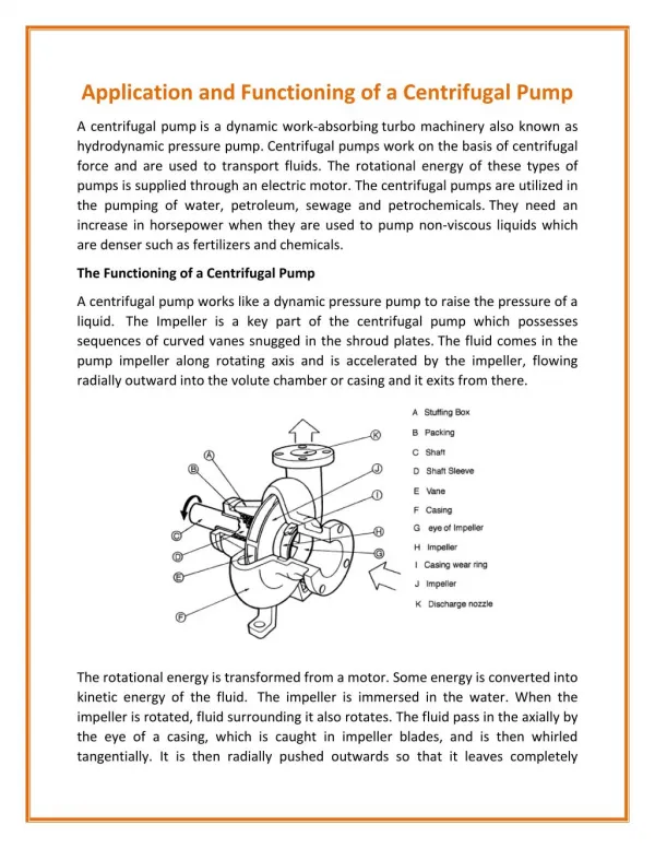
FUNCTIONALITIES The Shadowing System is an Hardware and Software integrated system for the support to the shadowing activity and surveillance of men and vehicles. It is based on the Mobile Operating Center installed on Notebook or Toughbook, on radio localization devices (Magnetic MiniEvolution – MAGSPY 2005 EVO) with integrated systems of communication and audio interception.
FUNCTIONALITIES The System allows: · to install MAGSPY outside the vehicle in discreet and express way · to know if vehicles are still or in movement · to know in real time the position of vehicle under surveillance · to unload historical position data recorded during the surveillance · to perform audio interceptions
FUNCTIONALITIES The device is made to resist to the atmospheric agents (extreme water, powder, temperatures, etc.) and to the mechanical solicitations. The power is independent and can guarantee up to 40 working days (according to the type of battery). The apparatus is equipped both with a coupling magnetic covering such to allow the express positioning under the vehicle or metallic buttonholes for implantation with band.
FUNCTIONALITIES • The Mobile Operating Center handles a database containing all information related to vehicles to be controlled. • The Application Software allows to select the vehicle and to perform the following activities: • Update Vehicle Position: MAGSPY is enquired in order to receive its real time position. • Shadowing: MAGSPY is enquired in order to receive its real time position every 5 seconds.
FUNCTIONALITIES • History log: MAGSPY stores on board all the GPS positions; it is always possible to unload those positions and to analyze past situations. • The positions can be limited in an arc of time. • Vehicle trace: allows to show on map the trace of the selected vehicle. • Map view: allows to have the vehicle always in the center of the map.
FUNCTIONALITIES • Detailed Maps: the system allows to show the vehicle position on different detail degree (zoom in - zoom out).
FUNCTIONALITIES • Self localization: allows to have on map the own position in order to compare it with the vehicle position. • Find Address: The user can ask the system to know the right position of a road, site or other, just supplying the address (State, road, city, province) or objective name (to supply how many relevant data to the target like for example the hotel name and the citt in which it is located).
3D MAPS The system was realized so as to be able to support also the three-dimensional cartography. All the functionality provided by the system on 2D maps, already described, stay valid also on 3D maps. The three-dimensional cartography is realized starting from the data of the territory obtained from the aerophotogrametry and the related DTM.
OPERATING FEATURES Voltage on Kms Voltage on Time Voltage on Nr of Logs
www.radionav.it Via Matteotti, 34 24054 Calcio (BG) Italy Tel. 0363/968520 Fax. 0363/969244 info@radionav.it