Download
1 / 50
510 likes | 723 Views
Weather. Advanced World Geography. Weather and Climate. What is the difference between climate and weather?. Climate . Tropical Moist Climates (A) includes tropical wet and tropical dry climates Dry Climates (B) dry arid and dry semiarid Moist Subtropical Mid-Latitude Climates (C)

E N D
Weather Advanced World Geography
Weather and Climate • What is the difference between climate and weather?
Climate • Tropical Moist Climates (A) • includes tropical wet and tropical dry climates • Dry Climates (B) • dry arid and dry semiarid • Moist Subtropical Mid-Latitude Climates (C) • Includes humid subtropical, Mediterranean, and marine • Moist Continental Mid-latitude Climates (D) • Includes dry winters, dry summers, wet all seasons. • Polar Climates (E) • Includes polar tundra and polar ice caps
MS Climate • MS is in a humid subtropical climate zone. • The humid subtropical climate is noted for its warm summer months, and relatively mild winters. Summer temperatures average between 21o (69.8oF) to 26o C (78.8oF) and no winter month has an average temperature below 0oC (32oF). • Precipitation is evenly spaced throughout the year.
Seasons • Why do we have seasons?
Seasons • SolsticesThe solstices are days when the sun reaches its farthest northern and southern declinations. The winter solstice occurs on December 21 or 22 and marks the beginning of winter (this is the shortest day of the year). The summer solstice occurs on June 21 and marks the beginning of summer (this is the longest day of the year). • EquinoxesEquinoxes are days in which day and night are of equal duration. The two yearly equinoxes occur when the sun crosses the celestial equator. • The vernal equinox occurs in late March (this is the beginning of spring in the Northern Hemisphere and the beginning of fall in the Southern Hemisphere); the autumnal equinox occurs in late September (this is the beginning of fall in the Northern Hemisphere and the beginning of spring in the Southern Hemisphere).
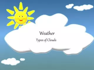
Clouds • Cumulus • Stratus • Cirrus • Nimbus Cumulus Cirrus Stratus Nimbus
Precipitation Rain and Hail • Rain and Hail Hail is a large frozen raindrop produced by intense thunderstorms, where snow and rain can coexist in the central updraft. As the snowflakes fall, liquid water freezes onto them forming ice pellets that will continue to grow as more and more droplets are accumulated. Upon reaching the bottom of the cloud, some of the ice pellets are carried by the updraft back up to the top of the storm. • Freezing Rain • Sleet
Precipitation - Snow • Snow Snowflakes are simply aggregates of ice crystals that collect to each other as they fall toward the surface. The diagram below shows a typical temperature profile for snow with the red line indicating the atmosphere's temperature at any given altitude. The vertical line in the center of the diagram is the freezing line. Temperatures to the left of this line are below freezing, while temperatures to the right are above freezing.
Pressure • Atmospheric Pressure force exerted by the weight of the air Atmospheric pressure is defined as the force per unit area exerted against a surface by the weight of the air above that surface. In the diagram below, the pressure at point "X" increases as the weight of the air above it increases. The same can be said about decreasing pressure, where the pressure at point "X" decreases if the weight of the air above it also decreases. • Thinking in terms of air molecules, if the number of air molecules above a surface increases, there are more molecules to exert a force on that surface and consequently, the pressure increases. The opposite is also true, where a reduction in the number of air molecules above a surface will result in a decrease in pressure. Atmospheric pressure is measured with an instrument called a "barometer", which is why atmospheric pressure is also referred to as barometric pressure.
Air Masses • An air mass is a large body of air that has similar temperature and moisture properties throughout. The best source regions for air masses are large flat areas where air can be stagnant long enough to take on the characteristics of the surface below.
Fronts • A front is defined as the transition zone between two air masses of different density. Fronts extend not only in the horizontal direction, but in the vertical as well. • Types of fronts • Cold Front • Leading edge of colder air replacing warm air. • Warm Front • Leading edge of warmer air replacing cooler air. • Stationary Front • A front that is not moving • Occluded Front • When a cold front catches up with a warm front. • Dry Line • Separates a moist air mass with a dry air mass.
Cold Fronts • Generally move NW to SE • A cold front is represented by a solid line with triangles along the front pointing towards the warmer air and in the direction of movement.
Warm Fronts • Warm fronts generally move from southwest to northeast and the air behind a warm front is warmer and more moist than the air ahead of it. When a warm front passes through, the air becomes noticeably warmer and more humid than it was before.
Occluded Fronts • Is usually accompanied with strong storms.
Dry Line Front • States like Texas, New Mexico, Oklahoma, Kansas, and Nebraska frequently experience dry lines in the spring and summer. Dry lines are extremely rare east of the Mississippi River.
El Nino • Every three to seven years, an El Niño event may last for many months, having significant economic and atmospheric consequences worldwide. El Nino is the presence of warmer water temperatures along the equator in the Pacific Ocean. During the past forty years, ten of these major El Niño events have been recorded, the worst of which occurred in 1997-1998.
El Nino for us • El Nino brings excessive rain in the winter months for us and also an increase in severe weather. • IN the Summer months El Nino decreases but does not eliminate the threat of hurricane activity in the Gulf.
La Nina • La Nina is opposite of El Nino and is the presence of cooler water temperatures along the equator.
Hurricanes • Hurricanes are tropical cyclones with winds that exceed 64 knots (74 mi/hr) and circulate counter-clockwise about their centers in the Northern Hemisphere (clockwise in the Southern Hemisphere). • Hurricanes are formed from simple complexes of thunderstorms. However, these thunderstorms can only grow to hurricane strength with cooperation from both the ocean and the atmosphere. First of all, the ocean water itself must be warmer than 26.5 degrees Celsius (81°F). The heat and moisture from this warm water is ultimately the source of energy for hurricanes. Hurricanes will weaken rapidly when they travel over land or colder ocean waters -- locations with insufficient heat and/or moisture.
Structure of a Hurricane • Hurricanes are Earth's strongest tropical cyclones. A distinctive feature seen on many hurricanes and are unique to them is the dark spot found in the middle of the hurricane. This is called the eye. Surrounding the eye is the region of most intense winds and rainfall called the eye wall. Large bands of clouds and precipitation spiral from the eye wall and are thusly called spiral rain bands. • They are measured by their wind speed on the Saffir-Simpson scale with 1 being the weakest and 5 being the strongest.
Names • Hurricane-like storms are called by different names in the different regions of the world. For example, the name "hurricane" is given to systems that develop over the Atlantic or the eastern Pacific Oceans. In the western North Pacific and Philippines, these systems are called "typhoons" while in the Indian and South Pacific Ocean, they are called "cyclones".
Past Hurricanes • Galveston Hurricane (1900)- The deadliest natural disaster in United States History, this Category Four Hurricane moved through Cuba into the Gulf of Mexico before slamming ashore in Galveston, Texas on September 8, 1900 killing 6,000 people.
Past Hurricanes • Camille (1969) - Was the last Category Five Hurricane to make landfall over the United States before Hurricane Andrew did in August, 1992. Hurricane Camille landfall over Gulfport, Mississippi on August 18, 1969 with winds of 180 mph, and a record storm surge of 24.3 feet. It left about 250 people dead from Louisiana to Virginia, and was responsible for approximately $1.421 billion dollars in damage.
Past Hurricanes • Andrew (1992)- This is probably the most recent memorable hurricanes in modern history. After struggling to develop in the Atlantic, this Category Five Hurricane rapidly developed over the Gulf Stream, and devastated South Florida with 165 mph winds on August 24, 1992. It was the costliest natural disaster on record with some $30 billion dollars in damage.
Past Hurricanes • Katrina (2005) became the fourth most powerful hurricane of all time ahead of Camille and behind Hurricane Gilbert (1988), the Labor Day of Hurricane of 1935, and Hurricane Allen (1980). After coming ashore as a Category One Hurricane in South Florida, Katrina struck two more times along the Gulf Coast. First in Buras, Louisiana with 140 mph winds, and then near Bay St. Louis, Mississippi with 135 mph winds. It created a 27 foot storm surge in Gulfport, Mississippi and a 22 foot storm surge in Bay St. Louis. Winds as high as 90 mph were felt as far east as Mobile, Alabama, which experienced its worst flooding in 90 years. To make matters worse, part of an oil rig broke away in Mobile Bay and hit a nearby causeway possibly causing damage there. Waves as high as 48 feet happened offshore in the Gulf of Mexico. Some 50 people were killed in coastal Mississippi including 30 in an apartment complex in Biloxi. Katrina even ripped off part of the roof of the Louisiana Superdome, where 10,000 people were staying in the facility, which was being used as a shelter of last resort. Extensive flooding occurred in New Orleans, which was actually spared the brunt of the storm. The 9th ward in the Crescent City was underwater as well as 80 percent of the city. People fled to their attics to escape drowning and some were rescued by helicopters and boats. So far, the latest death toll is at 1,833 (Louisiana-1582, Mississippi-170, Florida-30, Alabama-48, Georgia-2, Tennessee-1 with damage estimates now are up to $81 billion. Experts fear that the total cost for the storm could be $200 billion dollars, which would make Katrina the costliest hurricane and natural disaster in United States History.
Past Hurricanes • Wilma (2005)- the barometric pressure in the storm dropped some 102 mb to an all time low for pressure in the Atlantic Basin and made its first landfall over Cozumel, Mexico on Friday, October 21, 2005
Forecasting temperature • During the day, the earth is heated by the sun. If skies are clear, more heat reaches the earth's surface (as in the diagram below). This leads to warmer temperatures.
Forecasting temperature • However, if skies are cloudy, some of the sun's rays are reflected off the cloud droplets back into space. Therefore, less of the sun's energy is able to reach the earth's surface, which causes the earth to heat up more slowly. This leads to cooler temperatures.
Forecasting temperature • At night cloud cover has the opposite effect. If skies are clear, heat emitted from the earth's surface freely escapes into space, resulting in colder temperatures.
Forecasting temperature • However, if clouds are present, some of the heat emitted from the earth's surface is trapped by the clouds and reemitted back towards the earth. As a result, temperatures decrease more slowly than if the skies were clear.
Forecasting Precipitation • If there is sufficient moisture in the air and a forcing mechanism like a cold front (for example) is approaching the area, then there is an increased probability that precipitation will occur. • Clouds and precipitation are formed by the upward motion of air. Therefore, there must be a mechanism present to lift the air. Fronts often serve as such a mechanism. Air on one side of the front typically blows in a different direction from the wind on the other side, causing the air to converge, or pile up right along the frontal surface.
What? And How? • How is lighting formed? • How are tornadoes formed? • Parts of a thunderstorm • Updrafts/Downdrafts • Wind shear • Outflow Phenomena • Wall Clouds • Types of thunderstorms – • Single cell Storms • Multicell Cluster Storms • Mulitcell Line Storms • Supercells
Weatherman • Based on the information previously discussed, predict what the weather will be like based on the information given.
Scenario #1 • The date is October 3. The barometric pressure is steady at 30. The daytime temp is 82 degrees and it is partly cloudy. Estimate what the temperature will be for the night.
Scenario #2 • It was 72 degrees last night and cloudy. A strong cold front is approaching from the NW. What should happen to the barometric pressure? Will there be any precipitation?
Scenario #3 • It was 95 degrees yesterday and 73 last night. There is not a cloud in sight and no fronts moving in. What will the next day and night’s weather be like?
Scenario #4 • A cold front is stalled over Eastern Texas. A hurricane is in the central part of the Gulf of Mexico traveling North, Northwest. Is the hurricane likely to hit the states of Louisiana or Mississippi. Why or Why not?
Scenario #5 • In late December a warm front enters MS. The temps before the front were around 50 in the daytime and 35s during the night. What will be the approximate temps after the front moves through?