Download
1 / 34
340 likes | 430 Views
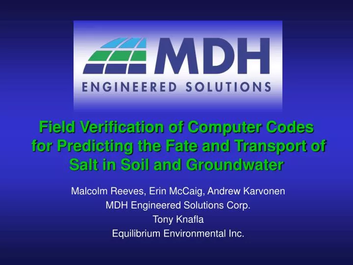
Field Verification of Computer Codes for Predicting the Fate and Transport of Salt in Soil and Groundwater. Malcolm Reeves, Erin McCaig, Andrew Karvonen MDH Engineered Solutions Corp. Tony Knafla Equilibrium Environmental Inc. R & D Providers. Alberta Environment. City of Calgary.

E N D
Field Verification of Computer Codes for Predicting the Fate and Transport of Salt in Soil and Groundwater Malcolm Reeves, Erin McCaig, Andrew Karvonen MDH Engineered Solutions Corp. Tony Knafla Equilibrium Environmental Inc.
R & D Providers Alberta Environment City of Calgary Petroleum Technology Alliance of Canada
Significance to Industry • Why model the fate and transport of salt? • to integrate data from diverse sources • to highlight data deficiencies • to test conceptual hypotheses • to quantify “unknowns” • to establish probable history • to predict the future from the past • to assess alternative remedial measures
Project Overview • The project was conducted by MDH Engineered Solutions Corp and involved two successive phases between October 2003 and March 2004 • Field Studies • Collected and supplemented data from four diverse field sites • Numerical Model Studies • Verified ability recommended computer codes to predict the behaviour of salt at four diverse field sites
Sources • Model contaminant sources M(x,t) = Q(x,t).C(x,t) can be entered into models in different ways, for example: • Boundary Conditions • Specified mass flux on a boundary • Specified concentration on a boundary • Initial Conditions • Specified spatial distribution of total mass at some time • Specified spatial distribution of concentration at some time • Observed data can be used to : • specify an initial condition for forward modelling • predict an initial condition by history matching • Help determine (calibrate) material properties • ............... • Ideally, model verification requires sites where material properties and sources are fully known in time and space.
Instantaneous Sources Diffusion Advection & Diffusion/Dispersion t2 to t1 to t1 t2
Ambiguous Sources Same Source Mass Same Source Distribution Different Material Properties Different Diffusion Time to t1 t2 to = Same Concentration Profile
Ambiguous Sources Same Material Properties Same Source Mass Different Source Distribution Different Diffusion Time t1 to to t2 = Same Concentration Profile
Ambiguity Explained s = √ (D/2t) There is an infinity of choices for D and t for the same distribution parameter s sA = √ (D/2tA) • = √ (D/2t) Initial source distribution at time tA with the distribution parameter sA will give distribution parameter s after time (t –tA), identical to a uniform source after time t.
Field Sites • Site A Heavy oil sludge soil augmentation trial • Sandy soil • Deep naturally-attenuated saturated zone plume • Site B Drilling mud disposal trial • Clay soil • Small shallow unsaturated zone plume • Site C Pipeline break • Clay soil • Small shallow unsaturated zone plume • Site D Road salt storage • Silty sand and sandstone bedrock • Shallow unsaturated and deep saturated zone plumes
Numerical Codes • The ability of three public-domain codes to model the four sites was verified • CHEMFLO • Oklahoma Agricultural Experiment Station (OAES) • 1D FDM unsaturated/saturated flow and transport • Sorption reactions • UNSATCHEM • United States Salinity Laboratory (USSL) • 1D FEM unsaturated/saturated flow and transport • Ion exchange, sorption reactions • VS2DTI • United Sates Geological Survey (USGS) • 2D FDM unsaturated/saturated flow and transport • Ion exchange, sorption reactions • Also included for continuity with earlier work • LEACHM • J.Huston (researcher) • 1D FDM unsaturated flow and transport • Ion exchange, sorption reactions
0 m 100 m Scale 1:1000 Site C: Pipeline Break Site Plan Pipeline Excavation Boundary to 2.0 mbgs BH 5, MW 03-5 MW 02-3A BH 02-1 BH 02-2 BH 6, MW 03-6 BH 1 MW 02-2A (destroyed) BH 8, MW 03-8C BH 8, MW 03-8B BH 8, MW 03-8A Estimated Impact Area BH 02-1A BH 02-1B BH 7, MW 03-7A BH 4, MW 03-4
Clay Till Ks= 3x10⁻⁸ m/s Site C: Pipeline Break Problem Infiltration = 2 mm/yr • Models Used: • UNSATCHEM • CHEMFLO • LEACHM 0 mbgs Instantaneous Applied Source = 70 g/L Chloride (1715 kg) Silty Clay Ks= 8x10⁻⁸ m/s 2.5 mbgs Sand Ks= 1x10⁻⁵ m/s 3.5 mbgs Water Table at 3.6 mbgs 10 mbgs Constant Pressure Head = 6.4 m
Site C: Pipeline Break Results 0 mbgs 17.0 70 g/L Chloride 17.0 Silty Clay 17.2 17.1 2.5 mbgs 11.8 Sand 3.5 mbgs 18 10 5 15 0 Chloride Concentration (g/L) Time = 2002 Clay Till BH1 BH-02-02 LEACHM Result UNSATCHEM Result CHEMFLO Result 10 mbgs
Site C: Pipeline Break Results 0 mbgs 70 g/L Chloride Silty Clay 3.3 3.3 2.5 mbgs 4.4 Sand 3.5 mbgs BH8 UNSATCHEM Result Clay Till CHEMFLO Result 10.0 5.0 2.5 7.5 0 Chloride Concentration (g/L) Time = 2003 10 mbgs
Site C: Pipeline Break Discussion • Site C is a shallow site in a clay soil • The source release is recent (4 years) • Little movement has occurred • Model match is precise and easy to obtain • BUT…… • Source term is unconstrained • Solution is highly ambiguous • Any predictions likely of low reliability
Site B: Drilling Mud Site Plan Type of Chloride Application Application Rate (kg/ha) KCl 1 0 2 500 3 1000 4 2000 5 4000 NaCl 6 0 7 350 8 700 9 1400 10 2800 Boreholes used to verify model
Water Table at 16 mbgs Silty Till Ks= 4x10⁻⁹ m/s Site B: Drilling Mud Problem Infiltration = 20 mm/yr • Models Used: • UNSATCHEM • CHEMFLO • LEACHM 0 mbgs Applied Source = 9.7 g/L Chloride 3400 kg/ha 20 mbgs Constant Pressure Head = 4.0 m
290 280 Silty Till Ks= 4x10⁻⁹ m/s M413-K M413-J M413-L M413-D UNSATCHEM Result LEACHM Result Site B: Drilling Mud Results 9.7 g/L Chloride 85 270 0 mbgs 370 160 5 mbgs 0 100 200 400 300 10 mbgs Chloride Concentration (mg/L) 15 mbgs 20 mbgs
Site B: Drilling Mud Discussion • Site B is a shallow site in a clay soil • The source release is relatively old (16 years) • Relatively little movement has occurred • Present day data is scattered • Model match is not exact and difficult to obtain • BUT…….. • Source term is reasonably well constrained • Lateral dilution affects 1D models in long term • History match should “over predict” peak concentration • 1D model is inherently conservative over time • Predictions likely upper bound estimates
Site A: Heavy Oil Sludge Site Plan Topographic Low M413-20 To Hwy #16 M413-19 Bush M413-24 M413-16 M413-22 Bush Original Boreholes M413-7 2004 Boreholes M413-2 CC M413-5 FC Fallow Crop CC Continuous Crop M413-15 FC CC M413-1 0 m 100 m Bush Scale 1:3000
Water Table at 3.2 mbgs Sand Till Ks= 8x10⁻⁴ m/s Ks= 2x10⁻⁸ m/s Site A: Heavy Oil Sludge Problem Applied Source = 220 g/L Chloride for 3 months • Model Used: • VS2DTI Infiltration = 12 mm/y Infiltration = 12 mm/y 0 mbgs Infiltration = 2 mm/y Silt Ks= 1x10⁻⁶ m/s Direction of Groundwater Flow Seepage Face 5 mbgs Total Head = - 3.2 m No Flow Boundary 10 mbgs 14 mbgs 680 m No Flow Boundary 0 m
Moisture Content Pressure Head Saturation Darcy Flux Site A: Heavy Oil Sludge Model
1 year 5 years 10 years 15 years Site A: Heavy Oil Sludge Results
Site A: Heavy Oil Sludge Results Applied Source = 220 g/L Chloride for 3 months 18 years Seepage Face
Site A: Heavy Oil Sludge Discussion • Site A is a relatively deep site in a sandy soil • The source release is relatively old (18 years) • Much movement has occurred • Present day data is ambiguous • 2D saturated/unsaturated model needed • Model match is not exact and difficult to obtain • BUT…….. • Source term is reasonably well constrained • Model simulation is plausible • Results are consistent with site data
0 m 100 m Scale 1:2000 Site D: Road Salt Storage Site Plan Stockpile Aggregate with NaCl 1 1 2 Silo with Pure NaCl Salt Storage Area 2 117 St NW Main Building Stockpile Aggregate with NaCl & CaCl 3 3 Bus Parking & Storage Area Retention Pond Parking Area Bearspaw Dam Road Infiltration Gallery Canadian Pacific Rail Line Bow River Bushes
Sandstone Shale Ks= 1.25 x10⁻⁹m/s Ks= 2.5x10⁻⁶ m/s Site D: Road Salt Storage Problem Applied Source = 220 g/L Chloride Annually for 2 months • Model Used: • VS2DTI Pressure Head = 0 m Infiltration = 20 mm/yr 0 mbgs Silty Sand Ks= 5.0 x10⁻⁶ m/s Water Table at 6.5 mbgs 8.5 mbgs Pressure Head = 0 m 13.5 mbgs No Flow Boundary Total Head = - 6.5 m 22 mbgs No Flow Boundary 334 m 0 m
Moisture Content Pressure Head Darcy Flux Saturation Site D: Road Salt Storage Results
5 years 1 year 46 years 19 years Site D: Road Salt Storage Results
Site D: Road Salt Storage Discussion • Site D is a relatively deep site in a sandy soil • The source release is relatively old (25+ years) • Much movement has occurred • Present day data is clear at discharge point • 2D saturated/unsaturated model needed • Model match is not exact and difficult to obtain • BUT…….. • Source term is reasonably well constrained • Model simulation is plausible • Results are consistent with site data
Conclusions • Model results mimic observed data using information from detailed site investigations • CHEMFLO, UNSATCHEM, VS2DTI performed as expected and were verified at three sites • The pipeline-break site could not be used for verification but the modelling helped constrain the probable mass spilled • Recent shallow spills are easy to match with models but predictive capability is likely limited • The verification study suggested that reduced data sets would make model conceptualization much less reliable • Modelling provided a powerful interpretive and predictive tool but is not a substitute for high-quality, site-specific data
Acknowledgements • Alberta Environment • PTAC Soil Salinity Working Group • Special thanks to: • Les Henry, Professor Emeritus, Soil Science, U of S • Dan Bulat, Envirotech Engineering Inc. • Roxanne Pauls, MDH Engineered Solutions Corp
Thank you for your attention March, 2005