Download
1 / 20
200 likes | 370 Views
Using Geographic Information Systems and the World Wide Web for Interactive Transit Trip Itinerary Planning. Brian Smith Center for Transportation Studies University of Virginia. Presentation Outline. Importance of Transit Information Traditional Approaches Itinerary Planning Functions

E N D
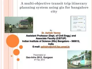
Using Geographic Information Systems and the World Wide Web for Interactive Transit Trip Itinerary Planning Brian Smith Center for Transportation Studies University of Virginia
Presentation Outline • Importance of Transit Information • Traditional Approaches • Itinerary Planning Functions • Design Case Study • Lessons Learned • Conclusions
Transit Information • Markets the system • Facilitates system use • Information must be: • accessible • easy to use • “attractive” (perceptions)
Route/Schedule Information • Fundamental • Traditional approaches • Printed Brochures • Telephone Service
Printed Brochures • Strengths • Portable • Graphic • Little staff support required • Weaknesses • No itinerary selection support • Static
Telephone Service • Strengths • Interactive • Direct itinerary selection support • Weaknesses • Cost • Availability (geographic and temporal) • No graphics
Trip Itinerary Planning • Relatively complex process • Printed Brochures • Search must be completed by customer • Telephone Service • Verbal results only • Key Decisions • Spatial • Temporal
Spatial Decisions • Determine set of stops accessible from origin • Distance • Impediments • Determine set of stops accessible from destination • What combinations are feasible given route structure?
Temporal Decisions • Multiobjective • Preferred time of departure • Preferred time of arrival • Minimize total trip time • “Special” service adds to complexity • Peak “express” service • Weekend schedules
Problem Formulation Minimimze: Total Trip Time Subject To: Spatial Constraints Temporal Constraints System Constraints
Geographic Information Systems • Tool that supports the processing of spatial data into information. DeMers • Traditionally used for planning applications in public transportation • Key Features • Spatial analysis (buffers, overlays, etc.) • Integration with database management system
World Wide Web • Global information distribution • Unprecedented growth • High degree of interactivity • Flexibility • Graphical user interface
GIS & WWW • Until recently, little to no integration • New products allow the use of the WWW as the “user interface” to GIS • Current applications are relatively simple • Serving static maps • Limited degree of interactivity
Design Case Study -- Pentran • Prototype trip itinerary planner accessible via WWW. • Primary software tools: • VisualBasic • MapObjects (Internet Map Server) • Access • Pentran drove requirements development
Development Approach • Traditional public transportation GIS applications use “scientific discovery” method. • Transit trip itinerary planner required a structured software development approach • Waterfall • Rapid prototyping
Prototype Design • Rapid prototyping • Allows for early determination if software tools support performance requirements • Tangible early results • Study team is nearing the end of the process • Current design document www.people.virginia.edu/~rbs5t/bus/default.htm
Lessons Learned • Detailed design is critical • Database structure importance • Design for maintenance
Conclusion • GIS/WWW software can support time-critical public transportation operations applications. • Requires structured software development approach • Potential to provide a very useful trip itinerary planning tool