Download
1 / 11

E N D
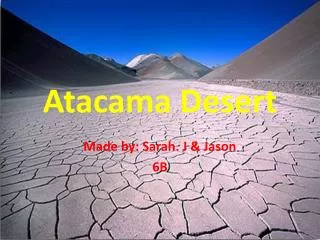
DESIERTO DE ATACAMA • The Atacama Desert of northern Chile is the world's second driest region (icy Antarctica is first). Although the Tropic of Capricorn passes through the region, the Atacama desert lies in the rain shadow of Chile's Coast Range, which squeezes out the moisture from the atmosphere. • The desert is completely barren and while most areas only receive moisture from an occasional fog or a shower every few decades, the rain gauge at Calama has never recorded any measurable precipitation. The Atacama is a high (most elevations are over 8000 feet) and cold desert, average temperatures range from 0° to 25° Celsius (32° to 75° F).
DESIERTO DE ATACAMA • Chile's leading export of the nineteenth century was nitrate which came from mines in the Atacama Desert. Since the beginning of the twentieth century, when synthetic nitrates began to be produced, the Atacama Desert became responsible for Chile's current leading export, copper. Copper is mined in the eastern portion of the country, lying near the Argentina border. • Population in the Atacama Desert is severely limited. Settlements are limited to oases and mining towns. Water was once shipped to mining towns via mules and barrels but now arrives via aqueduct. • Flora and fauna are sparse in this driest of dry regions that serves to provide its country with valuable mineral resources.
POR QUÉ ATACAMA ES UN DESIERTO • Por la subsidencia causada por la corriente fría de Humbolt, que recorre la costa del Norte de Chile y Perú. Toda esta zona costera es deficitaria en precipitaciones • Porque en le Este los Andes actúan como barrera a la penetración de los frentes de la Patagonia • Porque está en el límite de la zona tropical Sur y la temperatura no favorece la convección