Download
1 / 43
440 likes | 556 Views
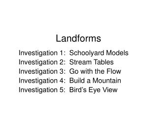
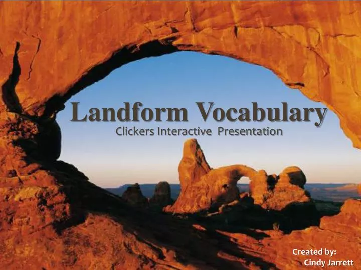
Landforms Vocabulary. Landform Vocabulary. Clickers Interactive Presentation. Clicker Presentation. Created by: Cindy Jarrett. Created by: Cindy Jarrett. Plate Gravity Erosion Deposition.

E N D
Landforms Vocabulary Landform Vocabulary Clickers Interactive Presentation Clicker Presentation Created by: Cindy Jarrett Created by: Cindy Jarrett
Plate • Gravity • Erosion • Deposition What Wears away earth materials by water, wind, or ice? Plants and trees along the river bank help protect the bank from this… 0 of 30
Ramp • Interval • Hill • Slope What is often used to describe the measurement of the steepness, incline, gradient, or grade of a straight line?The higher the value indicates a steeper incline. 0 of 30
Meandering Stream • Gravity • Precipitation • Floodplains What causes water to flow from higher places to lower places on the earth and in the stream table models? 0 of 30
Sand grains knocking the paint off of beach houses, and a Farmer’s rich topsoil being blow away are two good examples of… • Sand dunes • Wind Erosion • Deposition • Water Erosion 0 of 30
Ice Erosion • Moraines • Frozen Precipitation • Wind Erosion What is Water freezing and expanding (Ice) breaking rocks into soil ? 0 of 30
Mesa • River • Levee • Valley a low area between hills and mountains, where a stream often flows. 0 of 30
Mesa • Mountain • Moraine • Canyon a land mass that projects well above its surroundings; higher than a hill. 0 of 30
Deposition • Sediment • Erosion • Gravity The process by which eroded materials settle out in another place is called... 0 of 30
Mass movement • Sediment • Weathering • Deposition The process of breaking rock into soil, sand, and other tiny pieces is… 0 of 30
Stream bed • Moraine • Levee • Delta A fan shaped deposit of earth materials at the mouth of a stream. These are created by deposition. 0 of 30
Tsunami • Earthquake • Delta • Mass Movement The downhill movement of rock and soil because of Gravity is called… 0 of 30
Meandering Stream • Tributary • Stream bed • Alluvial Fan A curve or loop in a river or stream, where erosion on one bank and deposits on the other bank make big curves in the riverbed. 0 of 30
Levee • Dam • Algae bloom • Hydroelectric plant These are designed to hold back water so the river will not flood its banks. They provide places for people to boat, swim, and fish in the lake. In some cases they can provide electricity for a town. 0 of 30
Crust • Core • Mantle • Magma the thin, outer layer of Earth is called... 0 of 30
Crust • Core • Mantle • Magma The layer of rock beneath Earth’s crust. 0 of 30
Crust • Magma • Mantle • Core The center of the earth. 0 of 30
Resource Map • Elevation Map • Contour Interval Map • Political Map The vertical distance between contour lines on this type of Map is the contour interval. 0 of 30
Tributary • Mouth • Channel • Meandering stream A section of a stream flowing into a larger stream; A branch that flows into the main stream. 0 of 30
Basin • Plate • Canyon • Mountain a V-shaped gorge with steep sides eroded by a stream. These are created by erosion. One of the largest and oldest is located in Arizona. 0 of 30
Deltas • Stream bed • Crust • Fossils The substrate of the stream channel between the ordinary high water marks. The substrate may be bedrock or inorganic particles that range in size. 0 of 30
1. Fault 2. Plate 3. Mantle 4. Core a break or place where piecesof Earth’s crust move. 0 of 30
Volcano • Pangaea • Landforms • Plates The rigid blocks of crust and upper mantle block. 0 of 30
Sedimentary • Magma • Igneous • Metamorphic A hot, soft rock from Earth’s lower mantle. 0 of 30
Volcano • Grand Canyon • Alluvial Fan • Mesa A mountain formed by lava and ash. 0 of 30
Theory of Relativity • Mass Movement • Continental Drift • Kinetic Motion A theory of how Earth’s continents move over it’s surface. 0 of 30
Fossil • Pangaea • Magma • Obsidian The remains or traces of past life found in sedimentary rock. 0 of 30
Fossils • Mantle • Bedrock • Pangaea A super continent containing all of Earth’s land and existed about 225 million years ago. 0 of 30
Waterfall • Natural Springs • Tributary • Meandering stream A place where groundwater flows to the surface and issues freely from the ground. 0 of 30
Elevation Map • Political Map • Contour Interval map • Resource Map A map that indicates the elevation – using birds eye view and contour lines. 0 of 30
Volcano • Mountain • Canyon • Mesa an isolated, broad, flat-topped hill having at least one steep cliff. 0 of 30
Delta • Alluvial Fan • Channel • Levee a fan-shaped deposit of earth materials formed where a stream flows from a steep slope onto flatter land. 0 of 30
Sediment • Deposition • Sand dunes • Mesa A hill or ridge of wind-blown sand. 0 of 30
Magma • Sediments • Deposition • Fossils These are eroded earth materials that have been deposited. 0 of 30
Moraines • Alluvial fan • Sediment • Canyon An accumulation of boulders, stones, or other debris carried and deposited by a glacier. 0 of 30
Elevation Maps • Topographic Maps • Globe • Political Maps two dimensional representations of three dimensional surfaces directly overhead. 0 of 30
Waterfall • Natural Springs • Channel • River a steep to vertical descent of a stream channel. 0 of 30
Flood plain • Stream bed • Meandering stream • Channel the course or path the water takes in a stream or river. 0 of 30
Flood plain • Canyon • Basin • Natural Springs a low area in which Sediments are often deposited Is… 0 of 30
Levee • Alluvial Fan • Dam • Channel an embankment along a stream that protects land from flooding; This structure can be natural or constructed. 0 of 30
Channel • Basin • Mouth • Tributary This is where a stream enters another body of water. 0 of 30
Hill • Valley • Mountain • Mesa an isolated elevation in the land, usually no more than 30 m from base to peak. 0 of 30
Waterfall • Floodplain • Sand dunes • Levee land that gets covered with water during a flood. 0 of 30