Download
1 / 11
120 likes | 296 Views
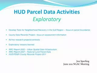
HUD Parcel Data Activities Exploratory. Develop Tools for Neighborhood Recovery in the Gulf Region – focus on parcel boundaries County Data Records Project– focus on assessment information Ad hoc research projects/contracts Exploratory/ lessons learned

E N D
HUD Parcel Data ActivitiesExploratory • Develop Tools for Neighborhood Recovery in the Gulf Region – focus on parcel boundaries • County Data Records Project– focus on assessment information • Ad hoc research projects/contracts • Exploratory/ lessons learned • NRC Report 2002 – Urban Spatial Data Infrastructure • NRC Report 2007 – National Land Parcel Data • HUD/PD&R County Records Project 2011 Jon Sperling June 2011 NGAC Meeting
Parcel Project: Gulf Coast: Multi-Agency Disaster Recovery Coordination • Two-fold: Damage Assessment, Recovery Grants & Loans • Neighborhoods need majority of properties in recovery in order to stabilize entire neighborhood • Need to find damaged properties that have NOT applied for recovery grants • Requires parcel maps to identify neighborhoods • Requires ability to link addresses with parcels
With HUD’s unique access to data sources, can we contribute ways to measure and track recovery and still protect individual privacy? • Damage assessment by address - FEMA • Flood depth by address – NOAA/HUD • Recovery grants by address - FEMA, SBA, HUD, State, etc. • Building permit – City • Vacancy data – USPS • Utility data If we can analyze at micro level, we can aggregate and present multiple views of recovery
Key Lessons – Gulf Parcel Project • Built on Successful Methodologies to Estimate Damages – linking FEMA, HUD, Census, NOAA and Other Datasets • Availability of Digital Parcel Data • Content, Coverage, Data Quality • Property/Situs Address (vs owner address) – Key Enabling Variable • Address Matching Capability: HUD’s “Geocode Service Center” - Key Enabling Resource • Link postal, parcel and census data (MAF/TIGER?) • Value of (govt) data often goes beyond its original purpose • Local partnerships
County Data Records Project • Collect and standardize most recent residential assessor data from 127 NSP counties and 27 corresponding states to evaluate performance • Assist programs to alleviate foreclosures, stabilize communities, and help recovery efforts after natural disasters • Assess feasibility for a national parcel database • Status: Pilot Data Collection completed. Waiting OMB approval for Main Data Collection. 10 10
Parcels+: Local Assessment Information • Acquire, assemble, analyze data from local county agencies • Home sales data, current value, housing stock conditions, • Vacancies • Multi-unit housing • Feasibility/ Sustainability