Download
1 / 33
370 likes | 607 Views
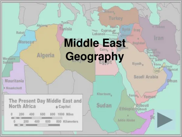
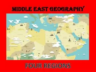
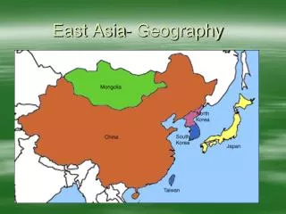
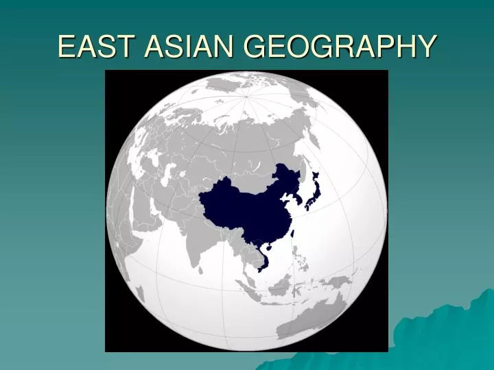
EAST ASIAN GEOGRAPHY. Introduction. East Asia is the most populous region in the world China is the most populous country, and the oldest continuous national culture Eastern China is undergoing rapid economic development China and Japan have been rivals from time to time

E N D
Introduction • East Asia is the most populous region in the world • China is the most populous country, and the oldest continuous national culture • Eastern China is undergoing rapid economic development • China and Japan have been rivals from time to time • East Asia has experienced colonization, and has seen both internal and international conflict • Japan is extremely wealthy, but poverty may be found in parts of the region • East Asia is one of the core areas of the world economy and an emerging center of political power
PHYSIOGRAPHY Globalization & Diversity: Rowntree, Lewis, Price, Wyckoff
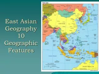
East Asia’s Physical Geography • Large area gives it large regional climatic variability • Similar latitude extent to U.S. • Climate of southern China like Florida; climate of northern China like Canada • Japan’s Physical Environment • Subtropical in the south and nearly subarctic in the north - Climatic variations in the east and west • 85% of the country is mountainous • Japan’s forests come from favorable climate, history of forest conservation • Limited alluvial plains used for intensive agriculture • Kanto Plain, Kansai Basin, and Nobi Basin
East Asia’s Physical Geography (cont.) • Taiwan’s Environment • Central and eastern regions are rugged and mountainous; west is dominated by an alluvial plain; mild winter climate; still has extensive forests • Chinese Environments • Southern China: rugged mountains and hills interspersed with lowland basins • Northern China: Gobi Desert, North China Plain, Loess Plateau • Korean Landscapes • Mountainous country with scattered alluvial basins • South Korea has better farmlands than North Korea
#1. East Asia features many islands & archipelagos Japan is an archipelago Chain of islands Over 3000 tiny islands
#2 The Ring of Fire is a narrow band of volcanoes that nearly encircles the Pacific Ocean. 75% of world’s active volcanoes are here.
#3 • China is home to 3 of the world’s largest cold deserts. • Gobi (largest desert in Asia) • Taklimakan (the sea of death) • Chang Tang (plateau of Tibet)
#4 • Three major rivers are a lifeline to Asia • Yangtze (longest) • Huang He (Yellow) • Mekong • Greatly influence the way people live in Asia
Chinese civilization began on the Yellow River • Loess – fertile topsoil spread by wind; largely agricultural society
#5. China’s civilization developed over a long period in considerable isolation, protected by physiographic barriers and by sheer distance from other cultures.
The Himalayas in the South • The TaklaMakan& Gobi deserts to West & North
#6: Mountains & Plateaus are major feature of topography • Himalayas & Tibetan Plateau • 4/5th of Japan is mountainous terrain, thus not a lot of arable land. • Korea also features many mountainous areas.
Tibetan Plateau . All told, some two billion people in more than a dozen countries—nearly a third of the world's population—depend on rivers fed by the snow and ice of the plateau region.
7. China’s enormous population is strongly concentrated in the country’s eastern regions. Western areas remain comparatively empty and unproductive.
In Japan • Most of the population lives in coastal plains and/or river valleys. • Kanto Plain very crowded • 20,000 ppl. Per sq. mile
#8: “The Land of Rice & Fish” • Rice is a staple • 90% of this crop is grown in East Asia & consumed there. • The majority of people in E. Asia eat rice 2 or 3 times a day. • North of the Yangtze River, the climate is more suited for wheat growing • The close access to water=diet of fish.
#9: Natural Resources vary greatly according to region • China: very rich in natural resources • Oil, coal, iron, etc. • Japan is limited in natural resources & is dependent on other nations
#10: Much of Southeast Asia is covered by rainforestWhat kind of effects would this have?
TheGreat Wall • Several walls were built over a long period • Protection from Mongol horsemen from the north – communication system • Monumental engineering feat – they claim it can be seen from orbit in space
Environmental Geography: Resource Pressures in a Crowded Land • Flooding, Dam-Building, and Related Issues • China’s Yangtze River is an important resource (3rd largest volume) • The Three Gorges Controversy • Chinese government wants to dam the Yangtze (Chang Jiang) River with the largest hydroelectric dam in the world • Purpose: control floods & generate electricity • Problems: Will jeopardize animal species, flood a major scenic attraction, and displace up to 2 million people