Download
1 / 25
250 likes | 372 Views
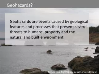
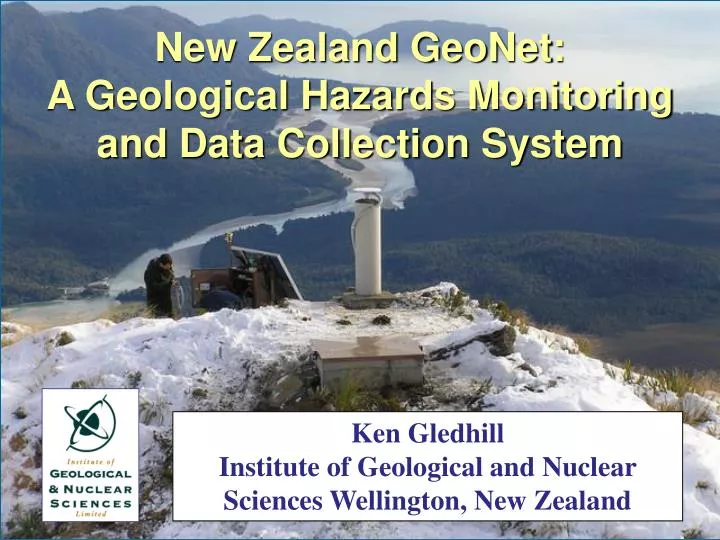
New Zealand GeoNet: A Geological Hazards Monitoring and Data Collection System. Ken Gledhill Institute of Geological and Nuclear Sciences Wellington, New Zealand. 1950 - 2000. 1840 - 2000. M 7.0 +. M 6.5 - 6.9. New Zealand GeoNet.

E N D
New Zealand GeoNet: A Geological Hazards Monitoring and Data Collection System Ken Gledhill Institute of Geological and Nuclear Sciences Wellington, New Zealand
1950 - 2000 1840 - 2000 M 7.0 + M 6.5 - 6.9
New Zealand GeoNet • National broadband, CGPS deformation and strong ground motion networks • Regional seismic and CGPS networks • Volcano gas geochemistry and remote sensing • Landslide response (national register) • Duplicate data centres • Diverse data communications • Continuous system monitoring • All data freely available
Linked Research Current Products FutureProducts End Users GeoNet Outcomes MonitoringNetworks MonitoringNetworks New Technologies Earthquake Information • Real-time loss estimates • Time varying hazard Successful evacuations(volcano, tsunami, landslip) S h o r t T e r m Volcano Status (Alert level) Warning of eruptions Volcano Forecasting Data Centre Data Centre Appropriate response(earthquake, volcano) Landslide Forecasting Landslide Warnings Geotechnical advice Reassured public Landslide Processes Other Data & Research Tsunami wave heights & loss estimates Seismology Earthquake Geology Probabilistic Geological Hazard Models Probabilistic Seismic Hazard Model Safer structures/Resilient infrastructure Physical Volcanology Earth Deformation RiskScape Vulnerability & Assets CDEM Planning L o n g T e r m Improved mitigation and readiness Paleo & Historical Tsunami Tsunami Hazard Planning & Policy Planning guidelines Social Science
last three earthquakes volcano alert levels
Data Availability • All data freely available (at least in theory) • Segmented/Event: AutoDRM (or call) [hh*] • Real Time: SeedLink • Catalogue/Metadata: www.geonet.org.nz • Data Sharing: GA, PTWC, IRIS, FDSN, NEIC • If all else fails: info@geonet.org.nz • GEOSS Issues: Formats, multiple feeds