Download
1 / 15
150 likes | 278 Views
Summary of Work Performed for the South Lee County Watershed Plan Update (2009). Presentation to Bonita Springs City Council By Roger Copp, A.D.A. Engineering, Inc. October 16, 2013. 215 W. Verne Street, Suite D Tampa, FL 33606. Summary of Study Objectives. Review Prior Studies

E N D
Summary of Work Performed for the South Lee County Watershed Plan Update (2009) Presentation to Bonita Springs City Council By Roger Copp, A.D.A. Engineering, Inc. October 16, 2013 215 W. Verne Street, Suite D Tampa, FL 33606
Summary of Study Objectives • Review Prior Studies • Identify Problem Areas • Develop and calibrate a Model for the South Lee County area • Use model to identify flooding problems from Estero south to Bonita Springs • Evaluate alternatives • Recommend strategy to increase flood flows to the Estero River, Halfway Creek, and Spring Creek and reduce flows to the Imperial River
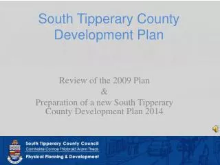
Problems Identified • Not enough flow to the Estero River and Halfway Creek • Too much water east of I-75 north of the Bonita Springs NE Quadrant • Flooding in Spring Creek east of Old US 41 • Bridges over-topped in Spring Creek at Strike Lane and Imperial Tributary at Pinecrest Lane • Flooding in Kehl Canal area and in Quinn/Dean Street area of Bonita Springs
Final Recommendations • Due to a variety of factors, the Update report remained draft for a period of time. • Final recommendations were adopted on Jan 20, 2011 by Lee County and SFWMD. • Recommendations pertinent to Bonita Springs are provided on the following slides
Final Recommendations(copied directly from Lee County/SFWMD document) See Figure on next page
Map of Proposed Spring Creek Improvements Note that some of these recommendations may have already been implemented
Final Recommendations(copied directly from Lee County/SFWMD document) See Figure on next page
Additional Comments(personal opinions of Roger Copp) • Additional storage is needed in the DR/GR area • Additional storage would be beneficial for a number of purposes, including augmentation of public water supplies, holding back wet season flows for subsequent release during the dry season, and water quality treatment • The area east of I-75 has historically been an area that experiences extended periods of flooding • Realtors are normally quiet about how much flooding one can expect, so further development east of I-75 may result in more complaints to City Council
Bonita Springs SWMP Predicted 10-Year Flood Map • Blue areas are flooded Once in 10-Year Flood Map, Intera, 2010
Flooding East of Bonita Grande Drive 2010 SMP 10-Yr: Aerial view:
Flooding East of Bonita Grande Drive 2010 SMP 25-Yr: Aerial view:
Map of Simulated Water Levels During Fall 2006 The area east of the NE Quadrant is very wet, often for more than 6 months/year NE Quadrant Study Area
Measured Water Levels at Kehl Canal Gate Key Take-Home Message: Water levels are the same on both sides of Kehl Gate