Download
1 / 7
70 likes | 182 Views
Overview of the VALMER scenario process. Dr Olivia Langmead Marine Biological Association. Management Scenarios. Develop plausible scenarios of alternative future management scenarios – horizon scanning

E N D
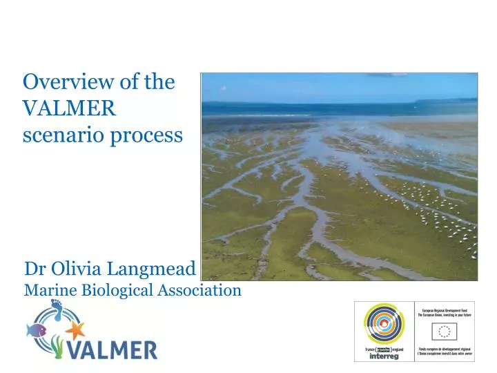
Overview of the VALMER scenario process Dr Olivia Langmead Marine Biological Association
Management Scenarios • Develop plausible scenarios of alternative future management scenarios – horizon scanning • We are interested in human activities that leave a footprint on the subtidal sediment habitats. • The overall aim is to compare the difference in the value of the seabed as fish habitat under different scenario conditions
Management Scenarios This may comprise new management measures for existing activities that changes the intensity or location of them (e.g. designation of rMCZs).
Management Scenarios • This may comprise new activities such as: • Cable laying • Renewables installations • Port expansion • Aggregate dredging • Or combinations of • both new activities and • new management
Scenario definition Each scenario will have: • a name e.g. ‘rMCZs all designated’ • a storyline describing what this means in terms of activities in the NDBR e.g. in ‘rMCZs all designated’ this might mean a suite of measures restricting human activities that are plausible and in line with the listed features for the rMCZs. This may cause other changes, for example displacement of fishing activity. • A series of associated pressure maps that show changes in the activities in terms of intensity and location e.g. if it was decided that towed gear was to be excluded from all rMCZs, would this be displaced to somewhere else? Would potting density increase in rMCZs? Or just the coastal ones?
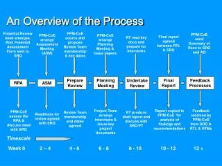
Modelling changes in subtidal sedimentary habitats and their value • Pressure maps will be used as input to a network model to work out what effect these changes would have on the value of the seabed habitat in terms of supporting fisheries production Current activities Pressures Seabed habitats Fish Current Value(£) Management scenario #1 Pressures Seabed habitats Fish Value(£) Marginal change in value Management scenario #2 Pressures Seabed habitats Fish Value(£) Stakeholder group Network model