Download
1 / 2
20 likes | 146 Views
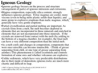
Aug 7. Sept 20. Sept. Aug. Dr. Lynn A. Leonard Associate Professor of Geology and Graduate Coordinator 910-962-2338; LynnL@uncwil.edu Recent Research Projects. Sediment Recycling: Marsh Renourishment Through Dredged Material Disposal .

E N D
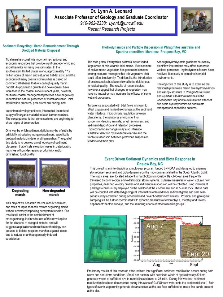
Aug 7 Sept 20 Sept Aug Dr. Lynn A. Leonard Associate Professor of Geology and Graduate Coordinator 910-962-2338; LynnL@uncwil.edu Recent Research Projects Sediment Recycling: Marsh Renourishment Through Dredged Material Disposal Hydrodynamics and Particle Dispersion in Phragmites australis and Spartina alterniflora Marshes: Prospect Bay, MD Tidal marshes constitute important recreational and economic resources that provide significant economic and social benefits for many coastal states. In the southeastern United States alone, approximately 17.2 million acres of marsh and estuarine habitat exist, and the economy of many coastal communities is based on commercial fisheries that rely on high quality marsh habitat. As population growth and development have increased in the coastal zone in recent years, however, multi-use coastal management practices have negatively impacted the natural processes of marsh accretion. Inlet stabilization practices, post-storm bull dozing, and The reed grass, Phragmites australis, has invaded large areas of mid-Atlantic tidal marsh. Replacement of native marsh vegetation has generated concern among resource managers that this vegetative shift could affect biodiversity. Traditionally, the introduction of exotic species has been viewed to be deleterious to habitat quality. The results of recent studies, however, suggest that changes in vegetation may have no impact or may increase the efficacy of some wetland processes. Turbulence associated with tidal flows is known to affect oxygen and nutrient exchanges at the sediment water interface, microclimate regulation between plant stems, the nutritional environment for suspension-feeding animals, larval recruitment, and sediment deposition and retention processes. Hydrodynamic exchanges may also influence substrate selection by invertebrate larvae and the trophic relationship between protozoan suspension feeders and their prey Although hydrodynamic gradients caused by plant/flow interactions may affect numerous wetland processes, hydrodynamic factors have received little study in estuarine intertidal environments. The objective of this study is to examine the relationship between marsh flow hydrodynamics and canopy structure in Phragmites australis and Spartina alterniflora marshes in the Chesapeake Bay and to evaluate the effect of fine scale hydrodynamics on particulate transport and deposition patterns. beachfront development have interrupted the natural supply of inorganic material to back barrier marshes. The consequence is that some systems are beginning to show signs of deterioration. One way by which sediment deficits may be offset is by artificially introducing inorganic sediment, specifically dredged material, in deteriorating marshes. The goal of this study is to develop a methodology of sediment placement that offsets elevation losses in deteriorating marshes without decreasing productivity and/or diminishing functionality. Event Driven Sediment Dynamics and Biota Response in Onslow Bay, NC This project is an interdisciplinary, multi-year program funded by NOAA and designed to examine storm-driven sediment and biota dynamics on the mid-continental shelf in the South Atlantic Bight. The study sites are located adjacent to hardbottoms in Onslow Bay, NC--an area frequently traversed by both tropical and extratropical storm systems. Eulerian measures of water column flow properties, near bed velocity profiles and sediment resuspension will be collected using instrument packages continuously deployed on the seafloor at the 23-mile site and at 5- mile rock. These data will be coupled with detailed geological information obtained from sediment grabs and side scan sonar surveys collected during scheduled and "event-determined" cruises.Physical and geological sampling will be further coordinated with synoptic measures of chlorophyll a, monthly and "event-dependent" benthic surveys, and the sampling efforts of other research groups. Degrading marsh Non-degraded marsh This project will constrain the volumes of sediment, and rates of input, that can restore degrading marsh without adversely impacting ecosystem function. Our results will assist in the establishment of management guidelines for use of this novel option for the disposal of dredged material and will suggests applications where this methodology can be used to bolster recipient marshes against losses due to natural or anthopogenically induced subsidence. Prelimnary results of this research effort indicate that significant sediment mobilization occurs during both storm and non-storm conditions. Small nor-easters, with sustained winds of approximately 30 knts generate waves of sufficient size to remobilize sediment at 23-mile. During fair weather, sediment mobilization has been documented during intrusions of Gulf Stream water onto the continental shelf. Both types of events apparently generate shear stresses at the sea floor sufficient to move fine sands present at the site.
1:21 2:42 5:24 6:45 8:06 0:00 9:27 10:48 14:51 18:54 20:15 4:03 13:30 16:12 17:33 22:57 12:09 21:36 Cape Fear River 2.5 Fort Caswell (P1) 2 1.5 1 0.5 Water Level (ft) 0 Eagle Island (P6) -0.5 -1 3 h 53 m -1.5 -2 -2.5 Black River (P9) North East Cape Fear River 2.5 Fort Caswell (P1) 2 1.5 1 0.5 Water Level (ft) Smith Creek (P11) 0 -0.5 3 h 17 m -1 -1.5 -2 Prince George (P14) -2.5 Time Role of Flow in Maintaining a Ridge and Slough Landscape: The Everglades Transplanted Oyster (Crassostrea virginica) Beds as Self-Sustaining Mechanisms for Water Quality Improvement in Small Tidal Creeks During this project, flow rates will be experimentally manipulated in order to quantify the importance of water flow to inorganic sediment and organic matter transport through the ridge and slough landscape. This research will parameterize hydrodynamic and ecological models used to test the implications of different restoration option in the Everglades. Benthic filter feeders, such as the oyster are believed to improve water quality in estuarine environments through filtration of suspended solids and nutrients. In addition, the biogenic structure of oyster reef communities may alter hydrodynamic conditions, further facilitating the removal of particulate matter and increasing water quality. This study examines the effects of a small-scale oyster restoration project on sediment loading, nutrient loading, and flow within a small tidal creek. Examination of Changes in the Cape Fear River Ecosystem Due to the Deepening of Wilmington Harbor, North Carolina This project is examining the effects of the Cape Fear River Harbor dredging project on selected physical, chemical, and biological parameters in the river and adjacent wetlands. Eleven data collection platforms have been constructed in the Cape Fear and Northeast Cape Fear Rivers. Each platform houses water level sensors, conductivity instruments, and data loggers that record changes in tidal amplitude and salt water excursion up river. These data are retrieved using telemetry. Additional conductivity sensors and piezometers are used to measure fortnightly salinity and water level changes, respectively, along transects in swamp and marsh sites. These fortnightly surveys are conducted in the winter and summer. Standard methods are used to asses impacts on benthic and fish populations along selected river edge locations. Pore water samples are collected at selected swamp sites in the summer and in the winter. These samples are analyzed to determine sulfate, chloride and methane concentrations. Recent Student Projects • Rick Civelli: "Effects of culvert geometry on sediment dispersal" • Shelly Miller: "Phosphorus as a biogeochemical indicator of anthropogenic effects in tidal watersheds" • Alex Croft: "Effects of dredged material disposal on tidal marsh processes" • Kim Nelson: "Transplanted oyster beds as self-sustaining mechanisms for water quality improvement in small tidal creeks" • Ansley Wren: "Sediment mobility on the mid-continental shelf: Onslow Bay, NC” • Jeff Marshall: “Sediment Mobility on the inner continental shelf: a response to high energy storm events” • Beth Reimer: “Effects of geomorphology and land use on sediment overwash to back barrier marshes” • Maverick Raber: “Characteristics of sediments in the Cape Fear River watershed” • Alisha Renfro: “Sediment transport and delivery in black water and brown water riparian buffers” • Jen O’Reilly: “Assessment of tidally influenced riparian wetlands as sinks for fecal coliform bacteria”