Download
1 / 15
150 likes | 153 Views
This study aims to investigate the contributions of groundwater and surfacewater gains in a reach of the upper Williamson River, between Sheep Creek and Klamath Marsh. The study will assess the inflow and outflow of the reach to determine the groundwater accretions. The discussion will focus on the representativeness of winter and summer groundwater accretions and the importance of aquifer characteristics. Limited data suggests that groundwater accretions play a significant role in the reach, particularly during winter and the irrigation season.

E N D
Middle Williamson River Accretions Investigation Between Sheep Creek and Klamath Marsh
Study Motivation • To investigate groundwater and surfacewater gains in a reach of the upper Williamson River.
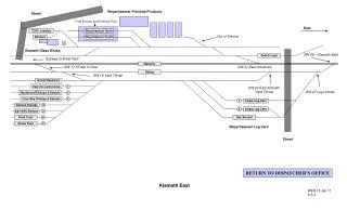
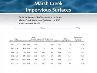
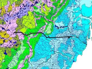
Area Description • Reach is delineated by the Williamson gauge below Sheep Creek and Cholo canal above Klamath Marsh. • Flows are heavily dependent on groundwater. • Most tributaries are ephemeral. • Roughly 7000 acres of irrigated lands according to claims and permit database.
Approach • Measure all surface inflows into the reach. • Sum of tributary inflows equals the surface accretions into the reach. • Measure outflow from the reach at the Williamson above Cholo canal. • Difference between surface inflows and outflow equals groundwater accretions.
Discussion • Does winter groundwater accretions represent typical summer groundwater accretions? • Both seasons groundwater accretions are derived from baseflows due to limited amounts of precipitation available to support streamflow. • Depends on the aquifer characteristic feeding the groundwater system. • Aquifer transmissivity and storage capacity. (spring creek example) • Well logs show a water bearing zone of sand, gravel, pumice, conglomerate, and basalt approximately 100 to 200 feet thick. • Based on this limited data, the winter and summer baseflows should be similar.
Discussion • Does the limited data from the accretions study represent average baseflow conditions for the winter. • Baseflows during the measurement were slightly elevated by warm trend and accompanying snowmelt in February.
Conclusion • Limited data demonstrates that groundwater accretions make up a significant portion of the gains into the reach during winter. • Groundwater accretions were probably somewhat elevated from warm trend in February. • Groundwater probably contributes significant flows to the reach during the irrigation season. • Surface flows from tributaries are not a conclusive indicator of accretions in this particular reach.
Recommendations • Install a continuous gage at the reach bottom (above Cholo ditch). • Take monthly miscellaneous measurements on the tributaries and diversion canals. • Perform pump tests to define aquifer characteristics. • Repeat the study during the summer, autumn and fall.