Download
1 / 36
360 likes | 502 Views
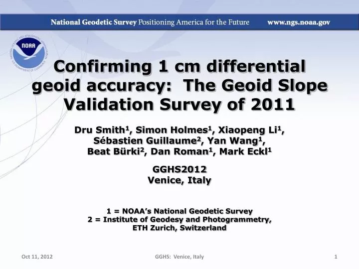
Confirming 1 cm differential geoid accuracy: The Geoid Slope Validation Survey of 2011 Dru Smith 1 , Simon Holmes 1 , Xiaopeng Li 1 , S é bastien Guillaume 2 , Yan Wang 1 , Beat B ü rki 2 , Dan Roman 1 , Mark Eckl 1 GGHS2012 Venice, Italy 1 = NOAA’s National Geodetic Survey

E N D
Confirming 1 cm differential geoid accuracy: The Geoid Slope Validation Survey of 2011 Dru Smith1, Simon Holmes1, Xiaopeng Li1, Sébastien Guillaume2, Yan Wang1, Beat Bürki2, Dan Roman1, Mark Eckl1 GGHS2012 Venice, Italy 1 = NOAA’s National Geodetic Survey 2 = Institute of Geodesy and Photogrammetry, ETH Zurich, Switzerland GGHS: Venice, Italy
Genesis of the survey “...the gravimetric geoid used in definingthe future vertical datum of the United States should have an absolute accuracy of 1 centimeter at any place and at any time.” -- The NGS 10 year plan (2008-2018) Admirable!...Achievable? GGHS: Venice, Italy
Goal of the survey • Observe geoid shape (slope) using multiple independent terrestrial survey methods • GPS + Leveling • Deflections of the Vertical • Compare observed slopes (from terrestrial surveys) to modeled slopes (from gravimetry or satellites) • With / Without new GRAV-D airborne gravity GGHS: Venice, Italy
Why not rely on existing surveys? • Most existing marks are not GPS or gravity friendly • Existing leveling is decades old • Existing leveling and GPS are tied to unmonitored passive control coordinates • Overlap of existing gravity, GPS or leveling is minimal in space and widely separated in time GGHS: Venice, Italy
Choosing the Place and Time for a New Survey • Criteria: • Significantly exceed 100 km • Under existing GRAV-D data • Avoid trees and woods • Along major roads • Cloud-free nights • No major bridges along the route • Low elevations • Significant geoid slope • Inexpensive travel costs GGHS: Venice, Italy
The Chosen Line 325 km 218 points 1.5 km spacing South Texas July-October, 2011 hot…Hot…HOT! GGHS: Venice, Italy
Surveys Performed • GPS: 20 identical. units, 10/day leapfrog, 40 hrs ea. • Leveling: 1st order, class II, digital barcode leveling • Gravity: FG-5 and A-10 anchors, 4 L/R in 2 teams • DoV: ETH Zurich DIADEM GPS & camera system • LIDAR: Riegl Q680i-D, 2 pt/m2 spacing, 0.5 km width • Imagery: Applanix 439 RGB DualCam, 5000’ AGL • Other: • RTN, short-session GPS, extra gravity marks around Austin, gravity gradients GGHS: Venice, Italy
GPS DoV LIDAR/ Imagery Gravity Leveling GGHS: Venice, Italy
Empirical Error Estimates • sDh (OPUS-S) : 2 - 6 cm • GPSCOM combination: ~ 4 mm • (no significant baseline dependency) • => 16 mm RMS over GSVS11 • sx , sh : 0.06 arcseconds • ~ 0.43 mm / 1.5 km => 6.6 mm RMS over GSVS11 GGHS: Venice, Italy
Existing Geoids vs GSVS11 Austin (North end) Rockport (South end) GGHS: Venice, Italy
Existing Geoids vs GSVS11 Austin (North end) Rockport (South end) GGHS: Venice, Italy
EGM2008 is better here USGG2009 is better here GGHS: Venice, Italy
Adding GOCO2s makes things better here Adding GOCO2s makes things worse here GGHS: Venice, Italy
Airborne Gravity Improves the Geoid across ALL DISTANCES GGHS: Venice, Italy
New software makes things worse here New software Makes things better here GGHS: Venice, Italy
Let’s remove this from all of the other bars to leave geoid-only RMSE GGHS: Venice, Italy
The “1 cm geoid” GGHS: Venice, Italy
Agreement with DIADEM DoVs(arcseconds) x N/S h E/W GGHS: Venice, Italy
Old minus new leveling North (Austin) South (Rockport) GGHS: Venice, Italy
Conclusions • For GSVS11, adding airborne gravity data improves geoid slope accuracy at nearly all distances <325 km • E/W deflections (“pointwise slopes”) improved, but not N/S deflections • Gravimetric geoid models and GPS are a viable alternative to long-line leveling • Improvements still being made to high resolution geoid modeling GGHS: Venice, Italy
Future Work • Dozens of studies, comparing all of the terrestrial positioning techniques of GSVS11 • Dig deeper on GRACE / GOCO2s disagreements with GSVS11 • GSVS13: IOWA!!! • Higher elevation, more complicated geoid, additional measurements (borehole gravimetry?) GGHS: Venice, Italy
Questions/Comments? Dru.Smith@noaa.gov http://www.ngs.noaa.gov/GEOID/GSVS11/index.shtml GGHS: Venice, Italy
Extra Slides GGHS: Venice, Italy
How to read the next chart • Pick any 2 (of the 218) points (Pi and Pj) separated by a distance “dij” • 23,871 possible (i,j) pairs of points • 0.4km < dij < 325km • Compute residuals: D(h-H-N) over distance: • D(h-H-N) = (hi-Hi)-(hj-Hj) – (Ni-Nj) • Accumulate statistics on residuals for all (i,j) pairs in a bin • Each dij bin contains ~2000 pairs of points GGHS: Venice, Italy
High Resolution Geoids(vs GPS / Leveling; cm) All separation distances show improvement with GSVS11 survey when airborne gravity are introduced. New software shows modest improvement at medium wavelengths GGHS: Venice, Italy
Tallies GGHS: Venice, Italy
Tallies • Total persons involved: 46 • NOAA Employees: 43 • First time in the field: 6 • Issues: • Medical Emergencies: 4 • Flat tires: 3 • Inoperative equipment: 2 GGHS: Venice, Italy
Note EGM08 2190 vs 220 GGHS: Venice, Italy
SHM representation of geoid agreement with GSVS11 GGHS: Venice, Italy
Austin (North end) Rockport (South End) GGHS: Venice, Italy
Experimental geoids and USGG2009 vs GSVS11 h-H GGHS: Venice, Italy
Weekly reports on a crew-by-crew basis from July 18 through November 4 GGHS: Venice, Italy
http://www.ngs.noaa.gov/GEOID/GSVS11 GGHS: Venice, Italy