Download
1 / 36
390 likes | 542 Views
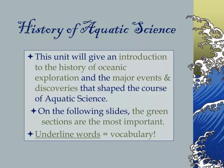
History of Aquatic Science. This unit will give an introduction to the history of oceanic exploration and the major events & discoveries that shaped the course of Aquatic Science. On the following slides, the green sections are the most important. Underline words = vocabulary!.

E N D
History of Aquatic Science • This unit will give an introduction to the history of oceanic exploration and the major events & discoveries that shaped the course of Aquatic Science. • On the following slides, the green sections are the most important. • Underline words = vocabulary!
Vessel Matching B A • Match the items below to the pictures to the right. • ROV • Satellite • Submarine • Buoy • Sonar D C E
Aquatic Science • What is Aquatic Science? • The study of all water environments, and the plants, animals, and organisms that live in them. http://habitatnews.nus.edu.sg/news/pulauhantu/images/LIT0007%20blog.jpg
Background • About ¾ of our Earth is water; without water,life on Earth as we know it would not exist. • The ocean is one of our last frontiers – the last places to discover. • Since the beginning of time human kind has required water for survival. http://watserv1.uwaterloo.ca/~saibaba/Boy%20Drinking%20Water.jpg
The Ocean • Through the study of the world’s oceans, we: • Enjoy recreation • Explore aquatic animals & plants • Find food • Get our weather systems • Learn the history of the planet • Mine for minerals, oil & building materials • Trade between countries • Transport goods and people
Areas of Study in Aquatic Science • Physical: currents, tides, waves, pressure, temperature, depth, density, as relating to weather phenomenon • Geological: history of the Earth, seafloor features, sediments, changes over time • Chemical: evolution and composition of seawater, its influences on animal and plant life, and impact of water pollution on the environment • Biological: plants, animals and their ecosystems (life cycles, food chains, and environments)
Oceanography • What is oceanography? • A multiscience field encompassing geology, geophysics, chemistry, physics, meteorology, and biology as they pertain to marine ecosystems. http://library.humboldt.edu/~rls/kelp.jpg
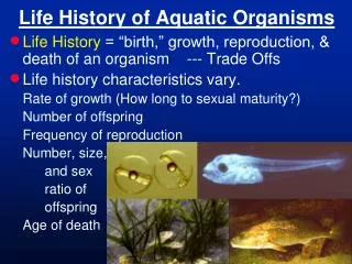
Marine Biology • Marine Biology – the study of marine organisms, their behaviors, and interactions with the environment.
Aquaculture • Aquaculture – the management of fisheries and hatcheries, where fish eggs are incubated and hatched.
Setting up Your Timeline • Take a sheet of legal sized paper. • Fold the sheet along the Y axis (skinny) and cut along the fold. • Tape the two ends of the paper together to make one long strip for the timeline. • Use the meter stick/ruler to draw a line down the center of the paper. • Create a key in the lower left hand corner: • 1 cm = 100 years
The Egyptians established sea tradethroughoutthe Indian Ocean as early as 2300 B.C. Ca 1938 - 1756 B.C. built the canal, the Isthmus of Suez, to navigate ships across land. It operated until 775 A.D. Egyptian Technology http://search.eb.com.ezproxy.uhd.edu/eb/article-22787
The Phoenicians • Phoenicians: (from the Middle East) Sailed around Africa in 590 B.C. A stone carving from the 1st century AD shows the kind of ship that the Phoenicians used on the Mediterranean Sea. The Granger Collection, New York Image http://search.eb.com.ezproxy.uhd.edu/eb/art-2116/Phoenician-colonization-in-the-Mediterranean
The Greeks • Herodotus (a Greek):published accurate map (see below) of Mediterranean region, ca 450 B.C. • Greeks: Developed trade routesthroughout the Mediterranean and expanded their empire under Alexander the Great, 336 B.C. http://www.henry-davis.com/MAPS/Ancientimages/109.JPEG
200 B.C. – the Greek Eratosthenesmathematically calculated the circumference of the Earth to be 40,000 km. It actually is 40,032 km. 2,200 years ago his math was good enough to be off only 32 km! Amazing Math! Eratosthenes knew that at noon on the summer solstice the Sun is directly overhead at Syene (a city)….He also knew the distance between Syene and Alexandria (another city), which, combined with his measurement of the solar angle a between the Sun and the vertical, enabled him to calculate Earth's circumference. From Encyclopædia Britannica, Inc.
The Arabs • ca 200 B.C Islamic and Arab Merchants: Experienced sailors ; traded throughout the Mediterranean andIndian Oceans. • They are believed to have invented the lateen sail, the triangular sail important in early navigation. http://search.eb.com.ezproxy.uhd.edu/eb/art-12539/A-lateen-rigged-ship-used-by-Arab-merchants
In the Middle Ages • 900 A.D. The Vikings crossed the North Atlantic to colonize Iceland, Greenland, and Newfoundland using the North Star to determine latitude. Exhumed Viking ship; Viking Ship Museum, Oslo, Norway. Image
15th and 16th Centuries • Chinese: Sailed to influence and impress their neighbors. • 1492 Columbus: Sailing for Spain, sailed the Atlantic and “discovered” the America’s. • 1497 Vasco da Gama: Sailing for Portugal, sailed around Africa from Portugal to India to establish trade routes. • Europeans searched for the Northwest passage through northern Canada to trade with Asia; explored the Artic.
Around the World in… • 1519 - Portuguese explorer Ferdinand Magellanwas the 1st European expedition to circumnavigate (travel all around) the world. • 237 men began the voyage; 18 returned. • Magellan actually died before the journey was finished, but his crew returnedin 1522. Trip http://www.solarnavigator.net/history/explorers_history/ferdinand_magellan_charcoal_fur_robe.jpg
Benjamin Franklin • 1762- The American Ben Franklin created a chart of the Gulf Stream. • The Gulf Streamgives the US its warm climate, bringing warm water north from the equator. http://oceanexplorer.noaa.gov/library/readings/hires/gulf_stream_map.jpg
Harrison & Cook • 1728 - Device invented by John Harrison (a carpenter) who was paid 20,000 pounds by the British government; a chronometer a device that calculates longitude. • 1768 - The English explorer Captain James Cook made 3 voyages to chart the Pacific Ocean. • He was the first to use a chronometerfor navigation. http://www.captaincookwhitby.co.uk/captainjamescookportrait.jpg
Charles Darwin • In 1831Charles Darwin took his voyage on the ship the HMS Beagle which led to the origin of species and the modern theories of evolution. http://uk.gizmodo.com/charles_darwin_l.jpg
Matthew Maury • U.S. Navy’s Lt. Matthew Maury, called the Father of Modern Oceanography, made charts and sailing directions through data collection and wrote the first book of oceanography in 1855. • Monument named him “Pathfinder of the Seas”. (Richmond, VA) http://www.18thmass.com/blog/media/2/20070417-Richmond%20-%20Matthew%20Maury.jpg
From 1872 to 1876, the ship HMS Challenger Expedition led by Sir Charles Wyville Thomsongathered more data in its time than all other data to date. It was this voyage that discovered the world’s deepest ocean trench, the Marianas Trench, now sometimes called the Challenger Deep. The Challenger http://www.zamboanga.com/history/histor8.jpg
The Marianas Trench(~8185 m or 26,850 ft) in the Pacific Ocean about 200 miles SW of Guam. • The map below shows the route of HMS Challenger (in red); the expedition lasted1,000 days and covered more than 68,000 nautical miles. http://oceanexplorer.noaa.gov/explorations/03mountains/background/challenger/media/route.html
1898 – The world wars were the catalyst for US oceanographic research; invention of the 1st gas engine/battery powered submarine (John Holland) bought by US government in 1900. Development of technology including electronic equipment, deep sea drilling programs, (1916) SONAR, use of GPS (global positioning system) and satellites. 20th Century http://oceanexplorer.noaa.gov/explorations/05arctic/background/plan/media/global_explorer_rov_600.jpg
The Meteor • The Meteor Expedition: mapped the ocean floor and features. • 1925-1927 - The German Meteor expedition systematicallysurveys the South Atlantic with echo-sounding equipment and other oceanographic instruments. http://oceanexplorer.noaa.gov/history/quotes/tech/media/echo_600.jpg
The Trieste • On January 23, 1960, the bathyscaph (small submarine) Trieste reached the greatest oceanic depth existing on our planet. • Don Walsh and Jacques Picard (US navy) piloted the Trieste to the deepest part of the trench (35,797ft > 6.5miles) . http://www.strange-mecha.com/ship/Bathyscaphe/trieste.jpg
".... I saw a wonderful thing. Lying on the bottom just beneath us was some type of flatfish… Even as I saw him, his two round eyes on top of his head spied us … Why should he have eyes? Merely to see phosphorescence?...Here, in an instant, was the answer that biologists had asked for the decades. Could life exist in the greatest depths of the ocean? It could!”- J. Picard http://www.travel-dive.com/images/frogfish-hairball.jpg
Designed by Woods Hole Oceanographic Institute and built in 1962,Alvinhastraveled around the world completing 4,162 dives. Alvin has mechanical arms and in 1966 helped to locate a H-bomb that was lost in the Mediterranean Sea. In 1979, Alvinand its crew discovered black smokers on the sea floor. Alvin http://www.oar.noaa.gov/spotlite/archive/images/oceandumping_alvin.jpg
The Glomar Challenger • 1968 – The Glomar Challenger, a drilling vessel that proved seafloor spreading and changes in the earth’s climate by taking core samples from the sea floor. http://www.pixelgraphicsinc.com/images/Glomar.jpg
View from Space • 1985 – JASON, a satellite found and documented the wreck of the Titanic. http://topex-www.jpl.nasa.gov/mission/images/OSTM-200707.jpg
The Japanese • 1989 - Japan launched the Shinkai 6500 which can carry a crew without a tether (rope) up to 21,414 ft deep into the ocean (a world record). http://www.sstg.org/images/shinkai.jpg
21st Century • In 2006, a Chinese mineral company(COMRA) designed a craft to reach 23,000 ft. http://interridge.whoi.edu/files/interridge/comra_celebrate.png
How do we study the ocean? • Types of Research Vessels: • Submersibles– small underwater vehicles • ROV– remotely operated vehicle • Bathysphere – is lowered by a cable from a ship • Drilling ships – which take sediment cores • Floating and Fixed platforms (FLIP – floating instrument platform) to gather data like temperature, salinity, density, and weather patterns
Other Research Instruments • Airplanes • Satellites – SEASAT: 1st satellite dedicated to ocean studies • Echosounding • Underwater cameras • Side scan sonar – great for sunken ships http://www.noaanews.noaa.gov/stories2005/images/side-scan-sonar-rude2.jpg
In Conclusion • The ocean represents the Earth’s last frontier for exploration and the key to understanding the future of our planet. • The human race depends on the life and sustainability of the ocean for economic, biological, and environmental stability. • The world of Aquatic science is ever reaching for new discoveries in this blue realm. http://www.cliffshade.com/colorado/images/earth_west.jpg