Download
1 / 28
280 likes | 494 Views
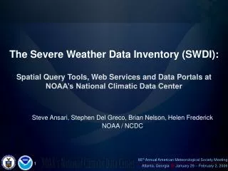
The Severe Weather Data Inventory (SWDI): Spatial Query Tools, Web Services and Data Portals at NOAA’s National Climatic Data Center. Steve Ansari, Stephen Del Greco, Brian Nelson, Helen Frederick NOAA / NCDC: Data Processing Branch. Goals. Inventory for Severe Weather Data

E N D
The Severe Weather Data Inventory (SWDI):Spatial Query Tools, Web Services and Data Portals at NOAA’s National Climatic Data Center Steve Ansari, Stephen Del Greco, Brian Nelson, Helen Frederick NOAA / NCDC: Data Processing Branch
Goals • Inventory for Severe Weather Data • Geospatial Database solution • Modular! • Unique spatial dataset relationship • Multiple user access methods
Data NEXRAD Level-III • Hail, Mesocyclone, and Tornado • Data from 1991 – Present • Estimates for hail size, wind shear, heights, etc… • All searchable!
Data NEXRAD Level-III Hail Product
Data NEXRAD Level-III Mesocyclone Product
Data NEXRAD Level-III Tornado Product
Data NEXRAD Level-II • Generate products with WDSS-II • Hail, Mesocyclone, and Tornado • Different Algorithms (NSSL vs. NWS) • Reprocess Data from 1991 – Present • 1000 terabytes!
Data NEXRAD Level-II – WDSS-II Display Image courtesy of Travis Smith, NSSL/CIMMS http://www.wdssii.org
Data NCDC Storm Events Database • Text reports from NWS and Storm Prediction Center. • Data from 1950 – Present • Tornado, Hail, Lightning, Wind, etc… • Fatalities, Injuries, Crop/Property Damage
Data NCDC Storm Events Database
Data Vaisala’s National Lightning Detection Network (NLDN) • 130 Sensors Nationwide • 1995 – Present Images courtesy of NASA (http://thunder.msfc.nasa.gov/primer/primer3.html)
Geospatial Database • Oracle Spatial Extension • Adds GIS functionality to Oracle database • Links all spatial datasets together “Select all NLDN within 50 miles of ATL between 20050819 18:00Z and 20050819 22:00Z” “Select all TVS contained by Fulton County”
Access Web Pages
Access Data Download • Shapefile, NetCDF, Text File
Access Web Map Server / Web Feature Server (WMS/WFS) • Direct access from GIS Clients
Access SOAP Web Services • Programmatic access to data
Analysis • Comparison between datasets “Select all TVS between 20050810 0:00Z and 20050811 0:00Z where there are no NLDN within 10 miles”
Analysis • Event Study
Analysis • Disaster Mitigation • Example: Compare 1 Hour of NLDN to Population Grid Data: NLDN 08/02/2005 20:00 – 21:00 UTC Gridded Population of the World - SEDAC (Socioeconomic Data and Applications Center at Columbia University) http://sedac.ciesin.columbia.edu/gpw
Analysis • Example: Compare 1 Hour of NLDN to Population Grid Process: 1. Download 2000 Population Grid at ~4 km resolution. 2. Convert cell centroids to points 3. Subset data for Florida 4. Spatial Join to closest NLDN data 5. Examine matching population grid cells
Example Analysis • Process: Download 2000 Population Grid (~12 km resolution).
Example Analysis • Process: Convert cell centroids to points, subset for Florida.
Example Analysis • Process: Spatially join to NLDN data based on distance.
Example Analysis Total Population Affected = 696,179 --- 5 Strikes or More = 166,346
Conclusion The Severe Weather Data Inventory: • Modular GIS spatial database approach • Datasets remain independent • Multiple user access methods • Improve disaster response, recovery and mitigation. • Many possibilities of application.
Future Plans • Finish reprocessing of datasets • Incorporate new datasets
Questions / Comments ? Contact • Steve Ansari: Physical Scientist, Data Processing Branch, National Climatic Data Center -- Steve.Ansari@noaa.gov -- • Stephen Del Greco: Branch Chief, Data Processing Branch, National Climatic Data Center -- Stephen.A.Delgreco@noaa.gov --