Download
1 / 28
280 likes | 684 Views
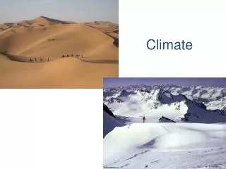
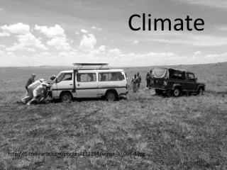
CLIMATE. What is Climate?. Climate - the weather conditions prevailing in an area in general over a long period. Tundra Desert. Rain Forest Deciduous Forest. Climate Zones. Climate BrainPOP. Factors Affecting Climate. Temperature Factors. 1. Latitude. Average Yearly Temperature.

E N D
What is Climate? Climate - the weather conditions prevailing in an area in general over a long period
Tundra Desert Rain Forest Deciduous Forest Climate Zones Climate BrainPOP
Factors Affecting Climate Temperature Factors 1. Latitude • Average Yearly Temperature • Yearly Temperature Range 2. Altitude 3. Ocean Currents 4. Marine Vs. Continental Rainfall Factors 1. Latitude 2. Mountains - Orographic Precipitation
Latitude - Average Yearly Temperature • The area that receives the most direct rays of the Sun (equator, 0°) will have the highest yearly temperatures. • As latitude increases, average yearly temperatures decreases Avg. Yearly Temp. • The area that receives the least direct rays of the sun (poles, 90°) will have the lowest yearly temperatures. 0° 90 ° Latitude
Latitude - Yearly Temperature Range • Equatorial areas receive the direct rays of the Sun for most of the year. Therefore, the yearly temperature does not change much. Low Latitudes Temperature Mid Latitudes High Latitudes JFMAMJJASOND Month
Latitude - Yearly Temperature Range • As latitude increases, yearly temperature range increases Yearly Temperature Range 0° 90 ° Latitude
Altitude - Average Yearly Temperature Range • Altitude - the height of an object above sea level. Low average yearly temperature range High average yearly temperature range
Altitude - Average Yearly Temperature • As altitude increases, average yearly temperature decreases Average Yearly Temperature Altitude
Ocean Currents • Ocean currents move warm water from the equator towards the poles. • Ocean currents move cold water from the poles back to the equator to be heated again. (pg. _4_ of ESRT) Animation
Marine vs. Continental • Sea or land locations affects temperature ranges. Since land gains and loses heat much more quickly than water, land areas tend to have warmer summers and cooler winters. Coastal areas near the ocean have cooler summers and milder/warmer winters. • Coastal areas have marine climates with a small yearly temperature range and areas inland have continental climates with a larger yearly temperature range
Marine Vs. Continental • Interactive Climate Map This graph shows the average monthly temperatures for two cities, A and B, which are both located at 41ºN latitude. Why is there a difference in the average yearly temperature range for the two cities? • Because City A is located inland (continental) and City B is located near water (marine)
Rainfall Factors - Latitude • Uneven heating of the Earth produces global wind & pressure belts. These belts determine the wetness or dryness of an area. • Low Pressure - rising air creates precipitation • High Pressure - sinking air creates a lack of precipitation Animation
Latitude Continued • What latitudes are areas of low pressure? • What is the climate like there? • What latitudes are areas of high pressure? • What is the climate like there? 0°, 60°N, 60°S High rainfall 30°N, 30°S, 90°N, 90°S Low rainfall
Orographic Precipitation LEEWARD WINDWARD 4.Condenses Windward 5. Precipitation 6. Sinks 3. Cools 7. Compresses 2. Expands rises 1. Rises 8. Warms Warm air Arid/Dry Humid/Moist
Windward Vs. Leeward • Rainfall occurs on the windward side of the mountain where the air is rising. • Cool & Wet • It is dry on the leeward side of the mountain where the air is sinking. • Warm & Dry
El Nino • A warming of the surface water of the eastern and central Pacific Ocean, occurring every 4 to 12 years and causing unusual global weather patterns. • El Nino brings heavy rain to western South American and drought to eastern Australia and Indonesia. Animation
Lake Effect Snow • The air moving over the water needs to be cooler than the water. • The surface of the lake can’t be frozen
Lake Effect Snow • Water begins evaporating off of the surface of the lake into the air. • Fetch - distance over open water • The greater distance the wind blows over the warm water, the greater the convection /evaporation.
Warm air over water begins to Lake Effect Snow CLOUD FORMATION CONDENSES COOL EXPAND RISE
In some localities, wind blowing from a lake onshore is forced to climb up hills creating the orographic effect Lake Effect Snow