Download
1 / 24
270 likes | 557 Views
INDONESIAN PORT CORPORATION IV. IMPLEMENTATION OF ENVIRONMENTAL ASPECT ON MAKASSAR URGENT DEVELOPMENT PROJECT. 8 TH IAPH ASIA OCEANIA REGIONAL MEETING & PORT FORUM HO CHI MINH CITY, JANUARI 31 ST – FEBRUARI 2 ND, 2007. MAX K. LUMEMPOUW DIRECTOR OF MARKETING AND PORT BUSINESS DEVELOPMENT.

E N D
INDONESIAN PORT CORPORATION IV IMPLEMENTATION OF ENVIRONMENTAL ASPECT ON MAKASSAR URGENT DEVELOPMENT PROJECT 8TH IAPH ASIA OCEANIA REGIONAL MEETING & PORT FORUMHO CHI MINH CITY, JANUARI 31ST – FEBRUARI 2ND, 2007 MAX K. LUMEMPOUWDIRECTOR OF MARKETING AND PORT BUSINESS DEVELOPMENT HEAD OFFICE ADDRESS :JALAN SOEKARNO NO 1 MAKASSAR - SOUTH SULAWESI, INDONESIA 90173TELEPHONE : +62411316549 – +62411326059FAXIMILE : +62411333757PO BOX 1040
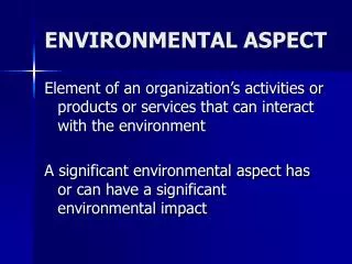
TITLE, SCOPE, AND BACKGOUND TITLE : IMPLEMENTATION OF ENVIRONMENTAL ASPECT ON MAKASSAR URGENT DEVELOPMENT PROJECT SCOPE OF EXPOSE: • EXISTING CONDITION OF MAKASSAR PORT MAKASSAR URGENT DEVELOPMENT PROJECT IMPLEMENTATION OF ENVIRONMENTAL ASPECT ON URGENT DEVELOPMENT PROJECT BACKGROUND : • MAKASSAR CITY IS WELL KNOWN FOR IT’S BEAUTIFUL BEACHES AND SEAFOOD BARBEQUES. SEA WATER QUALITY IS VERY ESSENTIAL ASPECT FOR FISH AND CORAL; PORT ACTIVITIES DONE VERY CLOSE AND INSEPARABLE WITH THE SEA, PORT EXPANTION MOSTLY THROUGH RECLAMATION FOR NEW LAND TO AVOID SOCIAL PROBLEM AND LAND ACQUISITION COST. PORT ACTIVITIES ( CONSTRUCTION PERIOD AND IT’S OPERATION ) MAY GIVE CONTRIBUTION TO ENVIRONMENT BY POLUTION SLIDE - 1
A GLIMPSE OF MAKASSAR PORT Position of Makassar Port : In the middle of Indonesia archipelago as well as in west to east distance and from north to south distances, on coordinate position of Latitude (S) 00º05’08” and Longitude (E) 119º24’02”. Dominant’s commodity : • Domestic Disch : • Vehicle • Fertilize • Coal • Wood • Iron • Iron sand • Cement • CPO • Gen car • Sugar • Gips • Domestic Load : • Cement • Rice • Clinker • Gen. Cargo • Wheat • Grist Bran • Sugar • Import : • Grist • Sugar • Vehicle • Fertilize • Gips • Pave • Cement • Spare Part • Export : • Clinker • Cocoa • Cement • Grist Bran • Plywood • Wood • Mollases • Marmer • Sea Weeds • The Port in 2006 Handled : • Cargo = 9.737.071 Ton • Container = 256.071 Teus • Passenger = 1.043.494 Person SLIDE - 2
MAIN FACILITIES OF MAKASSAR SHIPPING CHANNEL • Length : 2.00 Mill • Minimum Width : 150.00 M • Depth : - 16 m LWS BERTH & WHARF SLIDE - 3
SUPPORT FACILITIES FOR CONTAINER • PORT INFRASTRUCTURE. BERTH : 850 m CONTAINER YARD : 114.416 m2 CONTAINER FREIGHT STATION : 4.000 m2 • CONTAINER TERMINAL EQUIPMENT. 1. CONTAINER YARD (CY) : 114.416 M2 2. CONTAINER FREIGHT STATION : 4.000 M2 3. EQUIPMENT CONTAINER CRANE : 4 UNIT RUBBER TYRED GANTRY CRANE : 8 UNIT REACH STACKER : 2 UNIT @ 42 TON TOP LOADER : 2 UNIT @ 36 TON FORKLIFT : 10 UNIT @ 2 TON HEAD TRUCK : 14 UNIT CHASSIS : 32 UNIT REEFER FACILITY : 36 PLUG SLIDE - 4
DEVELOPMENT PLAN OF MAKASSAR PORTUNTIL YEAR 2025 DECREE OF MINISTRY OF COMMUNICATION NO.KM 2 YEAR 2004 DATED ONJANUARI 23RD, 2004 SLIDE - 6
MAKASSAR URGENT REHABILITATION PROJECT LAY OUT OF HATTA QUAY YEAR 1994 (BEFORE PROJECT) : SLIDE - 7
MAKASSAR URGENT REHABILITATION PROJECT LAY OUT OF HATTA QUAY YEAR 1998 (AFTER PROJECT) : SLIDE - 8
SCOPE OF WORKS OF MAKASSAR URGENT DEVELOPMENT PROJECT • SCOPE OF WORK : • 1. Demolition of existing old quay wall : 14,800 sqm; • Dredging works : 1,611,479 cum; • Construction New Quay Wall (caisson type) : 850 Lm; • Reclamation and Sand Replacement : 2,148,000 cum ; • 3. Container Yard and Multipurpose Cargo Area : 73,794 sqm • 4. CFS using Portal Beam system : 4,000 m • Pavement Asphalt : 15,170 sq.m • Concrete Apron : 24,417 sq.m • PROJECT IMPLEMENTATION SCHEDULE : • Review Design : September, 1922 to Februari, 1993 • Prequalification : November, 1922 to March, 1993 • Tender : September, 1993 to December, 1993 • Contract Signing : December, 1993 to Februari, 1994 • Constructions : May, 1994 to April, 1997 • PROJECT COST = Rp. 112 MILYAR ( + USD.11,2 MILLION) SLIDE - 9
OLD HATTA QUAY (1994) PROJECT ACTIVITY SLIDE - 10
PROJECT ACTIVITY SLIDE - 11
PROJECT ACTIVITY RECLAMATION ACTIVITY SLIDE - 13
CROSS SECTION OF MAIN QUAY WALL( CONTAINER BERTH ) SLIDE - 14
PROJECT ACTIVITIES, IMPACT TO ENVIRONMENT • Land Acquitation ( Social Impact ) • a. volume • - land : 50,719,00 sqm; • - building : 93,099.26 sq.m • b. Cost : Rp.13.957.690.605,00 • c. Method : Direct to the owner • d. Time : 5 years • Demolition of Old Wharf and Other Facilities : • a. Volume : 14,800 sqm; • b. Cost : Rp.943.943.945,00 • c. Method : Giant Breaker • d. Time : 2 year, 10 month • 3. Dredging : • a. Volume : 1,611,479 cum; • b. Cost : Rp.26.888.496.916,00 • c. Method : Grabdredger until Level -23,5 mlws • d. Time : 9 months • 4. Reclamation : • a. volume : 2,148,000 cum; • b. Cost : include in dredging work • c. Method : suction and bottom • dumping system • d. Time : 2 years 6 months • 5. Dumping Disposal Material : • a. volume : 1,611,479 cum; • b. Cost : include in dredging work • c. Method : Dispersal, bottom dumping • system at deep water – 20 mlws, - 16 km from project site • d. Time : 3 years SLIDE - 15
SEA WATER QUALITY AT PROJECT AND DUMPING AREA(REQUIREMENT AND MEASUREMENT) 11 LOCATIONS IDENTIFICATION SURVEY FOR CORAL AND FISH BEFORE AND AFTER PROJECT ACTIVITIES SLIDE - 16
SEA WATER QUALITY AT PROJECT AND DUMPING AREA(REQUIREMENT AND MEASUREMENT) LOCATION IDENTIFICATION SURVEY FOR WATER TURBIDITY, TEMPERATURE AND WATER QUALITY BEFORE AND AFTER PROJECT ACTIVITIES SLIDE - 17
METHOD OF ENVIROMENTAL SURVEY ACTIVITY • ES – 1 Done prior to dredging activity, aimed to recognize initial condition of dumping site and dumping site monitoring. Consisted of: Measurement of current and tidal current Measurement of water turbidity, temperature and quality Identification of kind and condition of coral reef and fish Simulation of turbidity dispersion. Method: a. Measurement of current and tidal current Using 4 authomatic measuring devices. Done at 1 major station and 4 sub stations. 15 days execution at the depth of ¼ and ¾. 2 days execution at sub station. SLIDE - 18
METHOD OF ENVIROMENTAL SURVEY ACTIVITY b. Measurement of turbidity Using 10 cm sea tech transmissiometer. Done at 6 different location. c. Identification of kind and condition of coral reef and fish Using transect boundaries of 10 x 10 m with 1 m of interval. Observation is taken place on coral reef and fish species, including the amount. Done at dredging and dumping site. Fish are collected using net at the area. SLIDE - 19
METHOD OF ENVIROMENTAL SURVEY ACTIVITY • ES – 2 Carried out to audit the condition of coral reef and fish as soon after dredging and reclamation is done. Consisted of : Part 1 : for dredging and dumping activity. Part 2 : for excavating and reclaiming dredged sand. Using the same method as ES -1. 3. ES - 3 A provisional sum when required. 4. Daily monitoring survey Daily monitoring of water turbidity at dredging and dumping areas, as well as excavating and reclaiming dredged sand. To take prevention actions to negative impacts, when turbidity moves toward the limit. SLIDE - 20
STANDARD VALUE AND RESULT • REMARKS : • During construction if water quality were detected as poor condition (turbidity more than 80 until 150 mg/ltr ), the project activities related to that particular places was stopped for a spent of time due to stabilized the condition, and continued by tight control. • REMARKS : • Mostly the Quantitu and Quality Line of Fish was no changes during and after project. • For few places, the kind and amount of fish (density) slightly increase comparing before to after project. SLIDE - 21
STANDARD VALUE AND RESULT SLIDE - 22
STANDART VALUE AND RESULT • REMARKS : • Some pant of coral was already in poor condition before the project started. • During construction a few corals were detected as poor condition, so the project activities related to that particular places was stopped for a spent of time due to stabilized the condition, and continued by tight control. • Standard for coral condition based on UNESCO guide (1984) • 100% - 76 % : EXCELLENT • 75% - 51% : GOOD • 50% - 26% : FAIR • < 25% : POOR SLIDE - 23
CLOSING REMARKS • Many Ports in developing countries now facing same problem to expand the port area due to the fact that ports location become are very close to the city activity. • So, reclamation for making new land is the most choice taken by for port expantion program. Social problem and cost of land acquisition are the first reason to be avoided. • The related activities such as dredging, reclamation and dumping disposal material are the activities with high potential negative contribution to environment by polution to sea water. • These activities should be followed by environment assesment before and after every particular activities, and these should be stated at the very beginning in the project tender document. • Many standards and guidance can be used for survey to coral, fish and water quality as well before, during and after construction, and for Makassar case it is very simple method, and this actually can be done by every reclamation project. • The benefit get by avoiding the land acquisition cost through reclamation alternative, should be compensated by proper environment impact assesment and its recovery program, in Makassar case its cover even not more than 0,3 % from total cost of civil works. • The port authority is willing to ensure this issue to the local government were in some cases this was leaved behind. • The city of Makassar now realized and thank to the project management for their commitments to keep or minimize the impact of project to the sea water quality. • These can be proved after few years as now people of Makassar city still can easily consume very good fish from its surrounding area. SLIDE - 24