Download
1 / 31
310 likes | 434 Views
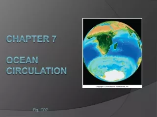
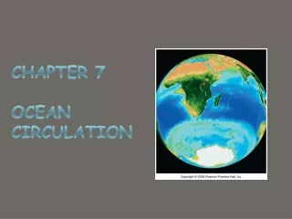
Chapter 7 Ocean Circulation. Look For The Following Key Ideas In Chapter 7. Ocean water circulates in currents caused mainly by wind friction at the surface and by differences in water mass density beneath the surface zone.

E N D
Look For The Following Key Ideas In Chapter 7 • Ocean water circulates in currents caused mainly by wind friction at the surface and by differences in water mass density beneath the surface zone. • Water near the ocean surface moves to the right of the wind direction in the Northern Hemisphere, and to the left in the Southern Hemisphere. • Surface currents affect the uppermost 10% of the world ocean, mostly above the pycnocline. Some surface currents are rapid and riverlike, with well-defined boundaries; others are slow and diffuse. The largest surface currents are organized into huge circuits known as gyres. • The Coriolis effect modifies the courses of currents, with currents turning clockwise in the Northern Hemisphere and counterclockwise in the Southern Hemisphere. The Coriolis effect is largely responsible for the phenomenon of westward intensification in both hemispheres. • Upwelling and downwelling describe the vertical movements of water masses. Upwelling is often due to the divergence of surface currents; downwelling is often caused by surface current convergence or an increase in the density of surface water.
Key Ideas Continued… • El Niño, an anomaly in surface circulation, occurs when the trade winds falter, allowing warm water to build eastward across the Pacific at the equator. • Circulation of the 90% of ocean water beneath the surface zone is driven by gravity, as dense water sinks and less dense water rises. Since density is largely a function of temperature and salinity, the movement of deep water due to density differences is called thermohaline circulation. • Water masses almost always form at the ocean surface. The densest (and deepest) masses were formed by surface conditions that caused water to become very cold and salty. • Because they transfer huge quantities of heat, ocean currents greatly affect world weather and climate. • Currents lie the very heart of physical oceanography. Their global effects, vast masses of water, complex flow, and possible influence on human migrations make their study of particular importance.
Mass Flow of Ocean Water Is Driven by Wind and Gravity What are some effects of ocean currents? • Transfer heat from tropical to polar regions • Influence weather and climate • Distribute nutrients and scatter organisms Surface currents are driven by wind: • Most of Earth’s surface wind energy is concentrated in the easterlies and westerlies. • Due to the forces of gravity, the Coriolis effect, solar energy, and solar winds, water often moves in a circular pattern called a gyre.
Surface Currents Are Driven by the Winds The westerlies and the trade winds are two of the winds that drive the ocean’s surface currents. About 10% of the water in the world ocean is involved in surface currents, water flowing horizontally in the uppermost 400 meters (1,300 feet) of the ocean’s surface, driven mainly by wind friction. (left) Winds, driven by uneven solar heating and Earth’s spin, drive the movement of the ocean’s surface currents. The prime movers are the powerful westerlies and the persistent trade winds (easterlies).
Surface Currents Are Driven by the Winds (above) Gyres can be further subdivided into distinct currents. The four interconnected currents in the North Atlantic Gyre have different flow characteristics and temperatures. (above) A combination of four forces – surface winds, the sun’s heat, the Coriolis effect, and gravity–circulates the ocean surface clockwise in the Northern Hemisphere and counterclockwise in the Southern Hemisphere, forming gyres.
Surface Currents Flow around the Periphery of Ocean Basins Surface water blown by the winds at point “A” will veer to the right of its initial path and continue eastward. Water at point “B” veers right and continues westward.
Surface Currents Flow around the Periphery of Ocean Basins The Ekman spiral and the mechanism by which it operates. The length of the arrows in the diagrams is proportional to the speed of the current in each layer.
Surface Currents Flow around the Periphery of Ocean Basins The effect of Ekman spiraling and the Coriolis effect cause the water within a gyre to move in a circular pattern. The movement of water away from point B is influenced by the rightward tendency of the Coriolis effect and the gravity-powered movement of water down the pressure gradient.
90° to the right of wind direction is up here At 15°N 30°– 45° Water continues clockwise? Trade wind Direction of water movement Stepped Art Fig. 8-6, p. 174
Surface Currents Flow around the Periphery of Ocean Basins Can you determine why the center of the hill is offset to the west? (top left) The surface of the North Atlantic is raised through wind motion and Ekman transport to form a low hill. Water from point B turns westward and flows along the side of this hill. (bottom left) The hill is formed by Ekman transport. Water turns clockwise (inward) to form the dome, then descends, depressing the thermocline.
Seawater Flows in Six Great Surface Circuits (above) A chart showing the names and usual direction of the world ocean’s major surface currents. The powerful western boundary currents flow along the western boundaries of the ocean basins in both hemispheres. Geostrophic gyres are gyres in balance between the pressure gradient and the Coriolis effect. Of the six great currents in the world’s ocean, five are geostrophic gyres.
Boundary Currents Have Different Characteristics What currents are found within gyres? Western boundary currents –These are narrow, deep, fast currents found at the western boundaries of ocean basins. • The Gulf Stream • The Japan Current • The Brazil Current • The Agulhas Current • The Eastern Australian Current Eastern boundary currents –These currents are cold, shallow and broad, and their boundaries are not well defined. • The Canary Current • The Benguela Current • The California Current • The West Australian Current • The Peru Current
Boundary Currents Have Different Characteristics The general surface circulation of the North Atlantic. The unit used to express volume in transport in ocean currents is the sverdrup (sv), named in honor of Harald Sverdrup, one of this century’s pioneering oceanographers. The numbers indicate flow rates in sverdrups (1 sv = 1 million cubic meters of water per second).
Boundary Currents Have Different Characteristics Eddy formation The western boundary of the Gulf Stream is usually distinct, marked by abrupt changes in water temperature, speed, and direction. (a) Meanders (eddies) form at this boundary as the Gulf Stream leaves the U.S. coast at Cape Hatteras. The meanders can pinch off (b) and eventually become isolated cells of warm water between the Gulf Stream and the coast (c). Likewise, cold cells can pinch off and become entrained in the Gulf Stream itself (d). (C = cold water, W = warm water; blue = cold, red = warm.)
Boundary Currents Have Different Characteristics Water flow in the Gulf Stream and the Canary Current, parts of the North Atlantic gyre.
Wind Can Cause Vertical Movement of Ocean Water Wind induced vertical circulation is vertical movement induced by wind-driven horizontal movement of water. Upwelling is the upward motion of water. This motion brings cold, nutrient rich water towards the surface. Downwelling is downward motion of water. It supplies the deeper ocean with dissolved gases.
Nutrient-Rich Water Rises near the Equator Equatorial upwelling. The South Equatorial Current, especially in the Pacific, straddles the geographical equator. Water north of the equator veers to the right (northward), and water to the south veers to the left (southward). Surface water therefore diverges, causing upwelling. Most of the upwelled water comes from the area above the equatorial undercurrent, at depths of 100 meters (330 feet) or less.
Wind Can Induce Upwelling near Coasts Coastal upwelling. In the Northern Hemisphere, coastal upwelling can be caused by winds from the north blowing along the west coast of a continent. Water moved offshore by Ekman transport is replaced by cold, deep, nutrient-laden water. In this diagram, temperature of the ocean surface is shown in degrees Celsius.
Wind Can Also Induce Coastal Downwelling Coastal downwelling. Wind blowing from the south along a Northern Hemisphere west coast for a prolonged period can result in downwelling. Areas of downwelling are often low in nutrients and therefore relatively low in biological productivity.
El Niño and La Niña Are Exceptions to Normal Wind and Current Flow An El Niño Year A Non-El Niño Year In an El Niño year, when the Southern Oscillation develops, the trade winds diminish and then reverse, leading to an eastward movement of warm water along the equator. The surface waters of the central and eastern Pacific become warmer, and storms over land may increase. In a non-El Niño year, normally the air and surface water flow westward, the thermocline rises, and upwelling of cold water occurs along the west coast of Central and South America.
L H 180º 0 200 m Moist air rises Rainfall Surface winds Warm-water pool Thermocline Upwelling Stepped Art Fig. 8-17a, p. 184
El Niño and La Niña Are Exceptions to Normal Wind and Current Flow El Niño changes atmospheric circulation and weather patterns. During an El Niño, low atmospheric pressure south of Alaska allows storms to move unimpeded to the Pacific coast of North America. The resulting weather is wet and cool to the south, and warm and dry in the north.
El Niño and La Niña Are Exceptions to Normal Wind and Current Flow In La Niña years, high atmospheric pressure south of Alaska blocks the storm track. Winds veer north, lose their warmth over Canada, and sweep down as cold blasts. The Pacific Northwest gets its usual rain, but the southwest suffers drought.
Thermohaline Circulation Affects All the Ocean’s Water The movement of water due to different densities is thermohaline circulation. Remember that the ocean is density stratified, with the densest water at the bottom. There are five common water masses: • Surface water • Central water • Intermediate water • Deep water • Bottom water
Thermohaline Flow and Surface Flow: The Global Heat Connection The global pattern of deep circulation resembles a vast “conveyor belt” that carries surface water to the depths and back again.
Deep Water Formation Can Affect Climate A simplified view of thermohaline circulation in the Atlantic. Surface water becomes dense and sinks in the north and south polar regions.
Water Masses May Converge, Fall, Travel across the Seabed, and Slowly Rise An idealized model of thermohaline circulation caused by heating in lower latitudes and cooling in higher latitudes. The thermocline at middle and low latitudes is “held up” by the slow upward movement of cold water.
Chapter 7 Summary Ocean water circulates in currents. Surface currents affect the uppermost 10% of the world ocean. The movement of surface currents is powered by the warmth of the sun and by winds. Water in surface currents tends to flow horizontally, but it can also flow vertically in response to wind blowing near coasts or along the equator. Surface currents transfer heat from tropical to polar regions, influence weather and climate, distribute nutrients, and scatter organisms. They have contributed to the spread of humanity to remote islands, and they are important factors in maritime commerce. Circulation of the 90% of ocean water beneath the surface zone is driven by the force of gravity, as dense water sinks and less dense water rises. Since density is largely a function of temperature and salinity, the movement of deep water due to density differences is called thermohaline circulation. Currents near the seafloor flow as slow, riverlike masses in a few places, but the greatest volumes of deep water creep through the ocean at an almost imperceptible pace. The Coriolis effect, gravity, and friction shape the direction and volume of surface currents and thermohaline circulation.