Download
1 / 37
370 likes | 574 Views
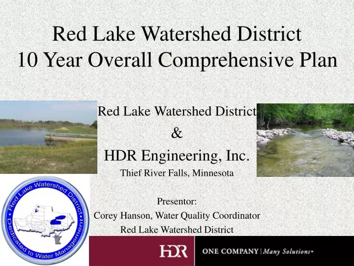
Red Lake Watershed District 10 Year Overall Comprehensive Plan. Red Lake Watershed District & HDR Engineering, Inc. Thief River Falls, Minnesota Presentor: Corey Hanson, Water Quality Coordinator Red Lake Watershed District. Overview of the Red Lake Watershed District - Location -.

E N D
Red Lake Watershed District10 Year Overall Comprehensive Plan Red Lake Watershed District & HDR Engineering, Inc. Thief River Falls, Minnesota Presentor: Corey Hanson, Water Quality Coordinator Red Lake Watershed District
Engineering Projects • Impoundments and Dams • Ring Dikes • Ditch Inspection • Ditch Cleaning • Permit Inspection • Stream Gauging • Snow Sampling • Clearing and Snagging
RLWD Projects- Water Quality - • Long-Term Water Quality Monitoring • Over 30 sites • At least 4 samples per year • Lake and Stream Monitoring • Special Studies • Clearwater Lake Water Quality Model, Habitat/Bioassessment, Tile Drainage Study • Water Quality Improvement Projects • Erosion Control • BMP Implementation
10-Year Plan – RLWD Concerns • Agricultural and Urban Flooding • Water Quality • Natural Resources • Water Supply • Economy • Recreation
Elements of the Plan • General Description of the District • Description of Water Resources • Economic Development • Historic Flood Problems • FDR/NRE Overall Watershed Goals and Objectives • Water quantity, quality, erosion, natural resources • Implementation Plans for each subwatershed • Annual Monitoring and Evaluation Program • Projects
Plan Process • Public Involvement • Hydrologic Model • Inventory and Assessment • Development of Long-Term Goals • Describe Ways of Measuring Success • Develop a Financial Toolbox
Public Involvement • Identify issues • Ag & urban flooding • Water quality • Natural Resources • Water Supply • Economy • Recreation • Consensus
Overall Advisory Group • Citizen Advisory Committee • Technical Advisory Committee • Broad array of stakeholders • Give them power to make decisions • Give credibility to the plan and justify implementation plan
Overall Advisory Group • Community-based assessment of problems (restoration) and opportunities (prevention) • Citizen involvement can increase chance of success • Constituency of advocates • Demonstrate solutions that can be applied to other communities • Citizens and stakeholders foot the bill, so they should have input • Use RLWD website (www.redlakewatershed.org) to share information
Hydrologic Model • 14 Subwatersheds modeled using GIS and HEC-1 interface (ArcView and HEC-GeoHMS)
Standard Geo-HMS Processes 1. Determine Sub-watershed Boundaries and Drainage Flow Directions – Raw Data came from MN-DNR 2. Terrain is then Pre-Processed to Arcview Format using Arc-GIS software.
Standard Geo-HMS Processes 3. A Digital Elevation Model of the study area is Created within Arcview 4. Flow Accumulation and Flow Direction Grids are generated next.
Standard Geo-HMS Processes 5. Based on the DEM, Flow Acc, and Flow Direction Grids, Arcview can determine the Minor Watershed Boundaries, and the streams and channels within those watersheds. 6. Stream and Sub-basin characteristics such as length, slope, mannings value, and basin centroid, are then determined within Arcview.
Standard Geo-HMS Processes 7. A sub-basin curve number, and a design Rainfall is then Applied to the watersheds. Also Tc or Time of Concentration is then calculated for each watershed. This data is then imported back into ArcView from Microsoft Excel. 8. Geo-HMS then generates a schematic, legend, and background map file for the entire study area watershed. This model is then exported from Geo-HMS to HEC-HMS. You now have a working Model.
Lost River Red Lake River Clearwater River Examples of Models Lower Badger Beau Gerlot Maple Lake Heartsville Coulee Burnham Creek • Examples of Models Grand Marais Hill River Poplar River
We can now use the model to help determine the benefits of new projects. Benefits • Ditch improvements, easements, diversions, retention, crop residue management, floodplain management, and changes in land use
Pre- and Post-Project Flood Areas Pre-Project Flooded Area Post-Project Flooded Area
Inventory and Assessment • Inventory and Assessment of Water and Land Resources Related to Priority Concerns in the Watershed • GIS data layers • Information from other agencies • Natural Resources Assessment
Natural Resources Assessment • Use GIS to develop base resource maps • Consult NR professionals to refine maps and develop goals, objectives, strategies,and priorities for each subwatershed • Present products to committees
Natural Resources Assessment • Existing Resource Analysis • Large habitat blocks, quality habitats, sensitive species, public/conservation lands, wildlife concentration lands • Restorable Resources • Farmed wetlands, partially drained wetlands, unstable waterways, water quality improvement areas, potential sediment yield • Priority Natural Resource Areas • CRP and RIM lands, large private parcels, watershed management initiatives, infrastructure, most productive agricultural land
Development of Long-Term Goals • 10-yr implementation strategy • Address priority concerns • Tangible outcomes are keys to success of plan • Workshops with committees for water quantity, water quality, erosion, and natural resources
Setting Flood Prevention/Protection Goals • Vision Statement • We envision a reduction in flood damages with active cooperation and education of constituents and public partners • Goals • Reduce peak flows by 10% • Reduce runoff volume contributing to peak flows by 30,000 ac-ft • Identify special projects to implement • Education • Floodplain management programs
Early, Middle, Late Concept • Early • Moves ahead of major flood flows • Increase speed of removal to reduce peak flows • Middle • Typically coincides with flood peak • Slow down to reduce flood peaks downstream • Late • After the major flood flows • Slow down to reduce downstream peak flood flows
Describe Ways of Measuring the Project’s Success • Specify levels of flood protection • I.E. Ag protection for a 10-yr 24 hr storm • Water quality improvements • Habitat Improvements • Acres of buffer strips, acre-feet of water, acres of habitat
Develop A Financial Toolbox • Projects benefit multiple groups – multiple sources of funds • Identification of funding partners • Review levy funding mechanisms
THE END Points to Consider • Water can be controversial • Planning process should be consistent over subwatersheds, even though subwatersheds have different goals • Try to return natural functions to the landscape where practical • Think long-term with low-maintenance solutions • Develop broad based understanding of the complicated nature of water management • Recognize past solutions that worked and did not work for meeting goals • Utilize existing studies and reports when setting goals • Create a set of goals for each subwatershed www.redlakewatershed.org


![[Name] School District Comprehensive Plan](https://cdn1.slideserve.com/2512216/name-school-district-comprehensive-plan-dt.jpg)