Download
1 / 17
170 likes | 307 Views
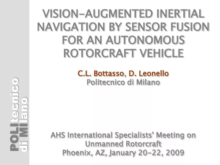
VISION-AUGMENTED INERTIAL NAVIGATION BY SENSOR FUSION FOR AN AUTONOMOUS ROTORCRAFT VEHICLE C.L. Bottasso , D. Leonello Politecnico di Milano AHS International Specialists' Meeting on Unmanned Rotorcraft Phoenix, AZ, January 20-22, 2009. Outline. Introduction and motivation

E N D
VISION-AUGMENTED INERTIAL NAVIGATION BY SENSOR FUSION FOR AN AUTONOMOUS ROTORCRAFT VEHICLEC.L. Bottasso, D. LeonelloPolitecnico di MilanoAHS International Specialists' Meeting onUnmanned Rotorcraft Phoenix, AZ, January 20-22, 2009
Outline • Introduction and motivation • Inertial navigation by measurement fusion • Vision-augmented inertial navigation • - Stereo projection and vision-based position sensors • - Vision-based motion sensors • - Outlier rejection • Results and applications • Conclusions and outlook
Rotorcraft UAVs at PoliMI • Low-cost platform for development and testing of navigation and control strategies (including vision, flight envelope protection, etc.) • Vehicles: off-the-shelf hobby helicopters • On-board control hardware based on PC-104 standard • Bottom-up approach, everything is developedin-house: • - Inertial Navigation System (this paper) • - Guidance and Control algorithms (AHS UAV `07: C.L. Bottasso et al., path planning by motion primitives, adaptive flight control laws) • - Linux-based real-time OS • - Flight simulators • - System identification (estimation of inertia, estimation of aerodynamic model parameters from flight test data) • - Etc. etc.
UAV Control Architecture Hierarchical three-layer control architecture (Gat 1998): • Strategic layer: assign mission objectives (typically relegated to a human operator) • Tactical layer: generate vehicle guidance information, based on input from strategic layer and ambient mapping information • Reflexive layer: track trajectory generated by tactical layer, control, stabilize and regulate vehicle Obstacles Sense vehicle state of motion (to enable planning and tracking) Sense environment (to enable mapping) Target
Sensing of vehicle motion states GPS Proposed approach: Recruit vision sensors for improved state estimation Accelerometer Gyro Sensor fusion algorithm State Estimates Sonar altimeter • Advantages: • Improved accuracy/better estimates, especially when in proximity of obstacles • Sensor loss tolerant (e.g. because of faults, or GPS loss indoors, under vegetation or in urban canyons, etc.) Magnetometer Other sensors Sensing of environment for mapping (This paper) Stereo cameras Ambient map Obstacle/target recognition Sensor fusion algorithm Laser scanner Other sensors
T T T T T T T T T T T T T E E E B E B T T ( ( ) ) ( ( ) ) h h : : : : u z v a r ! m y x v v r ! r m q = = = = G B O G O B s o n a r ; ; ; ; ; ; ; ; ; ; g a p c s c g g p y s r o m a g n ¡ ¢ ( ) ( ) ( ) ( ( ) ) ( ) ^ f _ t t t t t t ¹ + x x x x u º = = k k 1 1 + + ; ; ¡ ¡ ¢ ¢ ( ( ) ) ( ( ) ) ( ) h K t t t t t ¹ ¡ y z x y = k k k k k 1 1 1 + + + ( ) ( ) ( ) t t t + z y ¹ = k k k Classical Navigation System Sensor fusion by Kalman-type filtering to account for measurement and process noise: States: Inputs: Outputs Measures:
Vision-Based Navigation System Kanade-Lucas-Tomasi tracker: Tracks feature points in the scene across the stereo cameras and across time steps Each tracked point becomes vision-based motion sensor Has own internal outlier rejection algorithm GPS Accelerometer Gyro Sensor fusion algorithm State Estimates Sonar altimeter Magnetometer Other sensors Vision sensors Stereo cameras KLT Outlier rejection
0 0 0 0 0 ( ) 0 d d f b d C C O P B ¡ c c c c p r p ¼ p p = = O B 1 1 2 3 1 b C C d p = d Vision-Based Position Sensor Feature point projection: Stereo vision: disparity computed with Kanade-Lucas-Tomasi (KLT) algorithm Effect of one pixel error on estimated distance (BumbleBee X3 camera) ▶ Remark: stereo vision info from low res cameras is noisy, need care
Feature Point Tracking ▼ Left camera ▼ Right camera Tracking across cameras Tracking across time steps Time k ▶ Time k+1 ▶
0 0 0 0 0 d b f P C O B C c p c r c c O B 2 3 1 d C T T E B B C ¡ ¢ ( ) d _ M C R C E B C ¡ + £ + ( ) p v ! c d R R C 0 = + + B r c = d t Vision-Based Motion Sensor Differentiate the vector closure expression: Apparent motion of feature point on image plane (motion sensor): Attitude Linear velocity Angular velocity
T T T T T 0 T T T T T T C C E E B T ( 0 ) ( ( ) ( ) ) h d d : h d d : t t k k + + 1 1 z v r m y v r m = = k k 1 1 + + i i i i G O G s o n a r ; ; ; ; : : : ; ; ; : : : ; ; ; ; : : : ; ; ; : : : g p s g p s m a g n v s o n v s o n Vision-Based Motion Sensor • For all tracked feature points, write motion sensor equation • This defines a new output of the vehicle states • Measure apparent motion of feature pt: • Fuse in parallel with all other sensors using Kalman filtering This defines a new augmented measurement vector: GPS, gyro, accelerometer, magnetometer, altimeter readings + two (left & right cameras) vision sensor per tracked feature point Measured apparent velocity (due to vehicle motion)
Outlier Rejection • Outlier: • A point which is not fixed wrt to the scene • A false positive in the tracking KLT algorithm • Outliers give false info on the state of motion, need a way to discard them from the process • Two stage rejection: • KLT internal • Vehicle motion compatibility check Apparent point velocity due to estimated vehicle motion Measured apparent velocity Drop tracked point if the two vectors differ too much in length and direction ▶
Examples: Pirouette Around Point Cloud • Cloud of about 100 points • Temporary loss of GPS signal (for 100 sec < t < 200 sec) • To show conservative results: • Only <=20 tracked points at each instant of time • Vision sensors operating at 1Hz
Examples: Pirouette Around Point Cloud Filter warm-up End GPS signal loss Begin GPS signal loss Classical non-vision-based IMU Vision-based IMU Remark: No evident effect of GPS loss on state estimation for vision-augmented IMU
Examples: Flight in a Village • Rectangular flight path in a village at 2m of altitude • Three loops: • With GPS • Without GPS • With GPS ◀ Scene environment and image acquisition based on Gazebo simulator
Examples: Flight in a Village End GPS signal loss End GPS signal loss Begin GPS signal loss Begin GPS signal loss Filter warm-up Filter warm-up Some degradation of velocity estimates without GPS Some degradation of velocity estimates without GPS ◀ No evident effect of GPS loss on attitude estimation
Conclusions • Proposed novel inertial navigation system using vision motion sensors • Basic concept demonstrated in a high-fidelity virtual environment • Observed facts: • Improved observability of vehicle states • No evident transients during loss and reacquisition of sensor signals • Higher accuracy when close to objects and for increasing number of tracked points • Computational cost compatible with • on-board hardware (PC-104 Pentium III) • Outlook: • Testing in the field • Adaptive filtering: better robustness/tuning • Recruitment of additional sensors (e.g. stereo laser-scanner) BumbleBee X3 camera