Download
1 / 65
660 likes | 834 Views
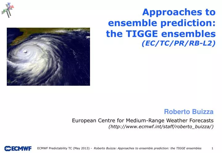
Approaches to ensemble prediction: the TIGGE ensembles ( EC/TC/PR/RB-L2). Roberto Buizza European Centre for Medium-Range Weather Forecasts (http://www.ecmwf.int/staff/roberto_buizza/). Outline. Objectives and approaches to ensemble prediction

E N D
Approaches to ensemble prediction: the TIGGE ensembles (EC/TC/PR/RB-L2) Roberto Buizza European Centre for Medium-Range Weather Forecasts (http://www.ecmwf.int/staff/roberto_buizza/)
Outline • Objectives and approaches to ensemble prediction • Comparison of the 2002 ECMWF, MSC and NCEP ensemble systems • The THORPEX/TIGGE ensembles
PDF(T) PDF(0) time 1. Ensemble prediction Ensemble prediction aims to estimate the probability density function of forecast states, taking into account all possible sources of forecast error: • Observation errors and imperfect boundary conditions • Data assimilation assumptions • Model errors
There is a strong constraint: limited resources (man and computer power)! 1. What should an ensemble prediction simulate? Two schools of thought: • Monte Carlo approach: sample all sources of forecast error, perturb any input variable and any model parameter that is not perfectly known. Take into consideration as many sources as possible of forecast error. • Reduced sampling: sample leading sources of forecast error, prioritize. Rank sources, prioritize, optimize sampling: growing components will dominate forecast error growth.
1. Monte Carlo approach (MSC): all-inclusive design The original (1995) MSC ensemble was designed following a Monte Carlo approach to simulate: • observation errors (random perturbations); • imperfect boundary conditions (perturbed surface fields); • model errors (different parameterisations and originally also 2 models, random error component added to the initial perturbations). The MSC ensemble
1. Simulation of init-unc: selective sampling In the original ECMWF and NCEP ensembles (1992), the initial conditions are generated by adding perturbations to the unperturbed analysis. The initial perturbations were designed to span only a subspace of the phase space of the system (selective sampling): • ‘dynamically dominant’ directions at ECMWF • ‘analysis dominant’ directions at NCEP
1. Selective sampling: singular vectors (ECMWF) A perturbation time evolution is linearly approximated: The singular vectors, i.e. the perturbations with the fastest finite-time growth: are computed by solving: time T
1. Selective sampling: breeding vectors (NCEP) At NCEP a different strategy based on perturbations growing fastest in the analysis cycles (bred vectors, BVs) was followed Each BV was computed by a cycle of (a) adding a random perturbation, (b) evolving and (c) rescaling it, and then repeat steps (b-c).
Outline • Objectives and approaches to ensemble prediction • Comparison of the 2002 ECMWF, MSC and NCEP ensemble systems • The THORPEX/TIGGE ensembles
2. The 2002 ECMWF, MSC and NCEP systems Results based on the 2002 operational systems are relevant since they highlight the relative impact of initial perturbation methods, analysis and model characteristics on ensemble performance. In all ensembles, each member is given by integrating the following equation:
2. The 2002 ECMWF, MSC and NCEP systems The perturbed initial conditions can be defined directly by a perturbed analysis or by adding a perturbation to the unperturbed analysis e0(0) where ej(-) is the DA starting point and oj(-) represents observations.
2. The 2002 ECMWF, MSC and NCEP systems The three ensembles differ also in size, resolution, daily frequency and forecast length. In 2002, the three systems had the following characteristics:
2. Similarities in EM & STD: 14/05/02 t=0 Due to the different methodologies, the ensemble initial states are different. • Area: the ensembles’ put emphasis on different areas; EC has the smallest amplitude over the tropics. • Amplitude: the ensembles’ stds are larger than the std of the 3-centers’ analyses (2 times smaller contour interval); EC has ~2 times lower values over NH. Ref=std(ANj)
2. Similarities in EM & STD: 14/05/02 +48h After 48h, the ensemble spreads are more similar, all identifying the main areas where the average of the ens-mean errors is larger. • Area: there is some degree of similarity among the areas covered by the evolved perturbations. • Amplitude: similar over NH; EC smaller over tropics. • Std-vs-rmse: certain areas of large spread coincide with areas of large error. Ref=std(EMj-ANj)
2. Similarities in EM & STD: 14/05/02 +120h After 120h, ensemble spreads are even more similar, all identifying the main regions where the average of the ens-mean errors is larger. • Area: perturbations show maximum amplitude in similar regions. • Amplitude: EC perturbations have larger amplitude. • Std-vs-rmse: there is a certain degree of agreement between areas of larger error and large spread. Ref=std(EMj-ANj)
2. Similarities in EM & STD: May ‘02 t=0 Average results for May 2002 confirm that the three ensembles have different initial-time spread. • Area: NCEP and MSC peak over the Pacific ocean and the Polar cap while EC peaks over the Atlantic ocean; MSC shows clear minima over Europe and North America. • Amplitude: MSC and NCEP are ~2 times larger than the std of the 3 centres’ analyses (2-times larger contour interval); EC has amplitude similar to 3C-std over NH but has too small amplitude over the tropics. Ref=std(EMj-ANj)
2. Similarities in EM & STD: May ‘02 t=0 The EC std shows a closer agreement with areas of baroclinic instability, as seen by comparing the stds with the Eady index (Hoskins and Valdes 1990: (with static stability N and wind shear computed using the 300- and 1000-hPa potential temperature and wind). Ref=Eady index
2. Similarities in EM & STD: May ‘02 +48h After 48 hours, the ensemble spreads are more similar. • Area: NCEP and MSC give more weight to the Pacific while EC gives more weight to the Atlantic; NCEP initial relative maximum over the North Pole cap has disappeared; MSC shows still a large amplitude north of Siberia. • Amplitude: MSC has the largest amplitude over NH; EC has the smallest amplitude over the tropics. Ref=std(EMj-ANj)
2. Main conclusions from the comparison • In terms of spread, the three systems differ substantially at initial time, while they are more similar after 2 days. • The spread of the ECMWF EPS grows faster than in the other two systems because of the combined effect of sustained SV-based perturbations’ growth and the stochastic simulation of random model errors. • Skill has not been compared in this talk. Buizza et al (2005) concludes that ensemble performance depends on the quality of the data assimilation system used to generate the initial conditions, the model used to produce the forecasts, and the perturbation strategies. Overall, the ECMWF EPS was the most reliable and performed best.
Outline • Objectives and approaches to ensemble prediction • Comparison of the 2002 ECMWF, MSC and NCEP ensemble systems • The THORPEX/TIGGE ensembles
3. THORPEX/TIGGE objectives THORPEX (THe Observing system Research and Predictability Experiment) is a WMO World Weather Research Program aiming to accelerate improvements in the accuracy of one-day to two-week high-impact weather forecasts for the benefit of society, the economy and the environment. TIGGE (the THORPEX Interactive Grand Global Ensemble eXperiment) is a framework for international collaboration in ensemble prediction systems. It aims to enhanced collaboration and to foster the development of new methods of combining ensembles from different sources and of correcting for systematic errors (biases, spread over-/under-estimation).
3. TIGGE relies on existing ensemble systems There are 10 operational global, medium-range ensemble systems (BMRC, CMA, CPTEC, ECMWF, FNMOC, JMA, KMA, MSC, NCEP and UKMO) with horizontal resolution ranging from T62 to TL639 (~32km), and with forecast length ranging from 8 to 16 days. Nine medium-range (all but FNMOC) and the short-range Meteo-France ensembles are archived in TIGGE (in total 557 forecasts a-day!). Two further global, medium-range systems (NCMRWF, SAWS) are under development and testing. The TIGGE data-base includes many parameters from all contributing centres (see http://tigge.ecmwf.int/ for more information).
BMRC CPTEC ECMWF FNMOC EC-AN NCEP 3. Z50000,120h: BMRC, CPTEC, ECMWF, FNMOC, NCEP Europe: 120h forecast probability of T850<0 degrees. What is the PR(T850<0) in Firenze? BMRC gives 0%, the others more than 20% probability*. * This is just one case: probability forecasts should be verified on a large dataset.
BMRC ECMWF JMA KMA NCEP EC-AN 3. Z50012,120h: BMRC, ECMWF, JMA, KMA, NCEP Europe: 120h forecast probability of T850<0 degrees. What is the PR(T850<0) in Tunisia? BMRC gives a zero probability.* * This is just one case: probability forecasts should be verified on a large dataset.
3. The TIGGE ensembles (updated May 2013) The 10 TIGGE ensembles use different methodologies to simulate initial-time and model uncertainties. Every day, they provide 557 global forecasts!
3. The SV-based ensembles: BOM, ECMWF, JMA, MF In these ensembles, the perturbed initial conditions are defined by adding to the unperturbed analysis (the interpolated high-resolution analysis) perturbations defined by a linear combination of SVs: • BOM: initial-time SVs computed over NH and SH extra-tropics • ECMWF: a combination of initial-time SVs, computed over NH and SH extra-tropics, and over few tropical regions , and perturbations generated from an Ensemble Data Assimilation (EDA) system • JMA: initial-time SVs computed over the NH extra-tropics and the tropics • MF: initial-time SVs optimized to grow over a European region plus EDA-based perturbations
3. The EnKF-based ensemble: MSC • The MSC ensemble uses an EnKF to generate the initial conditions (Houtekamer & Mitchell 2005). The perturbed initial conditions are defined by 20 EnKFmembers (randomly-selected from the 192 available members). The EnKF (Evensen 1994) is an approximation of the Kalman Filter that improves as the ensemble size increases. • The MSC EnKF uses a model error parameterization based on the forecast error description of the MSC 3D-Var. Thus, it should be considered as a hybrid scheme (Hamill & Snyder 2000). The EnKF runs with: • a 6 hour cycle; • double configuration with a pair of 48 members; • randomly perturbed observations, with random perturbations sampled from a normal distribution with obs-error statistics.
3. The BV-based ensemble: CMA, KMA In these ensembles, the perturbed initial conditions are defined by adding to the unperturbed analysis (the interpolated high-resolution analysis) perturbations defined by BVs (Toth & Kalnay 1997), computed following the method that was used at NCEP from 1992 till recently. Each BV is computed by adding a random perturbation to the starting analysis, evolving it for 24-hours and then rescaling it. BVs are grown non-linearly at full model resolution.
3. The ETKF-based (BV-inspired) ensemble: UKMO The Ensemble Transform Kalman Filter (ETKF) method was first proposed by Bishop et al (2001) in targeted observation studies, and used in ensemble systems by Wang & Bishop (2003). In the UKMO ETKF, perturbations are cycled and re-orthogonalized, and then ‘transformed’ using an estimate of the analysis error covariance matrix defined by observations and short-time forecast errors. ETKF perturbations can be considered as modified BVs, with BVs transformed using ETKF ideas. The perturbed initial conditions are defined by adding to the unperturbed analysis (the interpolated high-resolution analysis) perturbations defined by the difference of ETKF members.
3. The ETR-based (BV-inspired) ensemble: NCEP The Ensemble Transform (ET) method was first proposed by Bishop & Toth (1999) in target observation studies. The ET with rescaling (ETR) method is an extension of breeding (Wei et al 2008). Given a set of perturbations, in the ET method perturbations are ‘transformed’ using analysis error variances from the best possible data-assimilation system (instead of using an estimate of the analysis error covariance matrix defined by observations and short-time forecast errors, as it is done in the ETKF method). In the ETR method, the ET perturbations are re-scaled to have an initial spread distribution similar to an estimate of the analysis error variance. As for ETKF perturbations, ETR perturbations can be considered modified BVs, with BVs transformed using the ET method and rescaled. The perturbed initial conditions are defined by adding to the unperturbed analysis (the interpolated high-resolution analysis) perturbations defined by the difference of ETKF members.
3. The EOF-based (BV-inspired) ensemble: CPTEC The EOF-based method was developed by Zhang & Krishnamurti (1999) to apply an ensemble technique to hurricane forecasting: • an ensemble of forecasts is performed by adding random perturbations to the unperturbed analysis • each model is integrated for 36 hours with full physics • an EOF analysis is performed on the time series of the differences between the perturbed and the control forecast • the modes whose EOF coefficients increase rapidly are used as initial perturbations The perturbed initial conditions are defined by adding to the growing modes to the unperturbed analysis (the interpolated high-resolution analysis). As for ETKF and ETR perturbations, these EOF perturbations can be considered modified BVs, with BVs transformed using the EOF method.
3. TIGGE ens: 2009/01/10 12UTC – ICs EU T0 - 9 global TIGGE ensemble-mean (T850), ECMWF analysis (Z500 and T850) and EadyIndex. EC AN Z500 EC AN T850 Eady Index
3. TIGGE ens: 2009/01/10 12UTC – std EU T0 - 9 global TIGGE spread (T850 std), ECMWF analysis (Z500 and T850) and Eady Index. EC AN Z500 EC AN T850 Eady Index
3. TIGGE ens: 2009/01/10 12UTC +120h – EU T+120h - 9 global TIGGE ensemble-mean forecasts (T850), verifying ECMWF analysis (Z500 and T850) and Eady Index. EC AN Z500 EC AN T850 Eady Index
3. TIGGE ens: 2009/01/10 12UTC +120h – std EU T+120h - 9 global TIGGE forecast spread (T850 std), verifying ECMWF analysis (Z500 and T850) and Eady Index. EC AN Z500 EC AN T850 Eady Index
3. TIGGE ens: 2009/01/10 12UTC ICs – TR T0 - 9 global TIGGE spread (T850 std), ECMWF analysis (Z500 and T850) and Eady Index. EC AN Z500 EC AN T850 Eady Index
3. TIGGE ens: 2009/01/10 12UTC +120h – TR T+120h - 9 global TIGGE spread forecasts (T850 std), verifying ECMWF analysis (Z500 and T850) and Eady Index. EC AN Z500 EC AN T850 Eady Index
3. J12FM13 (90c): T850 rmse(CF) over NH RMSE(control) for T850 over NH, for winter 2012-13 (90 cases).
3. J12FM13 (90c): T850 rmse(EM) over NH RMSE(ensemble-mean) for T850 over NH, for winter 2012-13 (90 cases).
3. J12FM13 (90c): T850 std over NH Spread (std) for T850 over NH, for winter 2012-13 (90 cases).
3. J12FM13 (90c): T850 std and rmse(EM) over NH RMSE(ensemble-mean ) and spread for T850 over NH, for winter 2012-13 (90 cases).
3. J12FM13 (90c): T850 CRPSover NH CRPS for T850 over NH, for winter 2012-13 (90 cases).
3. J12FM13 (90c): T850 rmse(CF) over TR RMSE(control) for T850 over the tropics, for winter 2012-13 (90 cases).
3. J12FM13 (90c): T850 rmse(EM) over TR RMSE(ensemble-mean) for T850 over the tropics, for winter 2012-13 (90 cases).
3. J12FM13 (90c): T850 std over TR Spread (std) for T850 over the tropics, for winter 2012-13 (90 cases).
3. J12FM13 (90c): T850 std and rmse(EM) over TR RMSE(ensemble-mean ) and spread for T850 over NH, for winter 2012-13 (90 cases).
3. J12FM13 (90c): T850 CRPS over TR CRPS for T850 over the tropics, for winter 2012-13 (90 cases).
3. J12FM13 (90c): T850 CRPS over Europe CRPS for T850 over Europe, for winter 2012-13 (90 cases).
3. J12FM13 (90c): U850 CRPS over NH CRPS for U850 over the NH, for winter 2012-13 (90 cases).
3. J12FM13 (90c): U850 CRPS over TR CRPS for U850 over the tropics, for winter 2012-13 (90 cases).