Download
1 / 21
210 likes | 320 Views
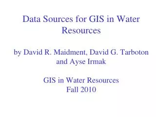
Structured Approach for Integrating Cadastral Data in a Geodata Infrastructure. Dr. Daniel Steudler Swiss Federal Directorate for Cadastral Surveying The State Land Service of Latvia 20th Anniversary Conference «Challenges for Cadastre in Digital Era» 8 May 2013, Riga, Latvia.

E N D
Structured Approach for Integrating Cadastral Data in a Geodata Infrastructure Dr. Daniel Steudler Swiss Federal Directorate for Cadastral Surveying The State Land Service of Latvia 20th Anniversary Conference «Challenges for Cadastre in Digital Era» 8 May 2013, Riga, Latvia
Table of Contents • Land related issues and needs • Role of land administration, land management and land governance • Six key elements for a «Spatially Enabled Society» • Focus on two key elements • Landownership information • Common data integration concept • Case study
World urban/rural population 1950-2050(esa.un.org) 30% rural 40% rural 70% urban 43% urban 51% urban 49% rural 60% urban 36% 57% rural 29% 64% 71% 1950 (2.5 billion) 1970 (3.7 billion) 1990 (5.3 billion) 2010 (6.9 billion) 2030 (8.3 billion) 2050 (9.2 billion) Challenges – Social • population growth (increasing to 9 billion by 2050), huge urbanization process • intensive development of infrastructures and basic services • conflicts between concept of private and individual landownership and of traditional, indigenous land tenure
Challenges – Environmental sustainability • environmental sustainability is hugely affected by the "tragedy of commons" dilemma; • serious erosion and degradation problems; • clear definition of responsibility and accountability for the resource "land".
Challenge – Disaster management • Thailand after tsunami: lack of proper landownership information allowed financial investors to take over land, while local fisherman have been ousted from their properties; • well documented landownership information would have protected minorities with lesser economic power against exploitation; • Aceh after tsunami: the loss of land registry and cadastral data caused huge problems for reconstruction, planning, and social stability; • Disaster management starts before the disaster; landownership information is crucial.
Challenge – Land Management Nail house in Chongqing, China (2007): A cadastre with documentation of land ownership is clearly in place, but something else seems to be non-satisfactory.
Publication «Spatially Enabled Society» Steudler, D. and A. Rajabifard, editors, 72 pages, FIG Publication no. 58 http://www.fig.net/pub/figpub/pub58/figpub58.pdf A spatially enabled society – including its government – is one that makes use and benefits from a wide array of spatial data, information, and services as a mean to organize its land related activities. Spatial enablement is a concept that adds location to existing information and thereby unlocks the wealth of existing knowledge about the land, its legal and economical situation, its resources, potential use and hazards. Information on landownership is thereby a basic and crucial component to allow for correct decision-making. Such data and information must be available in a free, efficient, and comprehensive way in order to support the sustainable development of society. It therefore needs to be organized in such a way that it can easily be shared, integrated, and analysed to provide the basis for value-added services.
Six Key Elements for a SES • Legal framework for basic geoinformation; • Common Data integration concept • legal and institutional independence of information (to allow for independent responsibilities); • common geodetic reference framework; • standardized data modelling concept; • Positioning infrastructure for the common reference framework; • Network infrastructure to enable integration and sharing of spatial data through the spatial data infrastructure SDI; • Landownership information as one of the basic information topics; • Data and information • official, authentic, complete, comprehensive, updated; • accessibility of data i.e. public sector information initiatives; • volunteered geographic information (VGI), web 2.0 possibilities.
1. Multipurpose Cadastre (German style) 2. Title or deeds tenure style Cadastres (Torrens/English style) Better decision making 3. Taxation driven cadastre (French/Latin/ USA style) Land Management Paradigm SDI Mapping agencies and other data providers Land management paradigm Spatially enabled government Cadastral engines… Tenure Value Use Development Incorporating: Land policy Spatially enabled LAS Services to business and public Country context Sustainable development - Economic - Environmental - Social - Governance Parcels Properties Buildings Roads Integrated functions (Williamson, Enemark, Wallace, Rajabifard, 2010)
Land Ownership Information Paul van der Molen • application of subsidiary principle: political decisions should be taken at lowest administrative and political level, and as close to the citizens as possible • interaction between Government, business, and citizens is concerned with land tenure, land tenure security, land and mortgage market • it is generally accepted that a land administra-tion system is to be based on land ownership data • examples are INSPIRE (where cadastral parcel is a core data set); the six Dutch official and authentic registries (one of them "parcel and land registration"); or the Danish basic data program (person, business, real property, address, geographic, and incomes data)
GeodataInfrastructure(GDI) Legal topic Institution, stakeholder textual information spatial data, geoinformation Water/noise protection Local government Environ. protection Environ. dept. Land-use planning Planning dept. Corporations, tribes, clan Collective land rights Land valuation Government Government Public-law restrictions Land registry, cadastre National government State government Local government - legal resp. institutional independence - common geodetic reference framework - standardized data modelling concept Three key elements for data integration concept: Common Data Integration Concept
GeodataInfrastructure textual information spatial data, geoinformation Legal topic Institution, stakeholder Water/noise protection Local government Environ. protection Environ. dept. Land-use planning Planning dept. Corporations, tribes, clan Collective land rights Land valuation Government Government Public-law restrictions National government State government Local government Land registry, cadastre Common Data Integration Concept Advantages (1/2) • stakeholders can (and have to) look after their own data sets, they only have to respect the defined basic principles for a GDI • the fear of stakeholders – loosing control over their data – can be overcome • work flow and data flow can be clearly defined and managed for each stakeholder independent from the others work flow definition
Common Data Integration Concept Advantages (2/2) • GDI can be operated independently from other stakeholders • layers/domains can be added or removed as the need arises • layers/domains can be used to manage and accommodate different legal or social issues (e.g. private landownership vs. traditional indigenous land tenure; crowd-sourced data; VGI; etc.) • local, national or regional GDI can be established, which can share and aggregate data sets for the benefit of sustainable governance
Common Data Integration Concept Issues • all stakeholders have to respect those basic principles and maintain and update their data sets accordingly • setting-up a GDI is less of a technical problem, it is much more about inter-governmental communication (to overcome stakeholder's silo-type of thinking and the fear of loosing control over its own data and information)
Conceptual Principles to Ensure Inter-operability in Land Administration • legal and institutional independence, “layer” principle (possibi-lity to define independent stakeholder responsibilities); • common geodetic framework; • standardized data modelling concept (long-term data security); • no logic relations between domains (connection through geographic location only); • mandate for an independent body to operate the GDI, in order to avoid power games between agencies. • These principles allow for an independent, very responsive, and rather flexible geodata infrastructure (GDI).
Case Study Switzerland • 1994: definition and introduction of digital format in cadastral surveying (with 8 information domains and standardized data modelling concept); • 2004: adapted data model for cadastral surveying with 3 additional information domains; • since 2009: development of GDI independently from cadastral surveying; includes today some 150 different information layers/domains (see map.geo.admin.ch); • 2012: decision to include additional 17 public-law restrictions (=domains) from different stakeholders into the cadastre in order to provide an integrated and more transparent picture of private-law (rights) and public-law (restrictions) issues related to land; • such developments – mainly also in a federated context – are possible only by respecting the basic conceptual principles for land administration.
Legal security in landownership Land register PLR cadastre Cadastral surveying LANDOWNERSHIP… …is secured through standardized and readily accessible documentation of private-law rights… …and of public-law restrictions.
GeodataInfrastructure 17 PL-Restrictions on the Federal level PL-Restriction Institution, stakeholder textual information spatial data, geoinformation Cantonal and municipal use planning Land-use planning Dept. Project zones Construction lines National Highway Dept. work flow definition Project zones Construction lines Railways Project zones Construction lines Aerial obstacles Airport authority Hazardous waste Environmental Dept. Ground water protection zones Ground water protection perimeters Water Management work flow definition Noise levels Environmental Dept. Forest delimitation (in constr. zones) Forest distance lines Forest Dept.