Download
1 / 45
490 likes | 809 Views
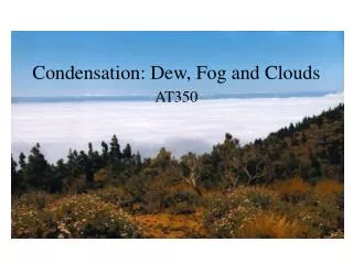
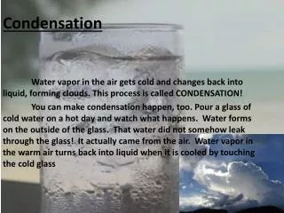
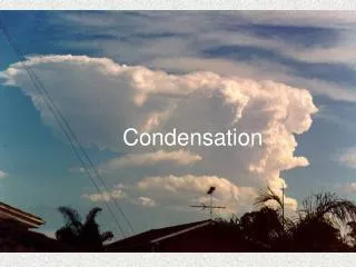
Condensation, Drops, and Fog. WX201 Henry Robinson. Temperatures Colder than Boiling Temperature. Water exists in the atmosphere as a solid liquid and gas (vapor). Even near DB in Summer

E N D
Condensation, Drops, and Fog WX201 Henry Robinson
Temperatures Colder than Boiling Temperature • Water exists in the atmosphere as a solid liquid and gas (vapor). Even near DB in Summer • Some water molecules are far enough apart that they don’t feel the attraction of other water molecules so they can remain a gas even though the temperature is below the boiling point.
Water Vapor • As the number of water vapor molecules in the air increase in number, they will have more chance of being close to another molecule and being attracted to each other. • After there are a certain number of molecules in the air, any more molecules will cause the molecules to clump together forming a liquid. • This point is the saturation point.
Saturation Point • Saturation point dependent upon: • temperature (higher temperature, faster molecules get away from one another) • pressure (number of molecules present)
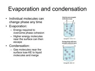
Evaporation/Condensation • Liquid-gas interface (surface of water) will exchange molecules. • Some molecules go from liquid to gas, some go from gas to liquid. When air is at saturation the number of molecules going equal the number of molecules coming.
Aitken Nuclei • Air has large numbers of microscopic bits of dust, smoke, salt, and other particles. • Particles are small, generally less than .2 microns. • Typically 1000 particles per cubic cm. • Number density variable. • Frequently called Aitken nuclei
Condensation Nuclei • Condensation nuclei are important for several reasons: • Hygroscopic (water seeking) nuclei attract water vapor molecules and help form water droplets. • Nuclei are very important in the formation of precipitation.
Haze • Haze is a restriction to visibility caused by fine particles in the air. • Aitken particles are smaller than visible light, so have limited light scatter- typically they scatter blue light.
Blue haze caused by very small particles (around .2 micrometers) Blue Ridge Mountains blue comes from small hydrocarbon particles (terpenes) released by vegetation. As particles get larger the haze becomes more white.
LA Smog As particles get larger the color shifts from blue to brown to red to white
“Wet” Haze • Hydroscopic (water seeking) particles will start to condense liquid on them. • As humidity reaches 100% (temperature reaches dew point), many droplets will form causing fog. • Density of fog droplets determines visibility.
IFR/MVFR/VFR • VFR- Visible Flight Rules – Pilot must be able to see the ground at all times. • IFR – Instrument Flight Rules – Pilot has special training and equipment to fly in clouds. • MVFR – Marginal VFR conditions. Still legally VFR but pilots should be aware of conditions that may exceed their capabilities • LIFR – Low IFR.
Fog IFR/MVFR/VFR • VFR – Visibility greater than 5 miles. • MVFR – Visibility 3-5 miles. • IFR – Visibility 1-3 miles. • LIFR – Visibility less than 1 mile. Red IFR Magenta LIFR Blue MVFR
Fogy Weather • Number of days with dense fog conditions
Forecasting Dense Fog is Difficult LIFR=Low IFR FAR=False Alarm Rate It was forecast but did not occur. POD=Probability of Detection It happened; Was it forecast?
Types of Fog – Radiation Fog • Radiation at night cools ground. Air temperature cools below dew point temperature. Fog forms near ground.
Variations in Ground Composition Can Cause Variations in Initial Fog Formation.
Dissipation of Fog • Sunlight warms ground, which warms air, which lowers relative humidity, which causes fog droplets to evaporate. • Thick fog reflects most sunlight which limits how quickly fog will dissipate. • Fog generally dissipates (“burns off”) first near edges of foggy area because fog is thinnest there as well as dryer air mixes with foggy air.
Advection Fog • Warm, moist air moving (advecting) over a cold surface. • Cold surface lowers the temperature to dew point, forming clouds. • Daytime fogs are generally advective fogs. • Frequent over Pacific coast; over fishing areas north of Gulf Stream in Atlantic; snowy areas with warm winds blowing over them.
Air picks up moisture and cools as it flows across the colder water
Upslope Fog • Air is lifted by moving up to higher ground.
Steam Fog • Cold air over warm water. Evaporation/mixing near water surface.
Sea Smoke over oceans caused by cold artic air. Rain fog- warm rain falling through layer of cold air. Precipitation can lower visibility to below IFR criteria, such as snow or heavy rain conditions. Evaporative/Mixing Fogs
Reduced visibility during precipitation event due to both falling precipitation and to cooling of air to dew point temperature
Summary 1 • Saturation point – condensation will occur. • Nuclei can help condensation start as well as causing haze. • Fog will limit visibility causing flight restrictions – IFR conditions. • IFR-visibility 1-3 miles; LIFR visibility less than 1 mile. • Fog common along west coast, NE US in winter, and Gulf coast in winter. • IFR conditions most frequent factor in weather related aviation accidents. • Radiation fog – cooling of surface/fog top by long wave radiation loss until fog forms. • Dissipation by sun warming ground; frequently fog burns off from edges.
Summary2 • Advection Fog – warm moist air moving over colder surface. • Advection fog frequent over Pacific coast, over North Atlantic fishing grounds, and over the NE US with snow cover. • Upslope fog – terrain forces air upward until condensation occurs. • Upslope fog frequent in western Kansas and eastern Colorado • Steam fog – cold air over warmer water. • Mixing fogs- occurs during precipitation