Download
1 / 24
240 likes | 249 Views
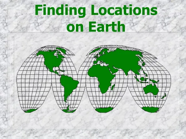
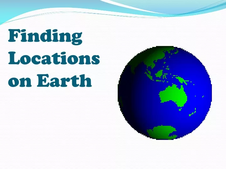
Finding Locations on Earth. Typical Graph. This is an example of a typical graph we are all familiar with. The graph is made up of different “points” with lines that connect the points. Y axis. Typical Graph. Each point has two values: The “X” value that runs along the horizontal “X” axis.

E N D
Typical Graph • This is an example of a typical graph we are all familiar with. • The graph is made up of different “points” with lines that connect the points.
Y axis Typical Graph • Each point has two values: The “X” value that runs along the horizontal “X” axis. The “Y” value that runs along the vertical “Y” axis. X axis
Y (3,8) (9,5) Typical Graph • The X value is always stated first. • It is followed by the Y value. • The “origin” is the point where the 2 axes intersect with a value of (0,0) (0,0) X
Typical Graph (-X,+Y) (+X,+Y) (0,0) • A point can also have negative (-) values • Negative X values are to the left of the origin (0,0) • Negative Y values are below the origin (-X,-Y) (+X,-Y)
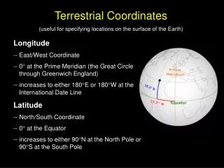
East/West, North/South on The Earth X • Let the X axis be the Equator. • Let the Y axis be the Prime Meridian that runs through Greenwich outside of London. • Latitude and Longitude are the 2 grid points by which you can locate any point on Earth. Y
N E W • Let each of the four quarters then be designated by North or South and East or West. S
N (N, W) (N, E) E W • The N tells us we’re north of the Equator. • The S tells us we’re south of the Equator. • The E tells us that we’re east of the Prime Meridian. • The W tells us that we’re west of the Prime Meridian. (S, W) (S, E) S
N (N, W) E W • That means all points in North America will have a North latitude and a West longitude because it is North of the Equator and West of the Prime Meridian. S Prime Meridian
N E W • What would the latitude and longitude directions in Australia? ? S Prime Meridian • If you said South and East , you’re right!
Latitude Earth has a geographic North pole and a geographic South pole. Half way between them is the Equator. The Equator divides the Earth into two halves: The Northern Hemisphere and the Southern Hemisphere.
Each hemisphere is divided into circles called parallels (because they are parallel to the equator). The distance north or south of the equator is called latitude. Latitude is measured in degrees beginning at the equator which is at 0°.
The MAIN lines of latitude occur every 15°. Latitude lines above the equator are labeled N. 30° N Latitude lines below the equator are labeled S. 45° S
Each degree of latitude is divided into 60 equal parts called minutes ( ' ). Each minute is divided into 60 equal parts called seconds( " ). Washington DC 38°53'51" N Each degree of latitude is approximately 69 miles (111 kilometers) apart. The range varies (due to the earth's slightly ellipsoid shape) from 68.703 miles (110.567 km) at the equator to 69.407 (111.699 km) at the poles. This is convenient because each minute (1/60th of a degree) is approximately one mile.Seconds are approximately 3 meters in distance.
5 Main Lines of Latitude to Know: 0°0'0" 23.5°N 23.5°S 66°33‘39“N 66°33‘39“S
Longitude Meridians are used to identify locations east-west locations. Each meridian is a half circle that runs from pole to pole. The Prime Meridian passes through Greenwich, England.
All locations east of the Prime Meridian have longitudes from 0° to 180° E. All locations west of the Prime Meridian have longitudes from 0° to 180° W. Longitude is also measured in degrees, minutes and seconds. The Prime Meridian is at longitude 0°.
Washington DC 38°53'51" N 77°0‘33" W Latitude lines have equal distance between them. But since longitude lines meet at the poles, the distance between them becomes less the farther north or south you go.
Magnetic Declination When using a compass to find a location an adjustment needs to be made for the difference between geographic north and magnetic north Geographic north pole The angle between magnetic north and true north is called the magnetic declination
Click on the link to take an online quiz: http://www.mcwdn.org/MAPS&GLOBES/LatitudeQuiz.html
True North • geographic North Pole never changes position the difference between magnetic north and true north (geographic north pole) requires a calculation