Download

1 / 55
550 likes | 657 Views
A Natural Disaster Crisis is often an endless crisis: people might be at risks for many years, decades or even centuries. There is always a permanent need for surveillance and awareness. M.S.R. UNOPS. E.U./DDC Suisse. G.V.O. Projet Goma UNOPS.

E N D
A Natural Disaster Crisis is often an endless crisis: people might be at risks for many years, decades or even centuries. There is always a permanent need for surveillance and awareness.
M.S.R. UNOPS E.U./DDC Suisse G.V.O. Projet Goma UNOPS Resultats 2 : Capacity Building of the G.V.O. Resultats 3 : Monitoring of Natural Hazards Project: Analysis and Prevention of Natural Hazards in DRC Fund Raisings Increasing capacities of MSR Resultats 4 : comunication/education/sensitization Resultats 5 : Projet Management Expanding this kind of Project Regionally
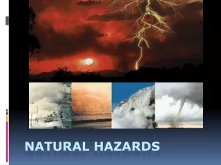
Natural Disasters in Lake Kivu area: a UNOPS pilot project … a best practice ? UNOPS/E.U./Swiss Coop. (DDC) Dept. Environmental Sciences, University of Naples2 (Italy) Goma Volcano Observatory (DRC)
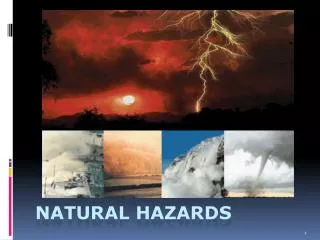
Identification of Possible Natural Hazards: • Volcanic Eruptions • Earthquakes • Acid Rains (up to pH 0) • Deadly Soil CO2 Gas Emissions • Poor Water Quality (Endemic Fluorosis) • Mudflows/Landslides • Killer Lake Man Made Hazards • Lake Pollution • Deforestation and Landslides
31 Mai -05m 03 Jun -15m 04 Jun -44m 05 Jun -49m 08 Jun -52/55m 1.8 Mm3 di lava 228m (220 in June 2010) 50/52m 253/260m (230 in June 2010) +5000m2
Crater rim -180 m -900 m -90 m Platform 1 600 m -600 m bottom Platform 2
10/15 Mm3 18/25 Mm3 . +3m Juin 2011
Early Warning System • Seismic (I.N.G.V.) digital, real time telemetered system • GPS network telemetered but data cannot be used in real time (hopefully soon should be available ) • EVOSS (and an E.U. funded project) gives real time satellite observations to GVO being an end-user. • In case of warning of a possible eruptive activity “sirenes will warn local population about the event”.
CO2 gas emanations: “evil winds/mazuku, elephants graveyard, the tragedy of the new comers
CO2 concentration usually ranges from 20-30% up to 90% in atmosphere. 10/15% is considered the lethal threshold for human beings
Bats were found dead 40 meters above the CO2 line during day time
Need to have a map with all mazukus of the area: Urban development&safer lives
Plume affects down wind areas pH rain waters from 0-1 to 5 HF-HCl-SO2-rich gas emisions
Plume Acid Gas Emissions and ashes are responsible for soil acidification and poor water quality down-wind the volcano. Long term emissions may cause increasing hazard and possible unrest for food production (agriculture and cattles) and related health problems. Problems. A mapping of elements “iso-concentrations” should be a good test to check such a possible hazard. Water analysis, from local rains confirm such an hypothesis. Using/drinking rain waters collected from metal roofs is also extremely harmful and dangerous …
Virunga Volcanic Province Kabuno Bay Gyiseni Lake Kivu Kibuye Idjwi Island Western Branch of the East African Rift System Kivu Volcanic Province
Rwindi Nyamulagira Nyiragongo Active volcanic centres Main regional faults Kabuno Bay Rift limits Maj ya Moto The water sampling Makera Bukomo Thermal and mineral water Cold water Lake water Mpenge Kisuma Spring Tingi Kisuma Sake Nyagatembe Mubambiro Kihira Rukore Mbizi Rukore Lac Vert Kabuno Bay Kaputembo Musholosa Lc Cap Rubona Legend Goma Ls R Rambo Lake Kivu Mayhuza Kankule I & II
Parameterscontrollinglakestability: verticaldistributionof the maindissolvedgases (Mainbasin)
CO2 CH4 CH4 Corganic E W Lake Kivu Kabuno Bay Basement Basement 0 Seasonally mixed layer 100 Fault system Permanently stratified Organic CO2? 200 13% sat at 50m 16% sat at 140m Depth (m) 300 High gas concentration Magmatic CO2 and magmatic Helium only slightly affected by that of the basement Biomass sedimentation 400 Microbial reduction 500 Microbial fermentation Magmatic CO2 and magmatic Helium diluted by that of basement 14% sat at 100m 33% sat at 470m Nyamuragira? Nyiragongo
The past is the key of the future … … in our case “is the present”.
The Contingency Plan The Contingency Plan is the operative mean to mitigate huge losses due to Natural Disasters. The CP for the city of Goma (DRC) and Gisenyi (Rwanda) is operative. It is the most important existing CP for a community, involving more than 1.5 milion people. The different scenario will be briefly introduced and discussed.
Nyamulagira : scenario 1PROBABLE Event: Fractures opening, important lava flows at west, north or east of the volcano, volcanic plume, scoria cones Area affected: Limited to the forest of Virunga National Park Population affected by the volcanic plume: Population in few kilometers around the eruptive site (mainly at west) Duration (estimation) Crisis (emergency period): several weeks to several months (up to 2 years) Post-emergency: ~3 months Rehabilitation: ~3 months
Smets et al., JAES, 2009 1938-1940 1948
Nyamulagira : scenario 2POSSIBLE Event:Fractures opening, important lava flows at south or west of the volcano, volcanic plume, scoria cones Area affected: Forest of the Virunga National Park, urban areas of Sake - Mubambiro, plus the Sake - Kitchanga & Goma - Sake road Population affected by the volcanic plume: Population few kilometers around the eruptive site (mainly on the south and south-western sides) Population affected by the lava flows: Sake - Mubambiro area (south) or less probably Kabalekasha - Kitchanga area (west) Duration (estimation) Crisis (emergency period): several weeks to several months (up to 2 years). Post-emergency: ~3 months up to few years (depending on the M of the event Rehabilitation: ~1 year or more (as above)
Nyiragongo : scenario 1 POSSIBLE Event: Opening fractures, lava flows, volcanic plume, scoria cones, phreato -magmatic explosion in case of fractures near the Lake Kivu Area affected: Area south of the volcano, Goma and vicinity, probably Gisenyi Population affected (estimation) Dead: ~200 Injured: ~2.000 Displaced: ~250.000 Duration (estimation) Crisis (emergency period): ~1 week to months, depending on the M of the eruptive event Post-emergency: ~3 months to years (as above) Rehabilitation: ~1 year ~ x or ? years
Awareness through Education and Communication (i) Animateurs in schools (170000 students reached in 2011) : How volcanoes work, how to live with them and what to do in case of eruption. (ii) Radio programs once a week on Natural Disasters (iii) SMS on cell phones on the situation of the volcanoes (iv) Launching a Design Prize in schools on Natural Disasters Perception (january 2012) (v) Conferences with Local Autorithies of DRC and Rwanda, humanitarians and civil society. vi) Distribution of leaflets, booklets, modules for teachers in schools on Natural Disasters both in french and hahili Messages and scripts need to be simple, transparent and clear