Download
1 / 22
220 likes | 379 Views
I-35W/Highway 62 Crosstown Commons Reconstruction. Nathan Aul, Bob Krussow, and Michael Martin. Background. Highway 62/Crosstown Highway Built in the 1960s by Hennepin County

E N D
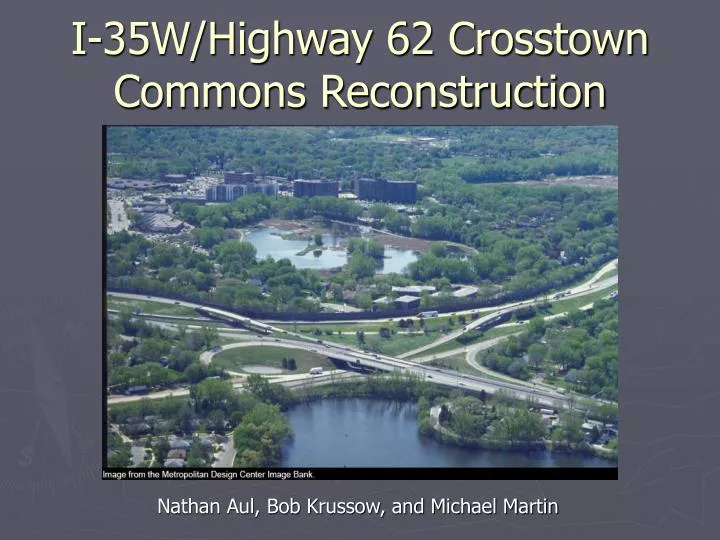
I-35W/Highway 62 Crosstown Commons Reconstruction Nathan Aul, Bob Krussow, and Michael Martin
Background • Highway 62/Crosstown Highway • Built in the 1960s by Hennepin County • Current alignment and design was decided in the 1950s and 1960s and were made to avoid land acquisitions and other impacts • Was one of only a few county operated highways in the United States • Operation was switched to the State of Minnesota in 1988 • Runs from I-494 to MN-55 through the cities of Minnetonka, Eden Prairie, Edina, Richfield and Minneapolis
Current Status • Interchange between I-35W and MN-62 is one of the most traveled and congested points in the Twin Cities • I-35W is the major north-south freeway in the region and has the largest transit ridership of any segment in the area • MN-62 serves as a major access route to both downtowns and the airport • Capacity in the area is exhausted during the morning and afternoon peaks • Congestion typical throughout the day
Need for reconstruction • On average 553 accidents occur yearly in the area, which is nearly five times higher than the average for metropolitan urban freeways • As congestion builds on the Commons drivers use local streets causing more congestion on the local network • When I-35W and MN-62 merge into a 6-lane freeway significant weaving movements are required
Project Goals • Improve safety and capacity needs in the Commons area • Proposal will address needs identified in the Metropolitan Council Transportation Policy Plan • Will decrease demand and congestion of local networks • Increase capacity on MN-62
Timeline • Final design and right of way acquisition - 2004-2005 • Contract letting - November 2005 • Begin construction - 2005-2006 • Complete construction - 2009 • Schedule on hold due to Minneapolis’ refusal to give Municipal Consent
Traffic Volume of 240,000 vehicles/day Congestion on some places for up to 13 hours/day Accident rate nearly five times the metro average Drivers using local streets during congestion Add transit advantage on I-35W Additional highway capacity Separate traffic between highways Remove left exits, replace with right exits Meet current design standards Need Benefits
Goals • Limit temporary highway closures during construction • Increase Highway Capacity • Minimize Right of Way acquisition • Provide advantages for bus transit and HOVs • Reconstruct aging highway facility
Stakeholders • State Legislature • Met Council/Metro Transit • Hennepin County • Cities of Minneapolis and Richfield • Federal Highway Administration • Department of Transportation • Minnehaha Creek Watershed District • U.S. Army Corps of Engineers • Department of Natural Resources • Property owners • Neighborhood groups • Local businesses • Metro area transit and highway users
Projected Timeline • 2002-2003 Refine Design Concept • Submit for agency and public review • Respond to agency and public comments • 2003-2004 Environmental Documentation • Environmental Impact Statement • BRT study • 2004-2005 Final Design • Final design plan and specifications • Property acquisition and Permits • 2005-2009 Construction
Existing Conditions • 6 shared lanes, 3 in each direction • No HOV lanes north of 494 on 35W • Uncommon left exits
2002 Concept • I-35W • 7 lanes • 3 Southbound • 4 Northbound • 1 HOV lane in each direction • Highway 62 • 5 lanes • 3 Westbound lanes (North of 35W) • 2 Eastbound lanes (South of 35W)
Limiting Factors • Highway Access vs. Timely Construction • Highway Access vs. Property Acquisition • Property Acquisition vs. landscaping/buffering • Construction Staging vs. Construction Cost • BRT study due to legislature by Dec. 10, 2004 • Maintenance of facility during long construction process
Externalities • Surrounding areas • Destruction of some parkland • Elimination of residential and commercial areas • Increased noise pollution • Four-year construction • Lower capacity for I-35W and Highway 62 • Parallel streets will see increased traffic volumes • Increased Travel Times • Driver confusion (more accidents)
Reasons for Municipal Consent Denial • MnDOT report was incomplete • Did not include “final layout” design in request for consent report • Report did not address a design or funding for a continuation of the fifth HOV/Bus lane to downtown • Inadequate analysis of health and environmental impacts • Incomplete analysis of storm water runoff • Requested BRT study has not been completed • Project’s impacts on surrounding area • Project appears to cause increases traffic on parallels and no solution is given • Insufficient pedestrian pathways • Unnecessary destruction of homes and businesses • Eliminates access of some streets to highways
Minneapolis Modification Requests • BRT/HOV(3) Improvements • Dedicate fifth lane for BRT/HOV(3) • Dedicate future fifth lane to downtown for BRT/HOV(3) • Develop BRT/HOV(3) from Lakeville to Commons • Construct BRT station at 46th St. and at least two other Minneapolis stations that are fully functional at completion of project • Obtain full funding for project and transit improvements • Neighborhood Improvements • Local street traffic management plan • Preserve or permit redevelopment of affected homes and businesses • Further minimize runoff effects • Provide better pedestrian facilities • “Replace trees . . . to prevent net loss in carbon sequestration. . .” • Others
Previous Alternative Plans • “Preferred Alternative” in 1995 • Included a Light Rail Transit line – lack of funding • “Deferred Project” in 1996 • Expand I-35W from I-494 to 42nd Street • Denied by Legislature due to concerns about capacity and lack of transit • No-Build Alternative • Major roadway maintenance and bridge repair • Routine maintenance • Minimal increased capacity (11 to 13 percent)
Questions • Was the city of Minneapolis too demanding in withholding Municipal Consent? • Were the original goals met in the current design? • What role should cities play? • What transit system should be used along I-35W? • What will be the impact on local roads? Both during and after construction. • What other externalities will result? • Will some negative externalities be improved or worsened? i.e. noise, water, and air pollution • Were there any stakeholders that were overlooked? • Comment on the trade-offs between time, space and cost.