Download
1 / 17
170 likes | 485 Views
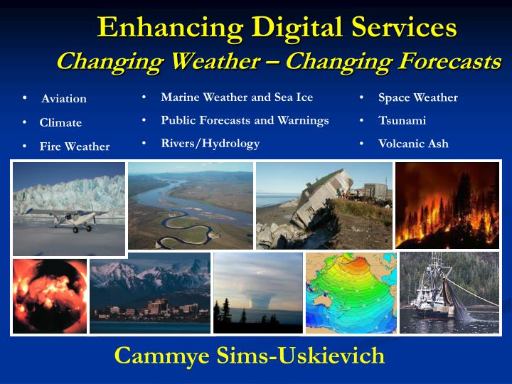
Enhancing Digital Services Changing Weather – Changing Forecasts. Marine Weather and Sea Ice Public Forecasts and Warnings Rivers/Hydrology. Aviation Climate Fire Weather. Space Weather Tsunami lca Volcanic Ash As. Cammye Sims-Uskievich. Enhanced Digital Services Roadmap.

E N D
Enhancing Digital ServicesChanging Weather – Changing Forecasts • Marine Weather and Sea Ice • Public Forecasts and Warnings • Rivers/Hydrology • Aviation • Climate • Fire Weather • Space Weather • Tsunamilca • Volcanic Ash As Cammye Sims-Uskievich
Enhanced Digital ServicesRoadmap • Enhanced Short Term Forecasting • Detailed hourly grids – updated at a minimum every 3 hours • Digital Aviation Services • Adding aviation elements to the National Digital Forecast Database (NDFD)
The Enhanced Short-Term Concept • Keep the forecast “fresh” • Focus on “high impact” weather events – to support Decision Support Services • Be as definitive and detailed as possible within the next 36 hours • Detailed hourly grids are a must – updated as needed or at a minimum every 3 hours • Tight gradients • Collaborate meteorology!
Why Enhanced Short-Term? Update was issued less than one hour ago! Forecast should be representative at T=0!
Digital Aviation Services • There is a demand for this information!
What are Digital Aviation Services Adding aviation elements to the National Digital Forecast Database (NDFD) Provide hourly graphical forecasts of ceiling and visibility out to 36 hours TAFs are generated from the database with little to no post-editing
A Change in Thinking KBED KBOS What About Here??? KORH KPVD
Moves toward the NextGen requirements: Digital ceiling and visibility Build a national ceiling and visibility grid to be used by AWC Consistent aviation forecasts, the Single Authoritative Source (SAS) for Ceiling and Visibility Important guidance tool for medical services, search and rescue, and General Aviation Improves NWS forecast consistency with aviation forecasts and beyond Why Digital Aviation Services?
Participating NWS Forecast Offices are producing experimental digital forecasts of ceiling and visibility Boston, MA Jackson, KY Caribou, ME Charleston, WV Greenville-Spartanburg, SC Sterling, VA Atlanta, GA TAFs are generated from the grids, with forecaster oversight Who is Producing Aviation Grids
Hourly Graphical Forecasts A benefit for aviation!
Operations Assessment • Customers noticing a difference • Increased consistency between TAFs and other products • More frequent and proactive updates • Forecast information available for any point in forecast domain • Users can take the gridded database and create their own forecast products and displays • “We have clearly noticed improved TAF performance and improved consistency in all public forecast products in the Boston area since NWS has been producing TAFs from the ceiling and visibility grids.” - Rick Curtis, Chief Meteorologist, Southwest Airlines
TAF Verification using Digital Aviation Services • No notable decrease in scores since beginning digital aviation services...some have improved • Overall - fairly steady and in the right direction • No significant decrease in quality • Best scores are in most recent years
Progress to Date • Enhanced Short-Term Forecasting: • All Eastern Region Offices Implemented in April 2011 • 34 Central Region began in April 2013, the remaining 4 offices delayed implementation due to AWIPS II • Southern and Western Region offices in initial phase • Digital Aviation Services: • 7 Offices are producing digital aviation services; 5 in Eastern Region, 1 in Central Region, and 1 in Southern Region • Additional offices are planning to come on board very soon! • 3 Western Region offices in initial phase • National Centers: • Alaska Aviation Weather Unit using IC4D
Verification Projects – FY13/14 • Lead time to onset and cessation of thunderstorms within 75nm of FAA Core Airports and Jet Routes • Real time verification for the following elements: • Ceiling Heights, Ceiling Categories, and Visibility • Temperature, Dew Point Temperature, Sky Cover • Wind: Speed, Direction, and Gusts • High Wind Warning, Relative Humidity
Current and Future Initiatives • Coordinate the national requirements for Enhanced Digital Services • Assess new guidance tools e.g. - Gridded LAMP, and high resolution numerical model output • Enhance verification for the future • AAWU/AWC to produce the Area Forecast from national Ceiling and Visibility grids using IC4D (or similar tool)