Download
1 / 24
270 likes | 667 Views
Mountain Operations. REFERENCES. FM 1-202, Environmental Flight, February 1983 TC 1-218, Aircrew Training Manual Utility Aircraft, March 1993 Aircraft Operator’s Manual. OUTLINE. Mountain Weather and Climate Winds Density Altitude Flight Techniques. Definitions.

E N D
REFERENCES FM 1-202, Environmental Flight, February 1983 TC 1-218, Aircrew Training Manual Utility Aircraft, March 1993 Aircraft Operator’s Manual
OUTLINE • Mountain Weather and Climate • Winds • Density Altitude • Flight Techniques
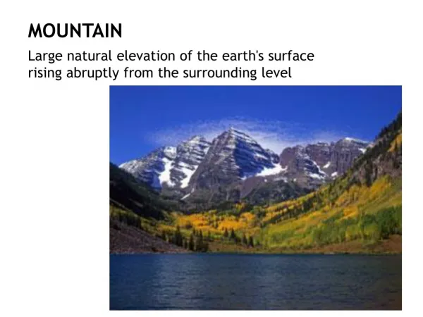
Definitions Prevailing Winds - Upper-level winds; flowing predominantly from West to East. Local Winds - (Valley Winds) created by convection heating and cooling. Surface Winds - Winds close to the ground. Less turbulent than both prevailing and local winds. Demarcation Line - The point which seperates the upflow from the downflow of air.
Types of Mountain Wind Flow DEMARCATION LINE Prevailing Winds Turbulence and Downflow Local Winds (Upflow) Surface Winds
WIND Light Winds DEMARCATION LINE
Light Winds • 1 to 10 Knots • Gentle updraft as wind accelerate uphill • Wind will follow the slope of the terrain • After the crest the wind will turn into a gentle downdraft
WIND Moderate Winds DEMARCATION LINE UPDRAFT
Moderate Winds • 11 to 20 Knots • Increase in the up and downdrafts will create moderate turbulence • There will be an updraft on the leeward side near the crest • The demarcation line will form closer to the crest and will be steeper
WIND Strong Winds DEMARCATION LINE
Strong Winds • Above 20 Knots • Demarcation line will move to the forward side of the hillcrest. • Updrafts, Downdrafts and turbulence will increase.
WIND Mountain Wave Stable Air Unstable Air
Mountain Wave • Conditions • Stable layer of air above a unstable of air • Wind directoin fairly constant with increasing speed with altitude • Mountain is perpendicular to the airflow • Effects • Updrafts of 2,000 FPM to 5,000 FPM • Moderate to Severe Turbulence • Altimeter errors as much as 1,000 Ft when penetrating a wave • Icing can be expected in clouds when below freezing
WIND Mountain Wave Cloud Formation When weather conditions are favorable, the following visual indicators can exist: Cap clouds, Rotor clouds and Lenticular clouds Stable Air Unstable Air Lenticular Clouds Cap Cloud Rotor Clouds
Mountain Wave Cloud Formation Lenticular Clouds - Lens shaped clouds normally found between FL250 and FL400. They may form downwind from the mountain ridge. Turbulence will exist below the clouds.
Mountain Wave Cloud Formation Cap Cloud - Consist primarily of updrafts. They will develop updrafts and downdrafts as it passes over the mountain
Mountain Wave Cloud Formation Rotor Clouds - Clouds of short duration will a rapid onset and dissapation. They can have updrafts in excess of 5,000 FPM. - Found downwind of mountain - Bases found below the ridge with tops up to the lenticular clouds
DENSITY ALTITUDE • Pressure altitude corrected for non-standard temperature. • Altitude at which your aircraft will perform at. • As DA increases-------air density decreases
Effects of DA on aircraft performance? • Reduced horsepower (Torque) available. • As DA incr. - air molecules spread out - less air going into the engine = less horsepower (Torque) being produced. • Reduced wing efficiency • Less air molecules acting on the wings to produce lift.
RESULTS • Increased takeoff roll • Reduced climb performance (ft./min.) • Increased landing distance (higher TAS, higher GS) • Decrease in the “excess power available” • Aircraft response----more sluggish • Deceleration effects (ability to slow down, and not fall through)
Flight Techniques • Preflight. Complete a detailed performance evaluation to determine if any operating limitations will be encountered. • Starting engine(s). Use normal starting procedures. • Taxiing. Use normal taxiing procedures. • Before takeoff. If a takeoff is made from an airport located at a high elevation-- • In Pressurized aircraft. Place the bleed air valves in the ENVIRO-OFF position to provide more power for the takeoff. • Takeoff. Use normal takeoff procedures. • NOTE: Many mountain landing strips or runways are not level. Unless local conditions dictate otherwise, always take off downhill.
Flight Techniques • During flight. Use normal procedures. Be alert for clear air turbulence that may be encountered because of uneven terrain and wind variations. • Landing. Use normal landing procedures. • NOTE: Many mountain landing strips or runways are not level. Unless local conditions dictate otherwise, always land uphill. • Before leaving the aircraft. Use normal procedures. Ensure that the aircraft is properly secured. (In mountainous areas, the possibility of severe and rapidly changing weather is greater than normal.)
SUMMARY • Mountain Weather • Density Altitude • Flight Techniques
QUESTIONS? QUESTIONS?