Download
1 / 24
250 likes | 410 Views
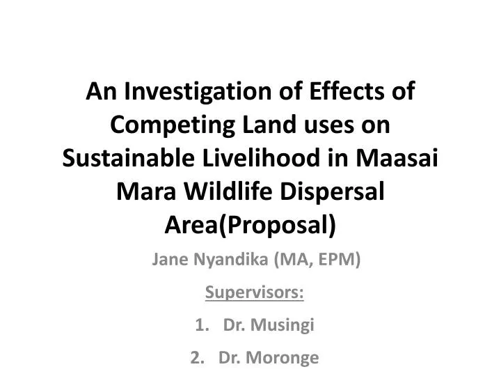
An Investigation of Effects of Competing Land uses on Sustainable Livelihood in Maasai Mara Wildlife Dispersal Area(Proposal). Jane Nyandika (MA, EPM) Supervisors: Dr. Musingi Dr. Moronge. PART I Background.

E N D
An Investigation of Effects of Competing Land uses on Sustainable Livelihood in Maasai Mara Wildlife Dispersal Area(Proposal) Jane Nyandika (MA, EPM) Supervisors: Dr. Musingi Dr. Moronge
PART I Background • Green growth in the context of sustainable development and Poverty Eradication- international policy agenda (UNEP, 2011) • Livelihoods and Governance -elements of sustainable production in the green growth agenda (Fadeeva, et al 2012 eds). • Different, excessive competition/ claims ; lead to competing land uses (Arets, et al 2011).
Background Contd • Expansion of agricultural area into poorly protected Africa savannah marginal land is an attractive alternative in meeting food demands (UNEP, 2011). • Planning in Kenya- Narok County level - policies of activities that degrade the environment and disputes of unharmonised utilization types occur (Ojwang, 2007).
Statement of the problem • Maasai Mara Wildlife Dispersal Area is identified as environment and governancehotspot (UNEP, 2009). • Locals &investors compete for land/NR access • Approach to land use is land subdivision. • No land master plan to steer land reform. • Sectoral laws are not managing hazards of local communities resource use. • Livelihood claims in activities/strategies & businesses.
General Objective The broad objective of this study is to: Investigate, the effects of existing governance arrangements in competing land uses in the Maasai Mara Ecosystem, and how it affects the livelihoods in the region.
Objective 1&2 • To identify the distribution patterns of competing land use emerging from interaction of land tenure systems since the issuance of certificates of title/lease. • To assess the influence of erection of formal boundaries on community access to natural resources and livelihoods.
Objective 3&4 3. To assess sectoral effects of land access rights enforcement on livelihood since the issuance of certificates of title/lease. 4. To explore causes and effects of land use competition in the Maasai Mara Wildlife Dispersal Area.
Policy Values and Power • National government claims in vision 2030 strategy • County government claims in devolution • Rights claims by land owners/Leases • Exclusion claims of un harmonised laws by actors • A range of Competing Interest on Livelihood • New land use patterns • Expansion of arable land within the wildlife dispersal area/livestock fields • Demand for, food, water, and pasture land Policy Influences Policy responses PRIR Ii PRIE • Property Rights Institutions claims • Incidences of emerging claims to utilization of land • Incidents of claims of longer distance to water points by erection of boundaries • Incidents of claims of disputes in rights enforcement Conceptual Model Adapted from Campbell, 2003 The single arrow (PRIE) represents Property Rights Institution Effects (emergent behavior) by regime. The single arrow (PRIR) represents Property Rights Institutions Responses (governance) by regime.
Hypotheses 1&2 • 1. H0 The issuance of certificates of title has no significant effect in the patterns of distribution in land use types of camps/farms/ households. • 2. H0 The erection of fences has no significant effects on exposure of households to longer distance to water points.
Hypotheses 3&4 • 3.H0 The farms/camps/household land disputes have no significance influence on enforcement levels of sectoral laws. • 4.H0 There is no significant influence of new agriculture farms on diverse Farms/camps/households livelihood activities in the area.
Justification of the study • Capital value of land in the area is a well known high stake issue, in land tenure regimes. • Land registration and issuance of certificate of title ,may be increasing conflict risks. • Weak linkages between national and lower planning levels (farms) • The study area has high variations in land activities of land lease, pastoral and ecotourism/ rapid changes (fig 3).
Scope and Limits of Study • Current trends; Olololunga/ Osupuko, and Majimoto area. • The socioeconomic factors; • livelihood needs and • indicators of land use risks. • interaction relationships through the lens of an adapted framework.
Selected key empirical literature and identified gaps for the study
(Source: Directorate of Resource Surveys and Remote Sensing)
Map • A structured questionnaire survey of Cross- site comparative analysis of 3 geographical area sites will be used. • Cluster sampling objectives one to three. • Under the 4th objective for/of policy assessment, a sustainability Impact Assessment (SIA) (Riedsma et al 2011). • SPSS will be used for statistical analysis.
Data Analysis • Objective 1 : Land use Cluster Analysis • The object data-Land use type, as nominal scale data will be categorized as per its frequency distribution. A chi- square test (χ2 df= 3, α=0.05) The output of the cluster analysis will be a cluster profile, constituting an object-attribute incidence matrix (Panneerselvam, 2011).
Data Analysis: Objective 2 • The independent variables will be; the length of erected permanent boundaries, time taken to reach water points /distance to water points, number of farms/houses/camps. The dependent variable will include, Longer distances to water points, A chi- square test (χ2) test df =2 , α=0.05)will be used to determine significance of distance to permanent water points.
Data Analysis Objective 2contd • The relationship between presence /absence of fences(Y) and e.g. presence of livestock (X1) and distance to permanent water (X2) will be studied by the following logistical regression Y=a +bx+∑i where x (independent variable) Leeuw JAN DE et al (2001). The causal analysis will employ (significance level α=0.01, and confidence level of 90
To assess sectoral laws’ enforcement • The independent variable will include no. of persons/actors enforcing. The dependent variables will be the law enforcement levels, risks, dispute incidents, and perceptions on behavior changes. • The Likert- type scale shall be used to assess the perception of sectoral laws enforcement levels.
Objective 4Assessment • would require a detailed analysis of existing policies, their timing, their actual implementation and their geographic impact. Social, economic and environmental indicators will be evaluated for varied policy scenarios. • Use of Multi- Criteria Analysis/ Content analysis
Expected Output of the Study • Data and Information • Objective1: Title deed effects on patterns of land use distribution by clusters of farm/fields/ camps. • Objective 2: effects of fences on easier access to livelihood sources in longer distances • objective 3 identified enforcement requirements / aspects and enforcement levels.
Expected Output • areas of conflict in policy objectives with sustainable livelihood objectives, and livelihood portfolios.
Appendices • Appendix 1: Questionnaire • Appendix 2 Questionnaire for Ministry(s) and Parastatals officials • Appendix 3- Research approach matrix • Appendix 4: Work Plan • Appendix 5: Budget