Download
1 / 42
420 likes | 571 Views
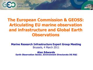
6 th Meeting of the Expert Group on Marine Research Infrastructure Ostend – Belgium 6 / 7 June 2011. Presented by : Slim GANA. Tunisia. Sicily. Algeria. Libya. Libya.

E N D
6th Meeting of the Expert Group on Marine Research Infrastructure Ostend – Belgium 6 / 7 June 2011 Presented by : Slim GANA
Tunisia Sicily Algeria Libya Libya Surface : 163,610 sq. km. / Number of habitants : 10 629 186 + 1 000 000 abroad.Closest neighbouring countries : Algeria, Libya and Italy.Coastline length : 1300 Km. It has 10 islands : La Galite, Kerkennah, Kneiss, Zembra, Kuriat, Cani, Djerba, Pilau, Chikly and ile plane. Tunisia was the first Mediterranean country to sign an association agreement with the European Union in July 1995. It came into force on March 1, 1998. An important component of the Association Agreement is the clause providing for the establishment of an EU-Tunisia free trade area by the year 2010. Tunisia is making good progress towards obtaining an advanced partnership status with the EU.
Tunisian Islands Framework of the Tunisia-EU cooperation Tunisia was the first Mediterranean country to sign an association agreement with the European Union in July 1995. It came into force on March 1, 1998. An important component of the Association Agreement is the clause providing for the establishment of an EU-Tunisia free trade area by the year 2010. Tunisia is now making good progress towards obtaining an advanced partnership status with the EU.
Offshore vessels • Currentlyown and operate a fleet of five vessels • ISM, ISPS and BV certified • SAROST 5 • - Multipurpose offshore support vessel, equipped with a 150T pull Hydraulic double drum winch in waterfall arrangement, suitable for towing and anchor handling operations. • It is fitted with a KONGSBERG DP1 class system and is upgradable to DP2 • - It offers large transport capacities for liquid cargo , bulk cement, mud, foam, dispersant, stores, materials and equipment transport
Subsea Works Division • Divers canwork in depths of up to 70 meters • A fleet of ROV’swithexperienced ROV surveyors, supervisors and pilots • ABS and BV certified for in-water surveys • Member of IMCA (International Marine Contractors Association)
Energy Logistic • Main objective is to allow the Oil and Gas companies to focus on core business, by handling logistics issues such as : • Providing competent experienced personnel, • Providing yard space and office space close to the main ports, • organizing the embarkment and disembarkment of equipment and people from the supply base to offshore platforms and vice-versa, • customs clearance, etc.
Marine Engineering Types of studiesthat SAROST realizes: 1- MetoceanStudies 2- Environmental Baseline Surveys 3- HydrodynamicalSurveys 4- Seabed Surveys 5- Coastal Engineering : • Wave, tide and currentmodelling • Structure design 6- Research and Development projects
Halk el Menzel permit This metocean study was carried out to determine the minimal environmental loads that must be taken in account for the design of the drilling platform structure that TOPIC plans to deploy in its Halk El Menzel offshore Oil field (Gulf of Hammamet, Tunisia). The deliverables of this study were: Significant wave height, direction and zero-crossing period statistics (sea-wave, sea-swell, sea and swell) Wind velocity and direction statistics (at 10 m level) Modeling of the extreme wind characteristics Modeling of the extreme wave height characteristics Estimation of the horizontal current vertical profile
Lambuca permit • This metocean study was carried out to determine the minimal environmental loads that must be taken in account for the design of the drilling platform structure that Alpine Oil and Gas plans to deploy on its LAMBUCA well in the Kerkouane permit offshore, Tunisia. The deliverables of this study were: • Significant wave height, direction and zero-crossing period statistics (sea-wave, sea-swell, sea and swell) • Wind velocity and direction statistics (at 10 m level) • Modeling of the extreme wind characteristics • Modeling of the extreme wave height characteristics • Estimation of the horizontal current vertical profile
EBS – Sabratah Basin • Site survey : water, sediment and benthos sampling • Analyses : Chemical, physical and biological analyses • Reporting
EBS – ALJURF Permit • Site survey : water, sediment and benthos sampling • Analyses : Chemical, physical and biological analyses • Reporting
Hydrodynamicalsurveyalong the pipeline Haggouna – Sidi Frej (Kerkannah) • Cartography of the pipeline Haggouna - SidiFrej • Mattresses & Free span underwater survey • Hydrodynamical Survey
Hydrodynamicalsurvey in Raoued Area • Current and physico-chemical measurements parameters at the projected zone for the sea outfall (Khélij) in Raoued Area
Seabed surveyat el HelM Permit • The objective of the survey was to provide geophysical data to assist with the determination of anchoring conditions for a rig • During the site investigation the following data were collected: - Sub-Bottom Profiler Data, with a vertical resolution of 10 – 20 cm. - Multibeam Data with 100% coverage
Seabed Survey atFrina (MONASTIR) • This geotechnical investigations included the following activities: • Recognition by auger drilling in order to identify the presence of sub-hard layers; • Recognition by coring; • Recognition by seismic refraction (Sub Bottom Profiler).
EIA – Tunis Bay Financial Harbor • EIA • Coastal Structure Design • Wave, tide and currentmodelling
R & D projects in collaboration with the European Union • ECOOP • Implementation of an integration of observations and modelling into a pan-European marine information system of systems (EuroMISS) and design of a European decision support system (EuroDESS) for coastal and regional seas. • CMCC • Climate and local anthropogenic drivers and impacts for TunisianCoastal Zone. • SESAME • Seasonal circulation and mass flux estimates in the western Sicily Strait derived from a variational inverse section model
Implementation of the SYMPHONIE (three-dimensional primitive equation model) code on the Tunisian coastal shelf area (COSTUM) 1 2 Implementation of the last release of the numerical code (symphonie V2010.5) on a larger area in order to include the Sardinia Channel (1) - Initialisation of the model with the INGV OGCM output (January 1st, 2007). The map shows the SST (2)- SST given by COSTUM 8 days after the initialization (January 9th, 2007) – ALADIN forcing are applied hourly and INGV OGCM BC are applied daily. (3)- SST given by COSTUM 17 days after the initialization (January 9th, 2007) – ALADIN forcing are applied hourly and INGV OGCM BC are applied daily. (4)- SST given by COSTUM 26 days after the initialization (January 9th, 2007) –ALADIN forcing are applied hourly and INGV OGCM BC are applied daily 3 4 Bathymetry interpolated on a polar grid.
Vulnerability assessment of Gulf of Gabes to Climate Change • Provision of environmental data in order to perform vulnerability and risk assessment for the Coastal area of the Gulf of Gabes • Analysis of the results of the OPATM-BFM biogeochemical model of the Gulf of Gabes Temperature anomalies for the Gulf of Gabes (difference between scenarios A1b and SXG) Outputs of the 2D and 3D models for different scenarios
Seasonal circulation and mass flux estimates in the western Sicily Strait derived from a variational inverse section model (Deep-Sea Research I 57 (2010) 1177–1191) • Inverse section model based on the finite element method combines a wide dataset from seasonal hydrographic and current metermeasurementsreproduces the seasonal climatological cycle of the circulation in the area. • It gives a description of the circulation, especially in its vertical phenomenology, as well as to give a firsthand indication of important dynamical features pertaining to the Tunisian near-shelf areas. Monthly distributions of the horizontal velocities across the hydrographic section
Site Survey Equipment W & S sampling Seabed Survey Hydrodynamics Smith McInthyre Grab DGPS : RTK SPS461 and SPS 852 Multibeam echosounder system Acoustic doppler current profiler Niskin bottles Dynamic motion sensor Sub-bottom profiler Aquadopp Multiparameter probe Sound velocity profiler Sidescan sonar system
Suggestions for cooperation and capacity building in marine science and oceanographyGaps and Needs
Kerkennah Island Chergui Gharbi • Traditionnal fisheries • Posidonia ocanica formsdense and large meadows • Oil and gas activities • Kerkennah may disappear due to sea level rise increase LG
Gaps and Needs Needs • Understanding, assessing, predicting, mitigating and adapting to climate variability and change, • Improving metocean information, • Improving the management and protection of coastal and marine ecosystems, • Understanding, monitoring and conserving biodiversity.
Gaps • Long-term observation of critical parameters is lacking • Funding, master plan and overall coordination are missing
Capacity Building • Degrees in marine engineering and physical oceanography • Summer schools • On field trainings
Coastal Survey Vessel • Training, • Research • Commercial