Download
1 / 88
900 likes | 1.17k Views
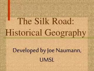
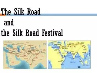
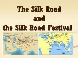
The Silk Road Part 1: Historical Geography. Developed by Joe Naumann, UMSL. The Silk Road.

E N D
The Silk Road Part 1:Historical Geography Developed by Joe Naumann, UMSL
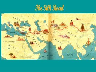
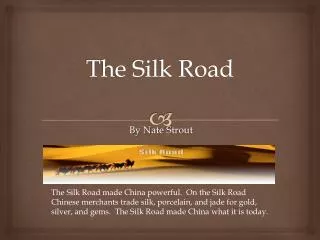
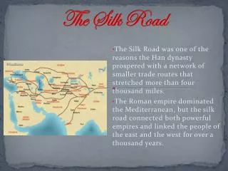
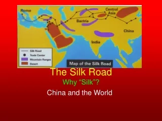
The Silk Road • The Silk Road, or Silk Route, is an interconnected series of trade routes through Southern Asia mainly connecting Chang'an (today's Xi'an) in China, with Asia Minor and the Mediterranean. It extends over 8,000 km (5,000 miles) on land and sea. • Trade on the Silk Route was a significant factor in the development of the great civilizations of China, Mesopotamia, Persia, India and Rome, and helped to lay the foundations for the modern world.
Major Stops on the Road: The whole trip. Leave China Here Taklamakan Desert
Cities and Sights: China Along the Silk Road
Chang’an (Xian today) • The site of the Han capital was located 5 km northwest of modern Xi'an. As the capital of the Western Han Dynasty, it was the political, economic and cultural center of China, the eastern terminus of the Silk Road, and a cosmopolitan metropolis comparable with the greatest cities of the contemporaneous Roman Empire. Many Silk Road caravans started here.
The statue is at the starting point of the ancient Silk Road of Chang'an (present Xian City).
Tianshui • Tianshuiis the second largest city in Gansu province in northwest China, with approximately 320,300 people. A nearby tourist attraction is the Maijishan Grottoes filled with thousands of ancient Buddhist sculptures. The Qin state, later to become the founding dynasty of the Chinese empire, grew out from this area, and the Qin name itself is believed to have originated, in part, from there. Qin tombs have been excavated from Fangmatan near Tianshui, including one 2200 year old map of Guixian county. It is a diocese of the Roman Catholic church, currently vacant.
Lanzhou • Early settlement in this region could be dated to the Han Dynasty and has a history of over 2,000 years. The city used to be called the Golden City, when it was a major stop on the ancient Silk Road. To protect the city, the Great Wall of China was extended as far as Yumen.
Wuwei • In ancient times Wuwei was called Liangzhou (凉州) and is the eastern terminus of the Hexi Corridor. People began settling here 5000 years ago. It was an important part of the Silk Road. In 121 BC Han emperor Wudi brought his cavalry here to defend the Hexi Corridor. His military success allowed him to expand the corridor west. Its importance as a stop along the Silk Road made it a crossroads of cultures and ethnicities from all over central Asia.
Zhangye • Zhangye is located in far western Gansu province. In the north it borders Inner Mongolia and in the south Qinghai. It has a large area of 42,000 km² and is blessed with numerous streams, abundant sunlight and fertile soil, making it an important agricultural center for Gansu and all of China. Zhangye is in the center of the Hexi Corridor, an important section of the Silk Road.
Jiayuguan • Jiayuguan is home to Jiayuguan Pass, the largest and most intact pass, or entrance, of the Great Wall. Jiayuguan Pass was built in the early Ming dynasty, somewhere around the year 1372. It was built near an oasis that was then on the extreme western edge of China. Jiayuguan Pass was the first pass on the west end of the great wall so it earned the name “The First And Greatest Pass Under Heaven
Urumqi • Located in a green oasis between the lofty ice-capped Bogda Peak, the vast Salt Lake in the east, the rolling pine-covered Southern hill and the alternating fields and sand dunes of Zunggar Basin in the northwest, Ürümqi has an average elevation of 800 meters. It is the largest city in the western half of China.
Korla • The Iron Gate Pass (Tiemenguan) leading to Karashahr is about 7 km (4 miles) north of the city and, as it was easily defended, played an important part in protecting the ancient Silk Roads from raiding nomads from the north Korla has long been the biggest centre in the region after Karashahr itself, having abundant water and extensive farmlands, as well as controlling the main routes to the south and west of Karashahr. Due to the discovery of oil in the Taklamakan Desert, Korla is now both more populous and far more developed than Karashar.
Dunhuang • The city is located near the historic junction of the northern and southern Silk Roads, and was therefore a town of military importance. • For centuries Buddhist monks at Dunhuang collected scriptures from the west, and many pilgrims passed through the area, painting murals inside the Mogao Caves or "Caves of a Thousand Buddhas."