Download

1 / 35
350 likes | 530 Views
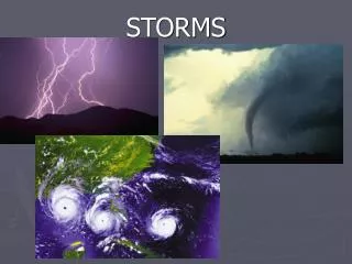
WINTER STORMS. MSC 118, 2/15/12 Prof. Sharan Majumdar. Structure of Winter Storms. Typical structure of most winter storms, although they can be very different. A Typical Winter Storm. Surface low pressure system, usually <1000 mb.

E N D
WINTER STORMS MSC 118, 2/15/12 Prof. Sharan Majumdar
Structure of Winter Storms Typical structure of most winter storms, although they can be very different.
A Typical Winter Storm Surface low pressure system, usually <1000 mb. Warm and cold fronts, although the low may be occluded (fronts weakened). Heaviest rain or snow in the ‘head’ of the storm system, with possible banding. Squally rain or snow along the cold front.
Outline 1. Some big storms! A. December 18-19 2009: VA/DC/MD B. Jan 31 – Feb 3 2011: “Groundhog Day Storm” 2. Formation of Winter Storms 3. Winter Storm Reconnaissance
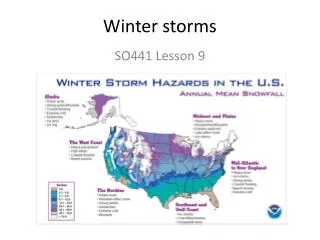
Northeast Snowfall Impact Scale http://www.ncdc.noaa.gov/snow-and-ice/nesis.php
December 18th-19th, 2009 Category 3 Snowstorm The December 2009 storm system first developed in the Gulf of Mexico and tracked northeastward right up the southeast U.S. coastline to Cape Hatteras, and then eventually just to the east of Long Island and Cape Cod, where the storm brought blizzard conditions some of the major Northeast U.S. cities. “Textbook" scenario for heavy snow for VA/DC/MD area, with a deepening low passing to the southeast drawing in both Gulf and Atlantic moisture, with fairly deep, cold air in place from an arctic high pressure centered over New England and the Mid-Atlantic area. This is considered a "Miller A" coastal cyclogenesis storm, and is far and away the most common pattern for bringing significant snowfall to VA/DC/MD.
January 31st – February 3rd, 2011 Category 3 Snowstorm Alberta Clipper L containing cold air from the polar vortex. A large Arctic H with a max pressure of 1,052 mb followed behind it. A L from the Pacific Ocean later came ashore over Northern California and crossed the Rocky Mountains, merging with the Alberta Clipper L and a developing Texas L drawing moisture from the northwestern Gulf of Mexico. The storm intensified and moved northeast, developing a front stretching toward the New England states, and moving northeast along this jet stream track. Lake effect snow started over Lakes Ontario and Michigan. Following the jet pattern, the storm developed a rapid forward trajectory and began to migrate toward the lower Great Lakes. The heaviest snow fell in a wide swath from central Oklahoma to Illinois, Indiana and the Ohio Valley
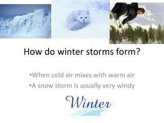
3. Winter storm formation:Ingredients Favorable jet stream position aloft. Cold polar air coming from north. Sharp ‘temperature gradient’. Availability of moisture.
Norwegian Cyclone Model • Initial ‘frontal boundary’ separating cold and warm air. • A “wave” forms along the front as an upper-air disturbance in the jet stream moves over it. • Front develops a kink where wave develops.
Isobars Isotherms
Winter storms are difficult to forecast. Why? One reason: a lack of detailed observational data over the oceans. Only satellite data are available – they are very useful, but do not cover the detailed structure needed to model winter storms. Solution: extra aircraft deployed over oceans. Data are ‘assimilated’ into computer forecast models. We hope the forecasts are improved!
The solution? http://www.noaanews.noaa.gov/stories2011/20110113_gulfstreamiv.html
http://www.cpc.ncep.noaa.gov/products/precip/CWlink/daily_ao_index/ao.shtmlhttp://www.cpc.ncep.noaa.gov/products/precip/CWlink/daily_ao_index/ao.shtml