Download

1 / 72
800 likes | 1.13k Views
E- Learning. w w w . f – a i r . c z. Crosscountry Navigation. Ground preparation. Preflight preparation procedure. 1. 2. Gathering of information (AIP, NOTAM, AIC) Route planning (map, nav log) Weather assessment (METAR / TAF). 3.

E N D
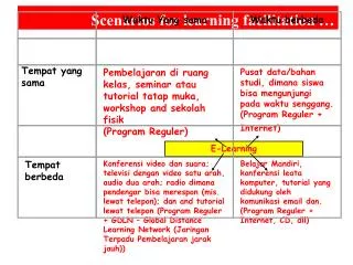
E-Learning w w w . f – a i r . c z
CrosscountryNavigation Groundpreparation
Preflightpreparationprocedure 1. 2. Gatheringofinformation (AIP, NOTAM, AIC) Routeplanning (map, nav log) Weatherassessment (METAR / TAF) 3. • Aerodrome departures/arrivals + RTF procedures • Lossoforientationprocedures • Communicationfailureprocedures • Proceduresfordeterioratedmeteoconditions • VFR navigation • FIC FIS VOLMET REG QNH XPDR • Radionavigation • FlightPlan • A fewusefultipsfor VFR flying
Officialsources: FIS publications ICAO chart 1:500 000 AIP AIP SUP NOTAMs AIC PIB – Preflightinformation bulletin Nonofficialsources: Othercharts Bottlang JEPPESEN AVION database Internet Informationsources • Beforewe start planningtheroute, weshouldobtainsufficientinformationregarding: • Airportsweintend to use(operationalhours, servicesprovided, type offuelavailiable, stateofthe aerodrome, FREQ, etc.) • Therouteweintend to fly (FREQ, airspace, specialequipmentrequired, etc.)
Aeronauticalinformationpublicationis a prime documentcontainingpermanent informationof a long term validity essentialforflightoperations. Itispublished by each ICAO stateforitsterritory. AIP consistsof 3 parts: AIP • GEN - General • National rules and requirements (adresses of important organizations, entry/exit of crew, cargo and passengers into/from the country) • Tablesandcodes (abbreviations, chart symbols, sunrise/sunsettables) • Services (FIS, Charts, ATS, communicationservices, meteo, SAR) • Charges (aerodrome, navigation, approachcharges) • ENR - Enroute • Generalrulesandprocedures • ATS airspace (FIR, TMA, MTMA, MCTR) • ATS routes (AWYs) • Radionavigation aids • Navigationalerts/ Prohibited, Restricted, Dangerous, TSA areas • AD - Aerodroms • IFR airports • Heliports • VFR airports AIP
AIP - SUP Temporary changes of a long term character (three monthsand longer) and information of a shorter validity that contains extensive text or graphics, supplementing information in AIP. e.g. Temporarytrafficrestrictionatanairport. AIP AIC A notificationcontaininginformation, that do not complywiththeconditionsfor NOTAM issuanceorpublishing in AIP, butthat are related to flightsafety, flightoperationsorrelated to technical, administrativeorjuristicalmatters. AIC ispublished in twoseries A and C. AIC series A containinginformationrelated to international civil aviation. Informationissentoutinternationally. AIC seriesCcontaininginformationrelated to thenationalaviation. Informationissentoutonlywithinthestateofissue . Notam
NOTAM Announcement, transmitted by meansoftelecommunication, containing information concerning the establishment, condition, or change in any aeronautical facility, service, procedures, or hazard, the timely knowledge of which is essential to personnel concerned with flight operations.Itisaninformationoftemporary validity (usuallyup to 1 month). Series A and B are published in English. Series X and Y containthesameNOTAMs in Czech language. SeriesA (X):The most importantseries. Containsallinformationregardingoperationat ATS routesandthemaininternationalairports in theCzechrepublic: BRNO/TUŘANY, KARLOVY VARY, OSTRAVA/MOŠNOV, PRAHA/RUZYNĚ. SeriesB (Y):Containsallinformationregardingoperationatotherairports in Czechrepublic (see AD 1.3) andotherinformation not enlisted in series A (X). Series S (SNOWTAM):Notifiesthe presence of hazardous conditions due to snow, ice, slush or standing water associated with snow, slush and ice on the movement area.
NOTAM - examples 0311040700-0311062100 LKAA A0873/03 D) DAILY 0700-2100 PJE IN AREA R 5KM CHRUDIM/AD (4956N01547E). ACT WITH PRIOR APV MTWR PARDUBICE F) GND G) FL 095. ___________________________________________________________________________________ 0401270948-0406302359 EST LKPM Z0004/04 AD CLSD ___________________________________________________________________________________ 0401290900-0401291600 LKAA N LK A0043/04 CIV TFC PROHIBITED IN AREA R 10KM STRAKONICE/AD (4915N1353E) F) GND G) FL 095 ___________________________________________________________________________________ 0401270935-0401280935 LKPR S0188/04 C)06 F)62/62/62 G)02/02/02 H)65/66/61 SFH N)62-MEDIUM/GOOD C)13 F)62/62/62 G)03/03/03 H)70/73/70 SFH N)62-GOOD R)APN NORTH-52-MEDIUM APN SOUTH-53-MEDIUM/POOR T)RWYS CONTAM. 50 PCT. SLUSH. RWYS TREATED WITH LIQUID DEICING CHEMICALS. TWYS,APNS CONTAM. 100 PCT. TAXI CAREFULLY. Youcanfindtheabbreviations in AIP – part GEN 2.2
Importantsectionsof AIP AIP isoneoftheessentialaviationdocuments, let’s now take a closerlook at some of its parts: • GEN 1.5.1 - Equipmentofaircraft by SSR transponder • ENR 1.2 - VisualFlightRules (VFR) • ENR 1.4 - ATS Airspaceclassification (+backsideof ICAO chart) • ENR 1.7 - altimetersettingprocedures • ENR 1.10.1 - flightplanningprocedures • ENR 1.12 - interceptionof civil aircraft • AD 1.1.8 - providingof aerodrome flightinformationservice(AFIS) • AD 1.4 - groupingofairports • ICAO Annex2 - Appendix 1, part 4 signalsfor aerodrome traffic Essential to study!!! Annex-2 AIP
Questions: • What are thedimensionsofan ATZ? • Whatisthe minimum flightheightfor a VFR flight? • Whatisthe VMC minima for a class G airspace? • Whatdoesitmeanwhen a militaryaircraft on ourleftisrockingwingsandflashingnavigationallights in irregularintervals? • What do these signals, whendisplayed on a signal area, mean?
Letsnowtake a look attheavailableinformation in AIP, section AD 4. Forourfirstcrosscountryflightwewill study these airports: • LKBE Benešov • LKPM Příbram Weshouldalwaystake A ADC (Aerodrome chart) and VOC (Visualoperations chart) ofimportantairports on boardtheaircraft. LKBE • Questions: • What are these data at LKPM: • RWYs(directionandlength)? • Circuits? • Altitude on thecircuit? • Noiseabatementprocedures? • FREQ ?
For a flight to anunfamiliarairportalwayscalltheoperatorandcheck these items : • RWY state • availabilityofrequiredservices (fuel, hangar space, customs, etc.) • specificlocalprocedures • weather Remember!!!!
ROUTE PLANNING Consistsof these steps: • Plottingtheroute on the chart • Fillingoutthe nav log • Fuelcalculation • Alwayscheckfor: • Airspaceareas • Flightaltitude/ flightheightabovetheterrain • Turningpoints Alwayskeep in mind!! Preparationfor a crosscountryflightshould start at least 2 hoursbeforetheactualflight. (thistimemaydifferaccording to thedifficultyoftherouteflownor pilot experience)
Getting to knowthe chart A thoroughfamiliarizationwiththe chart isnecessarybeforewe start plotting a route. It is important to be able to read the chart correctly. These are someimportantthings to notice: • Chart symbols (top andlowerrightcornerofthe chart) • Altitudes are measurein feet • Scale – 1:500 000 i.e. 1cm on the chart=5km Earth distance • Contour line interval 328 ft / 100 m • Chart informationcurrency (lowerleftcorner, youcanfindthe list ofupdates in AIP, part GEN 3.2.8)
2368 Questions: FL 75 GND LK P5 Whatkindofairspaceis on thepictureandwhat are itsverticalboundaries? Whatinformationcanwereadfromtheairportdescription? Whatisthemeaningof these symbols? Whatisthedateofissueofyour chart? Příbram 123,5 1529 - H 15 1623
Chart preparation LKBE – Benešov – Slapy – Dobříš – Příbram – Orlík – Sedlčany – Votice - LKBE If a turning point is a smallerobject, itisbetter to make a circlearoundit to keepitvisible When a biggertownisconsidered as a TP, we plot the line on theedgeofthetown, ratherthanits center ATZ symbol, itisimportant to realizewhat are itsdimensions The line shouldbeclearlyvisible, but not toostrong, so itdoesn’t coverupanyimportantinformation Thelegsshould not belongerthan10 minutes Notetheexpectedtimefrom a TP to othersignificantnavigationpoints
How to measurethe track ? Meridian – anindicatorof a truenorth Alignthelongestsideofthe triangle withthe track soits center intersectsthemeridan. Hereyoucanreadtherequired track. Makesure, thatyou don´t mistakeitfor a 180° opposite track. To calculatethemagnetic track, weshoulddeductmagneticvariation - 2°30´E Wecanneglectthiscalculation in VFR flyingdue to thefactthatmag. variation in Czech is approximately 3°.
Navigation log circuitanddeparture enduranceaccording to thefuel on board (min. reserve45 min.forall VFR trainingflights) New nav log foreachflight!! (formtakeoff to landing) Actualtimenotedduringflight Timeforeach leg andcorresponding speed (forTecnam P92JS calculate90 KIAS) Distance in NM (speed indicator in knots) Circuitandlanding True track Free spacefornotinginformationfrom AFIS/ATC ALTITUDE foreach leg Informationaboutairportsalongtheroute Wecannotetheradio-communicationforourfirstcrosscountryflight
Fuelcalculation Itisessential to properlycalculatethefuelrequiredforeachflight. According to the F AIR operations handbook the minimum reservefuelshouldbe45 minutes. flighttimefuel + reservefuel = totalrequiredfuel i.e.: 60´ + 45´ = 1°45´ Tecnam P92 JS 100 fuelconsumption …… 18 l/hod (depending on powersetting) 1°45´ x 18 l/hod = approx. 32 liters i.e.: weshouldhaveatleast 32 litersoffuel on board Thenwefill in theactualendurancecorresponding to theactualfuel on board, e.g.: 70 liters 18 l/hod = 3°50´ Question: Whatistheenduranceof a Tecnam P92JS withthefueltanksfull?
Itisimportant to carefully study theairspacealongtheplannedrouteanditsverticalboundaries: Airspaceareasalongtheroute FL 145 TMA I Prague------------------------- 1000 ft AGL FL 145 TMA III Prague------------------------- 4000 ft AMSL FL 145 TMA V Prague------------------------- FL 65 FL 410 LKR 5 ------------------------- GND FL 240 LKTRA 60 ------------------------- 1000 ft AGL FL 175 LKP 5 ------------------------- GND We can find the airspace planned activaction times in : • AUP message (issueddaily) • via telephone (Prague INFO) • duringflight – Prague INFO 126,1/136,175
Airspace Area RestrictedArea – LKRAn airspace of defined dimensions within which the flight of aircraft may be carried out only under certain specified conditions. ProhibitedArea – LKPAn airspace of defined dimensions within which the flight of aircraft is prohibited. This term is used when the flight of civil aircraft within the designated airspace is not permitted at any time under any circumstances. DangerArea – LKDAn airspace of defined dimensions within which activities dangerous to the flight of aircraft may exist at specified times.The purpose of the creation of a danger area is to caution operators or pilots of aircraft about the existing danger, having in view their responsibility for the safety of their aircraft. TemporaryReserved Area - TRAA defined volume of airspace normally under the jurisdiction of one aviation authority and temporarily reserved, by common agreement, for the specific use by military or another traffic and through which other traffic may be allowed to transit, under ATC clearance. Temporary Segregated Area - TSAA defined volume of airspace normally under the jurisdiction of one aviation authority and temporarily segregated, by common agreement, for the exclusive use by military or another traffic and through which other traffic will not be allowed to transit. ADIZ – Air Defence Identification Zone (no longer used in Czech Republic) Is airspace over land or water in which the identification, location, and control of civil aircraftis required in the interest of national security. Question: What are theconditionsfor a flight to LKR8 andwherecanwefindthisinformation? AIP
AUPAirspace Use Plan Do not forget to checkthe validity (dateandtime ) of AUP The list of planned Areas Abbreaviationsused in AUP: FRN - firing INACTIVE – Airspaceis no longeractive OAT - OperationalAirTraffic (not in compliancewith ICAO rules – usuallymilitarytraffic) WRNG – Warning (in AUP – only NAV warning)
Assesmentof METEO conditions • METAR / SPECI • TAF • SIGMET • WARNING • Aviationforecasts • Global meteorological situation knowledge (Synoptic maps, TV, ...) • Satelite and radar pictures • Consulting a meteorologist You can find all information in the online BRIEFING.
ID oftheairportforwhichthe METAR has beenissued Surfacewind Cloudcoverage TREND message QNH Significantwether Remark Timeofissue DDHHMM Visibility Temperature / Dew point RWY statemessage – shortened SNOWTAM TREND report Notee.g. regionalQNH METAR Meteorological Terminal Air Report. Codedandregularlyissuedeach 30 – 60 minutes. If a report isissuedoutsidethescheduled interval due to a suddenchangeofmeteoconditions, itiscalled SPECI. A TREND messageisattachedattheendof METAR. Itis a localforecastforthenext 2 hours. Examples: METAR LKPR211230ZVRB03KT9999CAVOK06/M00Q1015NOSIGRMK REG QNH 1011= SPECI LKPR211234Z31010KT 270V3604000-SHSNSCT013 OVC023M03/M05Q10150629//95 136902471TEMPO 31015G25KT 1200 +FZRASNRMK REG QNH 1011=
METAR – questions… What do these abbreviationsmean? • CAVOK • SKC • NSC • NOSIG • FEW • SCT • BKN • OVC • TCU • CB • VRB
TAF Regularlyissuedandinternationallycoded Terminal Aerodrome Forecast: • „short“ TAF - issuedevery 3 hours, forecastfor 9 hours • „long“ TAF - issued every 6 hours, forecast for 30 hours Examples: TAF LKPR 211300Z 211524 31012KT 9999 SCT020 BKN040 TEMPO 1524 4000 -SN SCT010 BKN020 PROB40 1521 1400 SHSN SCT007 BKN010= TAF LKPR 141000Z 141812 24016KT 9999 SCT025 TEMPO 0012 7000 RASN BKN013 PROB30 0012 26020G34KT 3000 SHRASN SCT013CB BECMG 1012 30016G26KT= TEMPO – TEMPOraryfluctuations to forecast meteorological conditions which last for one hour or less in each instance and, in the aggregate, cover less than half of the period. BECMG – BECoMingindicates that in the period given, the weather will start to change from the previous line to the next line
SIGMET Information concerning the occurrence or expected occurrence of specified en-route weather phenomena which may affect the safety of aircraft operations. Examples: LKAA SIGMET 1 VALID 200615/201015 LKPR- PRAHA FIR SEV ICE OBS MAINLY CENTRAL PART BTN FL100/FL180 MOV S-SE NC= LKAA SIGMET 1 VALID 182110/182400 LKPR- PRAHA FIR SEV TURB OBS SW PART OF LKAA BTN FL220/FL270 MOV E NC=
WARNING Examples: WARNING N.1 FOR LKAA VALIDITY 142359/150400 QNH PRESSURE VALUE WILL IN CZECH TEMPORARILY DROP BELOW 993 HPA DUE TO THE COLD FRONT MOVING FROM WEST. WARNING N.2 FOR LKAA VALIDITY 161400/162000 WIND VELOCITY IN THE WESTERN PART OF LKAA WILL ABOVE FL050 EXCEED 50KT FROM SW DIRECTION. WARNING N.3 FOR AIRPORTS LKTB,LKMT,LKKV,LKKU,LKHO VALIDITY 210610/211500 SNOW SHOWERS EXPECTED AT AIRPORTS LKTB,LKMT,LKKV,LKKU,LKHO. Warningsof a specificmeteorologicalphenomena (in plainlanguage)
LKAA Area Forecast FIR forecast in plainlanguage
Divisionofairports • International – Airportsintendedfordomesticandinternationaltraffic, whichprovidecustomsandimmigrationfacilitiesandservices. • Domestic– Airportsintendedsolelyfordomestictraffic. • Private– Airportswhereanoperator‘spermissionisrequired prior theflight to theairport. • Public –Allotherairports, permissiondoes not have to beobtained. • Controlled – ATC, FIS (information) and ALR (alerting) services are provided • AFIS – FIS and ALR services are provided • Uncontrolled – no servicesprovided (AFIS airportsoutsideoperationalhours) Warning!!! We are obliged to avoiduncontrolledairportsalongtheroute by 3NM or 5,5km!
Arrivals / Departures to/fromcontrolledairports According to theprocedurespublished in AIP andspecificforeachairport.
Arrivals / Departures to/fm AFIS aerodromes • On a departurefroman AFIS AD weusually report: • Commencingof taxi, andintentionsaftertakeoff • Intention to cross RWY or taxi back via RWY (backtrack) • RWY line up • Takeoff • Leavingthetrafficcircuit • Leavingthe ATZ • On anarrival to an AFIS AD we report: • WHO I AM • registration • • aircraft type • WHERE I AM • altitude • • where do I enter theATZ • WHAT I INTEND TO DO • intention (low-pass, landingorotheractivity) • • where do I leavethe ATZ (ifflyingthroughthe ATZ) According to theinformationprovided by AFIS officer, whoshouldcomplywiththeprocedurespublished in AIP • Benešov RADIO, OK-RWY, goodmorning, afterstartupat F AIR apron, crosscountryflightBenešov-Příbram-Orlík returning in 1 hour • Benešov RADIO, OK-RWY,on rightdownwind 24, leavingthetrafficcircuit NW • Benešov RADIO, OK-RWY,leavingthe ATZ NW, proceeding to Příbram • Příbram RADIO, OK-RWY, goodmorning • TecnamP92, (from Benešov to Benešov) positionDobříš, 2500 ft ALTITUDE, flightthrough ATZ westofairport to Příbram city, OK-RWY • BenešovRADIO, OK-RWY, goodmorning • TecnamP92, back to Benešov, posotionOlbramovice (orjoiningthe ATZ fromthesouth), 2500 ft ALTITUDE, (requestinformationforlanding), OK-RWY RTF procedures
Methodsofjoiningthedepartureroute • Climbingoverhead • Directdeparture – iftheiftheRWY and dep. HDG are similar • Departure to a significantwaypoingnearthe AD = to thefirst TP • Fromthetrafficcircuit – foradvanced
Arrivals / Departures to/fmuncontrolledaerodromes • On a departurefromanuncontrolled AD weusually report: • Commencingof taxi, andintentionsaftertakeoff • Intention to cross RWY or taxi back via RWY (backtrack) • RWY line up • Takeoff • Leavingthetrafficcircuit • Leavingthe ATZ • On anarrival to anuncontrolled AD we report: • WHO I AM • registration • • aircraft type • WHERE I AM • altitude • • where do I enter theATZ • WHAT I INTEND TO DO • intention (low-pass, landingorotheractivity) • • where do I leavethe ATZ (ifflyingthroughthe ATZ) According to theinformationpublished in AIP RTF communicationsame as atthe AFIS ADs, withthephrase „transmitting blind“ • Benešov RADIO, OK-RWY, transmitting blind, afterstartupat F AIRapron, crosscountryflightBenešov-Příbram-Orlík returning in 1 hour • Benešov RADIO, OK-RWY,transmitting blind, on rightdownwind 24, leavingthetrafficcircuit NW • Benešov RADIO, OK-RWY,transmitting blind,leavingthe ATZ NW, proceeding to Příbram • Příbram RADIO, OK-RWY, goodmorning • TecnamP92, transmitting blind,(from Benešov to Benešov) positionDobříš, 2500 ft ALTITUDE, flightthrough ATZ westofairport to Příbram city, OK-RWY • Benešov RADIO,transmitting blind ,Tecnam P92, back to Benešov, posotionOlbramovice, 2500 ft ALTITUDE, proceedingoverhead, OK-RWY • Aftercheckingthesignal area • Benešov RADIO, transmitting blind, proceeding to rightdownwind RWY 24 RTF procedures
Procedureforarrival to anuncontrolled AD • Turnoverhead • Altitudesame as on thecircuitor200-300ft higher • Iftheairspaceabovetheairportallowsit • Evaluatewindconditions • Winddirectionindicator • According to thesignal area (becautious – maybeold) • According to otherindications (waves on thewater, smoke, trees, etc.) • Jointhetrafficcircuitfortheselected RWY • Possibility to use theprecautionarylandingprocedure • Transmit blind yourposition on thecircuit
Lossoforientation • Staycalm • Evaluate, ifyoureally had lostorientation. • Ifwecannotdetermineourpresentpositionprecisely , butwe had knownourposition a fewminutes ago andthenextsignificant point isahead, itis not a lossoforientation • Allignthe GYRO withmagneticcompass • Ifwe are flyingnear CTR, LKR, LKP, ADIZ airspace • Turnawayfrom these airspaceareas • Firststeps to regainorientation • Climb to get a betterview (bewareofairspaceverticalboundariesandpossiblelimitations) • Calculateexpectedposition, usingthetimeandheadingfromthe last known WPT • Try to find a significant point (town, hill, mast) aroundyouor in the map • Return to the last knownposition (bewareofthewind drift) • Onlyifyou are surethatyouknewwhereyouwere a while ago • Ifyou had flownoversignificant nav. points • Join a significantorientation line (river, highway, mountainrange) • Use ofradionavigation • VOR, ADF, DME, GPS – iftheaircraftisequippedandyouknowhow to use theequipment • Callthe ATC (XPDR SSR, primary radar ifclose to controlledairports, VDF) • Requestpositioninformation • Request recommended heading • IforientationcannotberagainedandyoucannotcontactATC • Precautionarylanding • Do not waitforfuelexhaustion • Do not waittillsunset
Lossofcommunication For VFR flightlossofcommunicationcanoccuronly in airspacewhereradio-communicationisrequired – i.e. in controlledairspace • Firstyoushouldcheck : • Radio • Correctlytuned FREQ • Volume • Headset • SQUELCH • Radiocheck (e.g. previous FREQ) • Tryanother FREQ • Ifunsuccessful: • XPDR mode A 7600 • maintainVMC • Landatthenearestsuitable AD • Notifythe ATC ASAP about a successfullanding
Lossofcommunication in anuncontrolledairspace • Proceed to thedestination • Unless it lies in a controlled airspace • If I canavoidcontrolledairspace • In other case, landatthenearessuitableairportorattheairportofdeparture • BecarefulwhenflyingaroundATZ • Applythesameprocedures as foranarrival to anuncontrolledairport
Deterioratedmeteorologicalconditions • Itispossible to avoidthissituation by: • Proper preflightpreparation • Goodknowledgeof meteorology • Goodestimationandassesment • Gooddecisions • Having a good idea of a globalmeteosituation (TV, synopticmaps, …) • Flightplanningagainstthegeneralmovementofweatherfronts • Usuallydeteriorationof: • Visibility • Mostlymist, fog (usuallydoes not changefast) • Mist + sunset • Precipitation(local) • Cloudcoverage • Frontalor in the area of a lowpressure • Local(precipitation and storms) • Canalsoinclude • Turbulence • Icing • Increasingwinds – problematicespeciallyforlanding
In general, itispossible to continuetheflight, if: Poorvisibility– mist • Ifwecansufficientlyrecognizeterrainandsignificantobjects • Ifwecanseehillsandobstacles • Ifatthesametime a lowcloudcoverageis not present Lowcloudcoverage • Onlyifthevisibilityisgood • Itispossible to flyaroundprecipitationif: • Itisisolated • Itis not in a valley • Weknowthesurrounding area: • Mountainsandhills • Restrictedairspace • Wehave a sufficient map • Itispossible to flythroughtheprecipitationif: • Thereis a „hole“ – wecansafelyseethroughandrecognize a horizonbehind
Whenitis not safe to proceed: • Flytowardsthegoodweather: • Changethedirection, fly to analternateairport • Returntheairportofdeparture (iftheweatherisstillgood) • Ifyouhave to changetheroute, followsignificantnavigationlines • Emergencysolution – ifyougetsurrounded by badweather • Precautionarylandingintoterrain Unintentional flight into IMC: • Ifthecloudisisolated • Maintainaltitude • Turn 180° • In a solid cloudcoverage • Climb to a safe altitude • A goodknowledgeoftheterrainisessential • Safe ALT in CR isabout 4 000 ft • Exceptfortheboundaryareas (mountains) • Call ATC • Radar vectoring
Landing into the setting sun • Evaluate if really necessary • Landing in the opposite direction with a light tailwind (consult POH) • Flight to an alternate airport • Consider waiting and land after sunset (PPL students should plan their solo flights to landat least 60 minutes prior sunset!!!) • Procedure for landing into the sun – if unavoidable • Do not reduce power untill flare • Flare a bit higher than for a normal landing (1-1,5 meters above ground) • Reduce power to idle • Start pulling back on the stick to lose speed, look to the side, not directly ahead to monitor height above ground • Wait for the touch-down (positive landing) • Beware of a bouncy landing, do not push forward on the stick
Preflight preparation • F-AIR activate the flight (briefing) • AIRCRAFTAirworthy • CREWOK • A/C + CREW LICENCESOn board • WEATHERSatisfactory • BAGGAGEWeighted + secured • FUEL + CG….Calculated + withing limits • FLIGHT PLANPrepared + filed + accepted • MAPS + NAV EQUIPMENTOn board • PERFORMANCE + ENDURANCECalculated, safe • OTHER EQUIPMENTHeadphones, oxygen, tie downs...