Download

1 / 27
280 likes | 513 Views
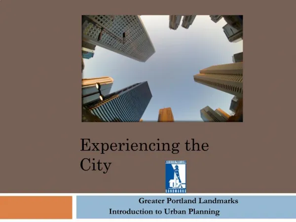
Experiencing the City. Greater Portland Landmarks Introduction to Urban Planning. Experiencing the City. Forward Greater Portland Landmarks (GPL) promotes preservation and revitalization historic building neighborhoods and landscapes and encourages high-quality

E N D
Experiencing the City Greater Portland Landmarks Introduction to Urban Planning
Experiencing the City • Forward Greater Portland Landmarks (GPL) promotes preservation and revitalization historic building neighborhoods and landscapes and encourages high-quality new architecture to enhance the livability and economic vitality of Portland and the surrounding communities. The work of GPL began in 1961 after the unfortunate demolition of one of Portland’s greatest historical markers, Union Station. In the strategic plan for the organization, education was identified as a high priority. Therefore, this unit on experiencing the city was developed to enable middle school students to learn about urban planning and experience the cities and town
Experiencing the City We would appreciate hearing back from you about your experiences, successes and challenges. Please e-mail us at: info@portlandlandmarks.org • Introduction • Experiencing the City is an introduction to urban planning. Using the concepts and activities in this unit, teachers can take their students through a process involving evaluating and analyzing a city or neighborhood from multiple perspectives. Students will have the opportunity to learn how cities came to be, what infrastructures are needed to keep them running, and how cities respond to the needs of people and organizations that use them. • Although many of the activities relate to Portland, there are lessons such as mapping your own neighborhood that apply to all towns. Lessons can be adapted for other cities such as Lewiston or Bangor. In addition, teachers and students can survey or research their own community to identify an issue or local need in which they may want to get involved. • Links to resources can be found at the end of this presentation.
Experiencing the City Activities • 1. What are the Physical Elements Which Make Up a City? ( brainstorming) • 2. Introduction to the Issues and Vocabulary to Urban Planning • 3. Illustrations of Urban Development (slide show of Portland) • 4. Identifying Key Components of a Neighborhood (mapping) • 5. Results of Urban Planning (walking tour) • 6. Analysis of Neighborhood (old maps of Portland) • 7. Primary Source Research (new maps of Portland) • 8. Who is Responsible for Changes? ( Guest speakers)
Experiencing the City ACTIVITY 1 What are the Physical Elements Which Make up a City? Purpose: To identify the basic building blocks that make up a city as well as identify the cultural elements which give a city its character Goal: Students will come up with a list of physical and cultural elements of a city from which students will develop the vocabulary of urban planning Activity: In groups or individually, students will develop lists of the physical and cultural elements of a city that they share with the class. A master list will be developed using urban planning vocabulary. ●Physical examples: Transportation: Roads, railroads, bridges, walkways, bike paths., buses. Buildings: Hospitals, churches, schools, homes, town or city halls. Signage: Road signs, store signs, directional signs. Open Spaces: Parks, yards, waterfront, plazas, trails. Infrastructure: Water, sewer, electric, gas, phones, cable. Neighborhoods ●Cultural Examples: Climate, diversity of people, language, economy. After sharing information they have gathered information have then answer the following : After developing your lists, what do you think urban planning is? The student’s original lists and class master list should be saved for activity 2.
Experiencing the City Urban Planning Issues Examples Transportation: Cars, Planes, trains, bicycles Open Space: Gardens, parks, roadside plantings Preservation: Homes in need of repair, real estate ads and banner headlines. Sprawl: dense development, clear-cutting, development images. Zoning: Inappropriate use of space, business in residential neighborhoods, chickens in residential yards. • Activity 2 Introduction to the Issues and Vocabulary of Urban Planning Purpose: To reinforce urban planning vocabulary and issues. Goals: Students will create a collage that draws from the information on their flip charts and master list from Activity 1. Activity: Students will collect magazines, journals, and newspapers that contain images of urban planning vocabulary and issues. Using the lists from Activity 1, students will create collages illustrating the vocabulary. ►Hang the collages around the room so that they can serve as visual reminders of urban planning concepts and provide “talking points” for continuing discussion. Students may start to collect written articles on urban planning issues. See vocabulary lists on next page
Experiencing the City Vocabulary
Experiencing the City Vocabulary
Experiencing the City Vocabulary
Experiencing the City Vocabulary
Experiencing the City Vocabulary
Experiencing the City Vocabulary
Experiencing the City Activity 3 Purpose: To illustrate the urban planning vocabulary by viewing visual examples of Portland’s development. To introduce the effects of urban planning in Portland. Goal: Students will identify the effects of urban planning. Students will compare and contrast urban planning issues. Activity: Students will view a slide show presented by the teacher or on their laptops and participate in discussions pertaining to individual slides. Slide show can be accessed on our website at : 1914 Congress Street 2009
Experiencing the City Activity ►Using city or county maps, students will locate their school and decide on the neighborhood boundaries. ►During a walking tour around their school, students will observe and create a list of the elements within their school community, such as buildings, streets, crosswalks and utilities. ►Back in the classroom students will share their lists. Using the school as the focus, students will create a map with a legend of their school community. Students will do the same activity at home in their neighborhood. ►Follow-up to this activity will be sharing of the neighborhood maps. Activity 4 Identifying Key Components of a Neighborhood Purpose: To begin looking at neighborhoods and communities in terms of urban planning. Goal: Students will identify key elements and cultural traits in their own neighborhoods. Students will complete a map of their school to be used as a template for their own neighborhood map that will include elements such as a road, buildings, infrastructure and transportation/parking. Continued
Experiencing the City Along with neighborhood and county maps students can utilize the Osher Map Library at the University of Southern Maine. The mission of the Osher Map Library “is to interpret its collections-to make them intellectually accessible-through K-12 outreach programs, dedicated university courses and special classes taught by its faculty scholar, public lectures and conferences, online and printed publications, and collaboration with scholars and teachers from the University and around the globe.” If you wish to include Osher Map Library’s resources in your curriculum please click on to the link below: http://www.usm.maine.edu/maps/k-12-lesson-plans Other Map Resources: www.googleearth.com www.aaa.com
Experiencing the City Activity 5 Results of Urban Planning Purpose: To reinforce what students have learned about urban planning. Goal:Students and a teacher or Greater Portland Landmarks docent will identify the real results of urban planning. Activity:Students and teachers will complete a walking tour through certain neighborhoods of Portland, starting at the corner of India and Commercial Streets on the water-side. Worksheets can be printed out from our website: Walking Tour
Experiencing the City Walking Tour Today, we will be taking a walk in Portland, looking at the real results of urban planning. As we stroll along, think about the elements we saw in the slide show that make a city welcoming, usable and friendly. You will be looking at: ●Sidewalks and crosswalks ●Types of buildings such as commercial, residential and retail ●Examples of adaptive re-use ●Types of infrastructure ●Availability of amenities ●Parking solutions You will be given a worksheet that you will use throughout the tour to answer questions and sketch.
Experiencing the City Activity 6 Analysis of Neighborhood Maps Purpose: Students will analyze maps of their own neighborhoods. Goal: Students will compare and contrast key elements of their neighborhoods and also begin to look at their neighborhoods like urban planners would. Activity: Students will display their neighborhood maps. They will be asked to look critically at each of their maps and discuss similarities and differences in their neighborhoods. Challenge them to identify what is missing. For example: Do all neighborhoods have public parks? Is there adequate parking? What are the people like in each neighborhood? Ask students to think about use. Are there examples of public and private use within their neighborhood? Next, students will write an essay on the things that they feel work and don’t work in their neighborhood in regards to urban planning issues. Click on the following link for access to Portland Neighborhood maps www.portlandmaine.gov/neighborhoods3.pdf
Experiencing the City Activity 7 Primary Source Research Questions Why is Portland located where it is? Why did it become a city? What are some differences you see between old and new maps? Similarities? Do you think urban planning has worked in Portland? What are some changes that you think should occur in the future? Who is responsible for the changes in urban planning? See the next slide for resource information and historical maps. Purpose: To review the concepts of primary source and secondary source information, as well as explore the results of urban planning over time. Goal: Students will discuss their answers to the following questions about the city using primary sources. Activity: Students will compare and contrast information on urban changes by using both historical and present day maps of Portland. (Photographs and documents may also be used.)
Experiencing the City Portland 1828
Experiencing the City Portland 1690
Experiencing the City Activity 7 Resources The links to the right represent added resources for students to access when completing Activity 7. • Osher Map Library: www.usm.maine.edu/maps • Google Earth: www.googleearth.com • Portland Maps: www.portlandmaine.gov/neighborhoods3.pdf • Map Memory Network: www.mainememory.net
Experiencing the City Activity 8 Who is responsible for Changes? Purpose: To introduce the people, the organizations and the institutions responsible for urban planning. Goal: Students will meet with key individuals responsible for urban planning in the area. They will discuss urban planning issues and interview these key people. Activity: Students will prepare questions pertaining to urban planning. Students will be responsible for creating a list of individuals who may be contacted to participate in a discussion with the class. Students will contact key individuals within their neighborhood, city or town to participate in these discussions. Participants will be asked to speak about their role in urban planning, followed by a question and answer session. Examples include: City Planner Mayor Greater Portland Landmarks Preservation Officer
Experiencing the City Resources for Educators LOCAL ORGANIZATIONS Cape Elizabeth Land Trust: http: www.capelandtrust.org Greater Portland Landmarks: www.portlandlandmarks.org Greater Portland Council of Government: www.gpcog.org/home/index.phpnts TRAILS ORGANIZATIONS Falmouth Trails: www.falmouthtrails.org Portland Trails http: www.trails.org Gorham Trails: www.gorham-me.org East Coast Greenway: www.greenway.org Eastern Trails Alliance: www.easterntrail.org ARCHITECTURAL RESOURCES Center for Understanding the Built Environment: www.cubekc.org Center for Architecture and Preservation at Greater Portland Landmarks: www.portlandlandmarks.org SMRT: www.smrtinc.com LANDSCAPE ARCHITECTURE Maine Olmsted Alliance: www.maineolmsted.com URBAN PLANNERS Maine State Planning Office: www.maine.gov/spo Portland Planning Office: www.portlandonline.com/bps American Planning Association: www.planning.org CONTINUED
Experiencing the City Resources for Educators TRANSPORTATION METRO Bus: www.gpmetrobus.com Maine Department of Transportation: www.maine.gov/mdot RIDESHARE: www.erideshare.com/statecity/ME.htm BICYCLES Bicycle Coalition of Maine: www.bikemaine.org Bike The Coast of Maine: www.bikeinmaine.com Alliance for Transportation Choice: www.thebikeshop1.org/ATC.html CITY OF PORTLAND http://www.portlandmaine.gov/departments.htm (This link will provide contact information for every department in the City of Portland) NEIGHBORHOOD ORGANIZATIONS Munjoy Hill Neighborhood Organizations: www.munjoyhill.org Friends of Deering Oaks: www.deeringoaks.org West End News: http://thewestendnews.blogspot.com Portland Maine Neighborhood Associations: www.livinginportland.org Bayside Neighborhood Association: www.baysideneighborhood.org North Deering Neighborhood Association: www.northdeering.org Back Cove Neighborhood Association: www.livinginportland.org/backcove.htm Friends of Riverton Trolley Park : http://publicworks.portlandmaine.gov/rivertontrolleypark.asp Friends of Evergreen Cemetery: www.friendsofevergreen.org Friends of West End Cemetery: www.interment.net/column/commentary/20000624/western.htm
Experiencing the City Resources for Educators SERVICE LEARNING ORGANIZATIONS Learning in Deed: www.ecs.org/html/projectspartners/clc/CLCLearningInDeed.htm KIDS Consortium: www.kidsconsortium.org FOUNDATIONS AND FUNDING SOURCES The Dunn Foundation: www.dunnfoundation.org/resources/index.html Project SEED: www.projectseed.org Portland Partnership: www.greatschoolspartnership.org HISTORIC PRESERVATION National Trust for Historic Preservation: www.preservationnation.org Maine Historical Society: www.mainehistory.org Greater Portland Landmarks: www.portlandlandmarks.org Maine Preservation: www.mainepreservation.org PUBLIC ART Portland Arts and Cultural Alliance: www.portlandarts.org Portland Museum of Art: www.portlandmuseum.org Maine College of Art: www.meca.edu Spiral Arts: www.spiralarts.org EDUCATIONAL SUPPORT Portland Partnership: www.greatschoolspartnership.org Muskie School at the University of Southern Maine: www.muskie.usm.maine.edu MAPS Delorme Maps: www.delorme.com Osher Map Library: www.usm.maine.edu/maps USGS Topographic Maps: www.topomaps.usgs.gov
Experiencing the City Credits PowerPoint presentation created by Joan Bennert, Dianne Manning and the staff at Greater Portland Landmarks Graphics by Dianne Manning All historical photographs courtesy of Maine Memory Network