Download
1 / 8
80 likes | 187 Views
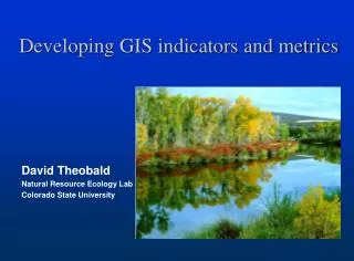
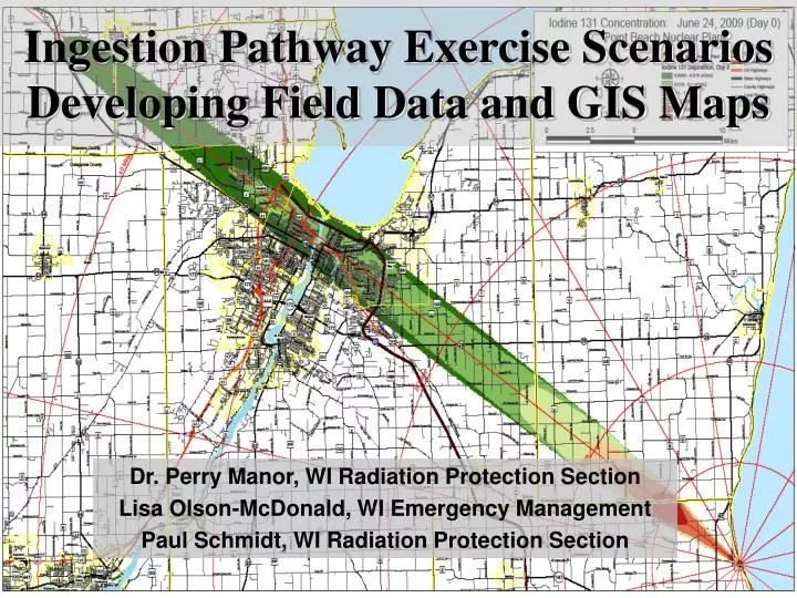
Ingestion Pathway Exercise Scenarios Developing Field Data and GIS Maps. Dr. Perry Manor, WI Radiation Protection Section Lisa Olson-McDonald, WI Emergency Management Paul Schmidt, WI Radiation Protection Section. Legend. Federal Activities. Federal and State Activities. State Activities.

E N D
Ingestion Pathway Exercise Scenarios Developing Field Data and GIS Maps Dr. Perry Manor, WI Radiation Protection Section Lisa Olson-McDonald, WI Emergency Management Paul Schmidt, WI Radiation Protection Section
Legend Federal Activities Federal and State Activities State Activities State and County Activities County Activities Field Activities Plume Release Timeline for Plume and Ingestion-phase Activities for the State of Wisconsin Day 14… Site Area Emergency General Emergency Release terminates Day 0 Day 1 Day 2 Day 3 Day 7 Fly-over Occurs Alert EOC Activation I-131 Concentration peaks in milk Livestock Advisory Issued Plume Projection Modeling Plume Release Risk County(ies) Agricultural Holds Implemented Ground monitoring and field sampling of soil, vegetation, milk, fish Plume Sampling Special Populations Evacuation Evacuation CMHT Contact Federal Assistance Arrives On Site Deposition Modeling Ingestion County Agricultural Holds Implemented Ingestion Sampling Strategy Developed Re-entry Assessment of Fly-over and Field samples Relocation Release of agricultural holds in unaffected areas (risk and ing. Counties) Return Release terminates
Scenario Pitfalls • Disconnect between plume phase and ingestion phase objectives • Transition between plume and ingestion phase • Relocation
Pitfall 1: Disconnect between plume and ingestion phase objectives • Ignore all data beyond 50 miles • Two source terms • Rain out • Smaller source on Day 1 • Develop Day 1 and 2 data and maps internally with same software
Pitfall 2: Transition between plume phase and ingestion phase • Gap Model • Time jump between phases • Continuous play model • No time jump between phases
Pitfall 3: Relocation Options for driving relocation decision-making • Arbitrary hotspot • DRL • 230 µR/hr
Three Rules of Scenario Development • Do NOT set the players up to fail!! • Scenario data may not need to be 100% accurate to adequately drive scenario play • Keep it Simple (when possible)

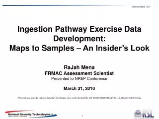


![Making maps, many maps! [What is GIS?]](https://cdn1.slideserve.com/3592384/making-maps-many-maps-what-is-gis-dt.jpg)