Download

1 / 47
480 likes | 889 Views
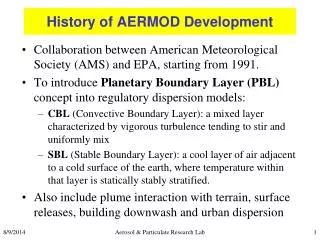
AERMOD Update. Roger W. Brode U.S. EPA/OAQPS/AQAD Air Quality Modeling Group. EPA Region 10 and State Meeting Seattle, Washington October 22, 2007. Outline. AERMOD Modeling System Update AERSCREEN Update AERSURFACE Update Questions. AERMOD Modeling System Status.

E N D
AERMOD Update Roger W. Brode U.S. EPA/OAQPS/AQAD Air Quality Modeling Group EPA Region 10 and State Meeting Seattle, Washington October 22, 2007
Outline • AERMOD Modeling System Update • AERSCREEN Update • AERSURFACE Update • Questions
AERMOD Modeling System Status • AERMOD promulgation as preferred model in full effect as of December 9, 2006 – end of 1-year grandfather period • Significant updates to all three components released January 2007 (dated 06341) • Limited update to AERMOD released January 26, 2007 (dated 07026)
AERMOD Model Changes:Recent Enhancements • Updated processing for PM-2.5 NAAQS and removal of “post-1997” processing for PM-10 • Additional options to vary emissions by month, hour-of-day and day-of-week (MHRDOW, MHRDOW7) • Multiple urban areas in single model run • User-specified default in-stack NO2/NOx ratio for Plume Volume Molar Ratio Method (PVMRM)
AERMOD Model Changes: Recent Enhancements (cont.) • New “BETA” option added to CO MODELOPT card to identify and allow use of new features added to the model that are still in a draft BETA-test status • Non-DFAULT option • Allows for more efficient evolution of code by reducing need for maintaining multiple versions • “Beta” options for capped and horizontal releases • EPA Model Clearinghouse procedure not applicable for PRIME downwash algorithm
AERMOD Model Changes:Recent Enhancements (cont.) • “Beta” option to account for NO2/NOx plume chemistry of combined plumes in the computation of PSD increment consumption with credits for PVMRM • Maximum number of vertices for AREAPOLY source allocated dynamically • More memory-efficient process for allocating array storage
AERMOD Model Changes:Recent Bug Fixes • Several minor fixes for PRIME (mostly undefined variables) • Correct variable type error for AREACIRC sources (minor impact), and correct potential error for all AREA source types (impacts may vary) • Correct error for PVMRM when multi-level on-site wind data are used • A few additional minor bugs
AERMOD Model Changes:Miscellaneous Items • Added range check on VPTGZI in AERMOD to avoid problems with data provided from sources other than AERMET (e.g. gridded met models) • Tightened range checks on optional urban roughness length on URBANOPT card • Default of 1m should be used in most cases; values greater than 5.0m not allowed; warnings issued for values less than 0.8m or greater than 1.5m • More details presented later • Miscellaneous code clean-up items
AERMOD Model Changes:Urban Roughness Length Issue • CO URBANOPT card includes option for user-specified urban roughness length; default value of 1.0m used if not specified • Urban Z0 used to adjust rural u* based on pseudo-convective urban w* to “urbanize” sigma-z for surface sources • Adjustment based on matching convective sigma-w profile with mechanical sigma-w profile at height of 7*Z0-urban
AERMOD Model Changes:Urban Roughness Length Issue • Considered removing option based on concern that unrealistic values were being used, and possible misinterpretation of how value is used in model: • It does not adjust for difference in roughness between met site and urban application site • Performed sensitivity analysis to determine potential impact of removing option • Results showed sensitivity limited to low-level sources, but greater sensitivity than hoped for • Issue is being addressed in revised AIG, and next AERMOD update will treat non-default values as non-DFAULT
AERMOD Model Changes:Capped/Horizontal Releases • Current Model Clearinghouse procedure not applicable to PRIME • Clearinghouse procedure sets Vs low (0.001m/s) and adjusts Ds to maintain flow rate and buoyancy • PRIME numerical plume rise uses input Ds to define radius of plume – use of effective radius may alter results in physically unrealistic ways • AERMOD Implementation Guide suggests using Vs=0.001m/s with actual Ds as interim solution
AERMOD Model Changes:Capped/Horizontal Releases • Draft/BETA options have been implemented for capped & horizontal • User inputs actual stack Vs and Ds • Source types POINTCAP & POINTHOR used to trigger BETA options • Non-downwash sources use Clearinghouse procedure • PRIME sources adjust plume radius (currently 2X) to account for initial spread from cap • Partition vertical and horizontal momentum
AERMOD Model Changes:Capped/Horizontal Releases *** THE SUMMARY OF HIGHEST 1-HR RESULTS *** DATE GROUP ID AVERAGE CONC (YYMMDDHH) - - - - - - - - - - - - - - - - - - - - - - - - - - - - - - STACK1 HIGH 1ST HIGH VALUE IS 2.97269 ON 90010102 STACK1C HIGH 1ST HIGH VALUE IS 2.98035 ON 90010102 STACK1H HIGH 1ST HIGH VALUE IS 72.16824 ON 90010102 STACK1C0 HIGH 1ST HIGH VALUE IS 19767.68555 ON 90010102 STACK1CE HIGH 1ST HIGH VALUE IS 2.97411 ON 90010102
AERMOD Model Changes:PVMRM PSD Credit Option • Define: • A = increment-consuming sources • B = existing (non-retired) baseline sources • C = increment-expanding (retired baseline) sources • Increment consumption without credits = (A+B) – B • PSD Credit = (B+C) – B • CHITOTAL = [(A+B) – B] – [(B+C) – B] = (A+B) – (B+C)
AERMOD Model Changes:Unresolved Issues/Planned Updates • Updated AERMOD Modeling System package planned ASAP to address: • Issues with portability of code to Linux for all three components • Additional improvements to AERMOD memory allocation • Problems with AERMAP for Alaska DEM data • Cross UTM zone and edge receptor bugs in AERMAP • Format problem with some ISHD data may cause AERMET to crash • FIXISHD utility program – interim fix released in April
AERMOD Model Changes:Unresolved Issues/Planned Updates • Inconsistencies between NWS surface data formats • TD-3280 sky cover codes • Abbreviated ISHD (TD-3505) sky cover • Allocatable arrays for AERMAP and modifications to support National Elevation Dataset (NED) • PRIME/BPIPPRM issues • Split building/elongated building issues • Discontinuity at GEP stack height • Upwind impact of building on plume • Possible bug for “out-side cavity” source
AERMOD Model Changes:Unresolved Issues/Planned Updates • Upgrade Fortran compiler • Compaq Visual Fortran no longer supported • Recent “quirk” with Compaq Visual Fortran • Using open-source G95 compiler to debug codes • Upgraded to Intel compiler for Windows; limited tests show about 40% improvement in runtime • Use of compiler option for double precision • Distribute Windows and Linux executables? • Updating user’s guides – convert to MS Word and merge with Addenda
AERSCREEN Finalization Workgroup • Jim Haywood, Chair, Michigan DEQ • Karen Wesson, EPA • Roger Brode, EPA (formerly with MACTEC) • James Thurman, EPA • Bob Paine, ENSR • Lloyd Schulman, TRC • Acknowledge Herman Wong, EPA Region 10
What is AERSCREEN? • AERSCREEN refers to applying the AERMOD model in a “screening mode” • SCREEN option added to AERMOD in 1995 forces model to calculate centerline concentration for each source/receptor/meteorology combination • SCREEN option limits output to 1-hour averages and selects NOCHKD option to eliminate date sequence checking • AERSCREEN interface developed by Jim Haywood • AERSCREEN program provides interface to run AERMOD in SCREEN mode, incorporates MAKEMET, BPIPPRM and AERMAP • MAKEMET program generates matrix of meteorological conditions based on user-specified surface characteristics, formatted for input to AERMOD (.sfc and .pfl files)
Description of AERSCREEN • MAKEMET includes loops through meteorological parameters: • Wind speed (stable and convective) • Cloud cover (stable and convective • Max/min ambient temp (stable and convective) • Solar elevation angle (stable and convective) • Convective velocity scale (w*) (convective only) • Mechanical mixing heights (stable only) • Uses AERMET subroutines to calculate u* and L, also calculates convective mixing heights • Generates AERMOD-ready surface and profile files with site-specific screening meteorology
Description of AERSCREEN • AERSCREEN command-prompt program developed by Jim Haywood, Michigan DEQ • Interactive data entry (command prompts/DOS Screen) • Single point, volume, area or flare source • Flat or complex terrain (user-specified list of 7.5-minute or 1-degree DEM – hopefully also 15-minute files soon) • PRIME building downwash (specify stack location for single tier or provide BPIPPRM input file) • MAKEMET meteorology with site-specific surface characteristics • Search routine to locate worst-case impact location • Re-Use of previous AERSCREEN run files • Includes factors for 3-hour, 8-hour, 24-hour and annual averages; similar to SCREEN3 factors (not finalized yet)
AERSCREEN Status • Draft AERSCREEN package submitted to EPA regions on 4/25/06 for internal (alpha) review and testing • Comments received from several regions and states; many comments related to problems with AERMAP • Public release of draft AERSCREEN package as soon as possible
AERSCREEN Status • ASCREEN program updated to use new AERMAP and AERMOD executables; AREA, AREACIRC and flare source options added • AERMET NR_ANG bug fix incorporated • Surface characteristic options being modified to provide some linkage with AERSURFACE • Previous testing to be updated with latest version; additional testing of AERSCREEN vs. on-site met data also planned • Additional documentation, including draft user’s guide and test results, needed before public release
AERSCREEN Tests • Significant testing to date shows good results across wide range of applications • “Good” defined as reasonable conservatism compared to AERMOD refined estimates • Testing performed for rugged terrain applications with downwash – minor modifications to MAKEMET
Averaging Time Factors (still under development) • 3-hour: fixed ratio of 0.95 (SCREEN3 = 0.90 ± 0.10); • 8-hour: fixed ratio of 0.70 (SCREEN3 = 0.70 ± 0.20); • 24-hour : fixed ratio of 0.40 for plume heights up to 100m, then linearly interpolated to a ratio of 0.30 for plume heights above 200m (SCREEN3 = 0.40 ± 0.20) • Annual: fixed ratio of 0.10 for plume heights up to 100m, then linearly interpolated to a ratio of 0.04 for plume heights above 200m (SCREEN3 = 0.08 ± 0.02).
AERSCREEN:Topics for Discussion • Results from testing • Averaging factors: Results? Fixed vs varying? • Multiple source screening? • MAKEMET and “site-specific” minimum wind speed and anemometer height? Defaults?
What is AERSURFACE? • AERSURFACE is a tool that produces surface characteristics data (albedo, Bowen ratio & surface roughness) for use in AERMET and/or AERSCREEN • Original program developed by Chris Arrington (WV DEP) and Larry Simmons (Energy & Environmental Management, Inc.) • New version being developed by EPA with contractor support (MACTEC)
AERSURFACE Description • EPA AERSURFACE program currently uses USGS NLCD 92 data • 21-category land cover classification scheme • 30 m spatial resolution • Currently draft supports both State and “seamless” files • AERSURFACE includes updated tables of seasonal variations for surface characteristics data by land cover category
AERSURFACE Status • Draft AERSURFACE design document submitted to RO’s for review July 2006 • Comments received from Regions and States, especially regarding draft look-up tables • Draft version of AERSURFACE being reviewed by AIWG • Recent changes to method for estimating surface characteristics from land cover data
AERSURFACE Design • Revisions to calculating area-weighted averages for surface characteristics: • Inverse-distance weighting to account for increased width/area of sector with distance • Revisions to calculation methods: • Averaging ln(zo) for surface roughness • Geometric mean for Bowen ratio • Revisions to default domain/fetch distances: • 1km fetch for roughness • 10x10km domain for Bowen ratio and albedo – no sector dependency
AERSURFACE Design • Default values/functions with several user choices: • Number of sectors (up to 12) • Output monthly, seasonal, or annual data • Wet/dry/normal conditions for Bowen ratio • Snow vs. no snow cover • Arid vs. Non-arid • Airport vs. Non-airport location
AERMET Stage 3 Formatted Datafrom AERSURFACE ** Generated by Internal Draft version of AERSURFACE, dated 07184 ** Center Latitude (decimal degrees): 35.891940 ** Center Longitude (decimal degrees): -78.781940 ** Study radius (km) for surface roughness: 1.0 FREQ_SECT SEASONAL 12 SECTOR 1 0 30 SECTOR 2 30 60 SECTOR 3 60 90 . . ** Season Sect Alb Bo Zo SITE_CHAR 1 1 0.15 0.37 0.089 SITE_CHAR 2 1 0.14 0.30 0.118 SITE_CHAR 3 1 0.15 0.24 0.143 SITE_CHAR 4 1 0.15 0.37 0.123 SITE_CHAR 1 2 0.15 0.37 0.011 SITE_CHAR 2 2 0.14 0.30 0.016 SITE_CHAR 3 2 0.15 0.24 0.022 SITE_CHAR 4 2 0.15 0.37 0.016 SITE_CHAR 1 3 0.15 0.37 0.025 SITE_CHAR 2 3 0.14 0.30 0.032 SITE_CHAR 3 3 0.15 0.24 0.038 SITE_CHAR 4 3 0.15 0.37 0.032
Potential AERSURFACE Issue • ASOS station location uncertainties • Excel file with ASOS station locations available on NCDC website is unreliable for location information • Additional data available for about 200 ASOS stations as part of tropical cyclone wind study appears to be (generally) reliable • Many station locations appear to be off by several hundred meters (median value of about 500m) • Use of erroneous station locations in AERSURFACE could invalidate results