Download
1 / 43
430 likes | 625 Views
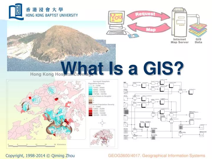
What Is a GIS?. What Is a GIS?. What is a GIS? Why does GIS matter? Spatial problem solving Geo-science, technology and business Where is a GIS from? Components of a GIS The future. Interpretation of the words. GIS : A particular form of information system applied to geographical data

E N D
What Is a GIS? • What is a GIS? • Why does GIS matter? • Spatial problem solving • Geo-science, technology and business • Where is a GIS from? • Components of a GIS • The future What Is a GIS?
Interpretation of the words • GIS: A particular form of information system applied to geographical data • A system: A group of connected entities and activities which interact for a common purpose • An information system: A set of processes, executed on raw data, to produce information which will be useful for decision making • Geographical data: Spatially referenced data sets What Is a GIS?
GIS – a system • A GIS is an information system • Its common purpose: decision making for managing use of land, resources, or any spatially distributed activities or phenomena • It processes raw geographical data • It produces information for decision making of spatial activities What Is a GIS?
Definitions of GIS Definitions of a GIS and the groups who find them useful (from Longley, et al., 2001, pp. 10) What Is a GIS?
Multipurpose geographical data system Multipurpose input land use system Computerised GIS System for handling natural resources inventory data Image-based information system Land resource information system Planning information system Resource information system Natural resource management information system Spatial data handling system Spatial data management and comprehensive analysis system Geographically referenced information system Geo-information system Spatial information system Environment information system Automated GIS Land information system Automated mapping and facilities management Knowledge based GIS Alternative names of GIS What Is a GIS?
Why does GIS matter? “Almost everything that happens, happens somewhere. … Knowing where something happens can be critically important.” —— Longley, et al., 2011, pp. 4 What Is a GIS?
Examples of geographical problems • Government: where to locate public facilities (e.g. schools, hospitals and police stations)? • Transportation: where to build the new highway that serves most critical bottleneck of the road network? • Commercial: where to build new shops or good distribution centres that make most cost effective services? • Travellers: where am I and how can I travel from Hong Kong International Airport to Hong Kong Baptist University? • Country park management: where to locate hiking tracks that provide the best scenery for hikers at different levels with the minimum impact on the environment? What Is a GIS?
A case of life: finding a hotel http://hotels.ctrip.com/Domestic/ShowHotelMap.aspx What Is a GIS?
Hotel booking http://hotels.ctrip.com/Domestic/ShowHotelMap.aspx What Is a GIS?
Where to have our lunch? http://www.dianping.com What Is a GIS?
How can we get there? http://www.dianping.com What Is a GIS?
Let’s go! http://ditu.google.cn What Is a GIS?
The technical concerns • “Spatial is special” (Longley, et al., 2011). • Geospatial – subset of “spatial” (on earth) • Technical matters • Multi-dimensional • Voluminous • Projected onto a flat surface • Special methods of analysis • Large variety of geographical information • Updating is complex and expensive • Visualisation and map making requires large amount of data What Is a GIS?
Spatial problem solving “Information systems help us to manage what we know by making it easy to organize and store, access and retrieve, manipulate and synthesise, and apply to the solution of problems.” (Longley, et al., 2011) • Data: raw facts • Information: contents assembled from raw facts • Evidence: results of analysis • Knowledge: information that is understood • Wisdom: Policies developed and accepted What Is a GIS?
Hierarchy of decision-making infrastructure (After Longley, et al., 2011, pp. 12) What Is a GIS?
Geo-science, technology and business • Geo-science: knowledge about how the world works • Information on how it looks, its forms and how it works • Prediction • GIS combines general scientific knowledge with specific information, and gives practical value to both. • The “test-bed” for geography • Geo-technology: to support both science and problem solving. • Geo-business: software, data, geo-service, publishing and education What Is a GIS?
Where is a GIS from? • Geography • Cartography • CAD and computer graphics • Surveying and photogrammetry • Remote sensing and space technology What Is a GIS?
Geography Cartography GIS CAD & computergraphics Surveying &photogrammetry Remote sensing Origins of GIS What Is a GIS?
A brief history of GIS • The era of innovation • 1960s – 70s • The era of commercialization • 1980s – 90s • The era of exploitation • The 21st century What Is a GIS?
The era of innovation What Is a GIS?
The era of commercialization 1980’s What Is a GIS?
The era of commercialization 1990’s What Is a GIS?
The era of exploitation What Is a GIS?
Components of a GIS • Computer hardware • GIS software • People • Data What Is a GIS?
Computer hardware What Is a GIS?
GIS software What Is a GIS?
Management Information for management Aims and queries from management GIS Data gathering People What Is a GIS?
Satellite imagery Maps Multimedia Ground survey Existing data GIS User Data gathering and retrieval Data What Is a GIS?
The future • Technology diffusion • People oriented applications • Interactive and real-time applications • Cleverer and more comprehensive • To use GIS, or not to use? What Is a GIS?
System, science, study and service • Geographical information system • Emphasising infrastructure • Geographical information science • Emphasising principle and theory • Geographical information study • Emphasising data and data mining • Geographical information service • Emphasising socio-economic service What Is a GIS?
Geographical information service What Is a GIS?
Image view What Is a GIS?
Map view What Is a GIS?
3-D view What Is a GIS?
Street view What Is a GIS?
Get direction What Is a GIS?
Everything has a location What Is a GIS?
Everyone is a provider What Is a GIS?
Everyone is connected What Is a GIS?
GIS and geography • Many roots of GIS come from principles of geography. • However, many geographers remain suspicious of the use of GIS in geography. • Lack of geospatial data • Science and technology, with which GIS is strongly associated, are viewed by some as fundamentally flawed. • Geography itself is sometimes too “ambiguous”. • The ‘bias’ that GIS presents the Earth’s surface is often at the expense of others. What Is a GIS?
Why do we bother? • GIS is becoming an essential tool for geography study and practices. • Geographical data is becoming more widely available and less expensive so that the ability in using such data efficiently and wisely gives competitive margin for a business. • Using GIS will eventually make your study in geography easier, more efficient and enjoyable. • After all, the technology is already in your life, whether you like it or not! What Is a GIS?
Summary • GIS was initially a system, or merely a toolbox for geographical applications. • It has now advanced as science, technology, service and business. • It has become an essential part of management and decision-making practices. • In modern era, people’s life is increasingly dependent upon the information and services provided by GIS. What Is a GIS?