Download
1 / 48
480 likes | 621 Views
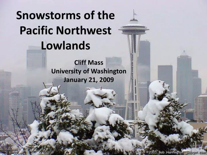
Snowstorms of the Pacific Northwest Lowlands. Cliff Mass University of Washington January 21, 2009. Seattle Feb 1-2, 1916. The greatest 24 hr snowfall (21.5 inches) since official record keeping in Seattle (1890). 29 inches on the ground. 4-5 ft drifts. The dome of the

E N D
Snowstorms of the Pacific Northwest Lowlands Cliff Mass University of Washington January 21, 2009
Seattle Feb 1-2, 1916 The greatest 24 hr snowfall (21.5 inches) since official record keeping in Seattle (1890). 29 inches on the ground. 4-5 ft drifts.
The dome of the St. James Cathedral collapsed
Seattle December 2008 12-24 inches of total snowfall (18 inches SeaTac
Understanding and dealing with local snowstorms have become safety, economic, and political issues. We know a lot more about local snowstorms and are better at predicting them.
Annual Snowfall
Greatest Annual Snowfall Totals in the World in our Mountains The Mt. Baker Ski Area in northwestern Washington State reported 1,140 inches of snowfall for the 1998-99 snowfall season
Lowland snowfall was greater in the 50s, late sixties and early 70s Lots of year to year variations.
One Possible Explanation: the Pacific Decadal Oscillation (PDO) Decadal Oscillation (PDO) PDO is thought to be a natural mode of atmospheric variability Negative phase of PDO associated with greater snowpack in NW.
Important terminology: snow level and freezing level 32F Freezing Level 1000 ft Snow Level
Sometimes you can see the snow level around here Not unusual in marginal situations for there to be much more snow on hill tops
Why are snowstorms rare over the western Washington lowlands? • To get snow you need cold and wet. • It is easy to be mild and wet here • Sometimes we are cold and dry (this week!). • To get cold and wet is very hard…but why? Seattle 2007
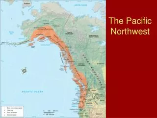
The weather of the Pacific Northwest is dominated by local weather features, most forced by our regional terrain.
During the winter the mountains block the cold air from the interior. Cold Air
Cold Air from the Continental Interior Has a Hard Time Reaching Western Washington
Our air and weather systems generally move west to east: Thus, our weather comes from off the mild Pacific.
The secret of Northwest snow is usually to bring in cold air from the north and interior while moist, cool Pacific air moves in aloft.
Cold Air Moisture
The Fraser River Valley is an important conduit of cold air into western Washington.
The Pressure Pattern That Does It
A snowstorm associated with the Puget Sound Convergence Zone December 18, 1990 The surprise snowstorm
The same problems with buses The city was crippled Trees fell Power failures were widespread
Kitsap County and the Hood Canal area is another focus for heavy snow
Why do we often get sheets of ice with snow over the Puget Sound lowlands. November 27, 2006
Why so icy? • Since it is usually mild here, the surface ground temperatures are generally above freezing. • Snow falls on the roads and is not removed or plowed to the side (you know who to talk to about that!). • The snow starts to melt, but then cooler temperatures behind the weather disturbance freezes the air slush into ice. • Now it is impossible to remove without salt or a warm up.
Seattle and vicinity generally gets 6-9 inches of snow a year in 2-3 events. Not unusual to have year with nearly no snow. On the other hand, roughly once a decade we get a big event, with a foot of snow or more…like December 1996
Heavy snow (nearly two feet north of Seattle), followed by heavy rain caused the collapse of buildings throughout the region--1/2 billion dollars damage
Melting snow plus heavy rain led to landslides throughout the area
Snowstorms are the most difficult forecast problem for meteorologists • Why? Have to accurately predict temperature and precipitation amount to get the forecast right. • Not much practice! • Often right on the edge of rain or snow
We are getting many of the snowstorms generally right now, but not all. • Better computer models • Better understanding • More observations
Communication of snow forecasts is still an issue. There is a major problem for local meteorologists…..
Jim Foreman: The king of snow hype …but all TV stations do it.
The Book My attempt to write a comprehensive introduction to Northwest weather suitable for the layman. Includes everything from the big storms and local weather features, to climate, weather prediction, and how to read the skies. Full of color illustrations and photos.