Download
1 / 25
260 likes | 424 Views
Near-Real Time Land-use Planning of the Northern Zone of the Nile Delta Coast, Egypt. Elham Mahmoud Ali Department Biological and Geological Science, Suez Canal University Egypt. Overview. Background Facts Problems Objectives Methodology Results Consultations and rap up.

E N D
Near-Real Time Land-use Planning of the Northern Zone of the Nile Delta Coast, Egypt Elham Mahmoud Ali Department Biological and Geological Science, Suez Canal University Egypt Elham Mahmoud Ali
Overview Background Facts Problems Objectives Methodology Results Consultations and rap up Elham Mahmoud Ali
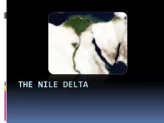
Study area & Background • It occupies the northern part of the Nile Delta between 30 0 E and 31 45 E and 31 10 N and 31 30 N • It has a total area of ~ 4530 km2. and is bounded • The Suez Canal and the Sinai peninsula to the east • The western desert to the west • The Mediterranean Sea to the north The study area is experiencing the typical climatic conditions of the Mediterranean basin. It has many classes of sand dunes and coastal landforms, for example, beaches, wetlands, and salt marshes. Elham Mahmoud Ali
Facts • The Nile Delta coast is a sensitive and highly dynamic ecosystem • This dynamic nature is attributed basically to the various earth surface processes that control the various landforms that constitute many coastal areas • Due to internal economy issues, this area is targeted for human activities • Its population has grown by a rate of 2% per year. This increases the demographic pressure that has resulted in significant modification of the natural resource base. Elham Mahmoud Ali
Problem • Through the early 1990's, It is affected by a range of natural and anthropogenic stresses and unplanned development projects which have led to: • coastline movement due to erosion and deposition processes that occurred • limited land reclamation and cultivation of scattered urban areas • Changed infrastructures such as construction of new roads. Elham Mahmoud Ali
Rational & Objectives • Developing a highly accurate technique • based on high resolution satellite integrated with field observations to: • detect the changes occurred in the study area. • to identify/classify the different land forms, land use & cover, and water resources • to assess the rate of change in both landforms and land use from 2003 to 2006. Elham Mahmoud Ali
Rational & Objectives • Developing a highly accurate technique This integrated techniquewill help in defining and addressing the main controlling factor(s) that have caused the net changes of the landscape along the study area. This information can then serve as a basis to develop the national information system for ICZM to be able to handle with these hazards in future. Elham Mahmoud Ali
Results – Fish farms • 5.5% increment in Fish farms’ area in 2006 • 6.9 km2 per year during the period of study. • 1.8 km2 were determined from 1990-1995 (El-Asmar, 2000) • 1.4 km2 during the period between 1984-2006 (El. Magd & Hermas, 2009) Elham Mahmoud Ali
Results – Urban Land • The total area of the urban lands has increased by 10.7% from 2003 to 2006 • A rate of 9.4 km2 increase per year Elham Mahmoud Ali
Results – Roads Development • the total length of roads increased by a 32% in 2006 (4783.1 km) of the total length in 2003 (3608.6 km). • This gave a net rate of increase of about 392 km/yr during the three years period Elham Mahmoud Ali
Results – Agriculture Development • The agricultural land along the northern Nile Delta zone decreased by 1.2% during the period from 2003-2006 . • the spatial expansion in urban lands occurred mostly at the expense of the black fertile agricultural lands. Elham Mahmoud Ali
This loss (approximately 32.5 km2) is mainly due to the overgrazing activities of date palm farms at Damietta, Rosetta, and Edku.Such activities and its consequences (e.g. exportation to other Mediterranean countries) led to transform some of this land into other related activities; such as storing wood (near Damietta harbour) or urban expansion. Elham Mahmoud Ali
Shoreline changes Elham Mahmoud Ali
Shoreline changes • An increasing average rate of -25.8 mm/yr for shoreline retreat • (-13 mm/yr) by Frihy et al. (2004) • -10.4 mm/yr (Frihy and Komar, 1993) and • -15 mm/yr (White and El-Asmar, 1999). • The increasing rate of shoreline retreat could be attributed to the local reversed SW current • An average rate of shoreline retreat of -20.97m/yr was determined at Baltim in response to the up-drift of the detached breakwaters. • There is a dramatic increase in shoreline retreat particularly after construction of the detached breakwaters as recorded Ras El-Bar and related to reversed current produced after the construction of this protection system. Elham Mahmoud Ali
Erosion & Accretion Processes • a reversed picture of shoreline behaviour west of the Western jetty of the Damietta Harbour was observed with a an accretion rate of +19.10 mm/yr • Accretion was also detected along Gamasa shoreline with an average of +14.9 mm/yr (almost twice the rate previously determined (+4 to +8 mm/yr) by El-Asmar (2000) • A relatively higher rate (+32.47 mm/yr) of accretion was detected at Baltim shoreline • Accretion process experiencing in this area is mainly related to the construction of detached breakwater system along the coast Elham Mahmoud Ali
Shoreline changes Source: Google Earth Elham Mahmoud Ali
Erosion & Accretion Processes Elham Mahmoud Ali
Summary & Conclusion • Due to the global tendency for living along the Nile delta and its wealth of natural resources (e.g. fresh water, flat fertile soils, recreation places, mineral resources, fish farming opportunities), the coastal Nile Delta is experiencing an aaggressive human impact • Man-made interventions result in considerable changes along coastal zones and causes various landforms/land uses transformation. This include either loss or gain in the different landforms classes. Elham Mahmoud Ali
Summary • Man-mad processes that have led to landforms transformation and which were mainly in favour to the other most economic land use classes were relying on the local economy and the market trends. • For example, the increasing tendency towards land transformation diverted to fish farming in late nineties and early twenties • About 81 km2 of land along the study area has been transformed with: • 28.1 km2 increases in urban land, • 20.7 km2 increases in fish-farms • 32.5 km2 decrease in cultivated land Elham Mahmoud Ali
Conclusion • These changes are expected to reshape the spatial characteristics of various landforms • This will led to great environmental consequences; such as sea water intrusion, shoreline erosions, modification/transformation or/and disappearance of some ecosystems naturally exists in the study area. Elham Mahmoud Ali
Recommendations • . This highly dynamic coastal zone requires further studies for monitoring (on medium and long term scales) the negative consequences of human alternation • This would propose a mitigation measures to restore and balance the environmental and ecological systems in this area and similar environments as well as ground water monitoring. Elham Mahmoud Ali
Tanks to Dr. Mahmoud Ahmed National Authority for Remote Sensing and Space Sciences and Dr. Hesham Asmar Mansoura University Elham Mahmoud Ali
For furthur correspondenceelhamali05@yahoo.co.uk Tank You Elham Mahmoud Ali