Download
1 / 27
270 likes | 395 Views
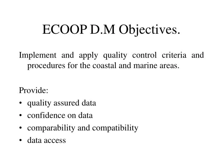
ECOOP D.M Objectives. Implement and apply quality control criteria and procedures for the coastal and marine areas. Provide: quality assured data confidence on data comparability and compatibility data access. Consensus meeting. Agree on concepts Regional approach Implementation

E N D
ECOOP D.M Objectives. Implement and apply quality control criteria and procedures for the coastal and marine areas. Provide: • quality assured data • confidence on data • comparability and compatibility • data access
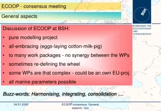
Consensus meeting • Agree on concepts • Regional approach • Implementation • Integration • Comparability/compatibility • Archiving • Define guidelines, actors + working procedures
Existing elements • Basic elements are in existing systems: • Baltic • Arctic • North Sea/Atlantic • Mediterranean • Black Sea • There are significant differences (and in some cases no operational systems)
Regional approach • Links with regional Conventions: • BOOS / HELCOM • North Sea, Atlantic,Arctic / OSPARCOM • Mediterranean / Barcelona (UNEP MAP) • ……. • There are long traditions in Q.A. procedures and subsidiary bodies are existing (e.g. ICES, IAEA/MEL)
Other organisations/projects in D.M. IOC WOCE MEDAR/MedAtlas OTHER (? overview can be provided by MAMA, PAPA, ARENA?)
ECOOP WP3 role WP3 will include the data management for (near)real-time, delayed mode and climatological data. The same q.c. procedures will be applied to them, but delayed mode data could include some additional checks.
ECOOP Data Management • It is proposed that responsibilities will reside in regional centres • How to define the regions (biogegraphical characteristics? Modelling requirements?) • Who are data providers in the regions? • How share the responsibilities?
What is needed • Regional/coastal climatologies • NRT Q.C. procedures / standards for data acquisition and processing • Procedures for assessment of data comparability /compatibility • Q.C. procedures for delayed mode data, before archival • Common formats for data exchange (ASCII? Binary?)
Climatology This will be used for modeling purposes as well as for a step of the q.c. procedures. Some relatively old climatologies are existing (e.g. Levitus, Medar/MedAtlas). These will be acquired and implemented with recently acquired data, where possible. New updated climatologies will be produced.
Instruments and Algorithms • Instruments used are different (accuracy is different) • Algorithms for derivation of parameters /averaging are normally provided by Instr. Producers and are different • Procedures for data acquisition are different (e.g. falling speed of CTD, vertical resolution of averaged data, …) • In case of XBTs depth calculation algorithms could differ from region to region
Procedures • Also the procedures for data collection are different in each place and institution. The comparability and compatibility of data collected requires the application of some control procedures of instruments and processing methodologies. • (e.g. falling speed of the CTD probes • Vertical averaging of data)
Harmonisation • Find common elements • Find the gaps • Homogeneisation of the systems
Integration/homogeneisation • Describe the state of art at the beginning of ECOOP • Implement common protocols for common parameters (to be measured in each region) • Implement ’common’ protocols for ’site specific’ parameters
Integration/homogeneisation • Define common methodologies for data access • Data archiving and retrieval
Delayed mode Quality Control and archiving The Q.C. criteria developnew methodologies to assure the consistency of multiparametric data sets
Tasks Task 3.1 In situ regional/coastal climatologies Task 3.2 Data acquisition protocols and procedures: In Situ Task 3.3 NRT Procedures: In situ Task 3.4 NRT procedures: Satellite (Radar) data Task 3.5 Distributed data bases (in collaboration with coordination WP) Task 3.6 Delayed mode Quality Control and archiving
Task 3.1 Regional / coastal climatologies This will be used for modeling purposes as well as for a step of the q.c. procedures. Some relatively old climatologies are existing (e.g. Levitus, Medar/MedAtlas, …). These will be acquired and implemented with recently acquired data, where possible. New updated climatologies will be produced. Subtask 3.1.1 Acquisition of historical data and climatologies This will allow to have a baseline climatology for each area included in ECOOP. The procedures for the production of the climatologies from original profiles will be analysed and compared. Subtask 3.1.2 Implementation of existing climatologies Recently acquired data, not included in the previous climatologies, will be used. On the base of the analysis/comparison in 3.1.1 it will defined a common procedure for the production of new climatologies using historical data and recently acquired data.
Task 3.2 Data acquisition protocols and procedures: In Situ Different instruments used. The precision of the instruments is depending on internal hardware and software. Procedure for data collection is different. The comparability and compatibility of data collected requires the application of some control procedures of instruments and processing methodologies. Subtask 3.2.1 Calibration, intercalibration (for instruments and water samples). Calibration in specialized centers (accuracy of the data in a static environment). Intercalibration among different probes in situ (in a ‘dynamic’ environment). Different falling speed and different acquisition intervals. Subtask 3.2.2 Real time data acquisition procedures (sampling interval, probe falling speed) procedure for data acquisition probe falling speed + vertical resolution.
Task 3.3 NRT Procedures: In situ Subtask 3.3.1 Near real time data processing and q.c. procedures The aim of this task is the definition of common procedures for elimination of outliers, smoothing, averaging, gross range check, comparison with local climatologies, low level consistency analysis Subtask 3.3.2 Interpolation of near real time data into models’ grids. This task will define a common procedure for the interpolation for model-data comparison. This will be used for an assessment of the sampling strategy and q.c. procedures. Subtask 3.3.3 Data flow from data collectors to regional data assembling centers. A strategic component of the data management if the monitoring of the data flow from the different platforms to regional centers. The monitoring will be possible by defining data collection schedules and transmission strategy.
Task 3.4 NRT procedures: Satellite (RADAR) data Subtask 3.4.1 Near real time data processing and q.c. procedures Subtask 3.4.2 Interpolation of near real time data into models’ grids. Subtask 3.4.3 Data flow from data collectors to regional data assembling centers.
Task 3.5 Distributed data bases This task aims to build a distributed information system aggregating the national/local data centers. A specific middleware enables the federation of local data centers in regional systems. A main portal provides high-level services to access the federation of regional systems. Subtask 3.5.1 The regional portals: confederation of national/local data centres. Regional portals provide access to national/local data centers. They are based on the Federated Information Systems (FIS) approach where the interoperation among several autonomous, distributed and possibly heterogeneous Information Systems is obtained through a shared global data schema. Subtask 3.5.2 Data access (Local data centers enabling). This subtask aims to the design, development and implementation of the middleware that enables the national/local data centers to interoperate in a federation accessed through a regional portal. Wrapping and mediation solutions will be designed and developed using advanced IT platforms.
Task 3.6 Delayed mode Quality Control and archiving Subtask 3.6.1 Definition of relationships between parameters There are relationships between parameters that can be used for assessing the consistency of the data. Such relationships could be different in the different environments. There will be a research of the relationships existing by using historical data Subtask 3.6.2 Consistency analysis of data The relationships found in the previous subtask, will be applied to the data collected in the framework of ECOOP Subtask 3.6.3 Final archiving The data acquired in ECOOP have to be safeguarded for future use. They will be archived in regional archiving centers. They will also be sent to World Data Centres, at the end of the project. Furthermore, the data will also be distributed to project participants with CD-roms.
DELAYED MODE ADDITIONAL TESTS 1. Use of forecast fields to compare to incoming data, when information is available. Those data mismatching the forecast require closer looks. 2. Check that sea surface reference temperature (from satellite) agrees with the XBT surface value to within 3 degrees. 3. A test is required that takes the position of a profile and uses the fact that it is near a source of freshwater to refine the permissible salinity limits (refinement of range tests based on regions). 4. Use of statistical criteria on data accumulated over one month, in a region whose spatial dimensions could be defined on the base of statistical considerations (e.g. similarities of profiles, eof analysis, etc.). The individual observations are then tested to see if they exceed 3 standard deviations based on the distribution of values.
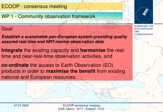
WP3 Links. • Community Observing Framework WP2 • Interactive Modelling and Monitoring System WP5, for the establishment of reference database in regional Seas for major physical-biochemical parameters • WP12 Use of climatological data
To be discussed The regional components The regional rresponsibilities The parameters to be included The data providers Responsibilities
ECOOP Data Management (WP3) The quality of the data are depending on the procedures for: · Data Collection (WP2) · Data Encoding (WP2) · Data Routing · Error Checking and Quality Control · Monitoring