Download
1 / 33
330 likes | 597 Views
High Performance Wireless Research and Education Network. An interdisciplinary collaboration. University of California, San Diego http://hpwren.ucsd.edu/. HPWREN project objectives. focus on access networks for research and education applications fixed or temporary installations

E N D
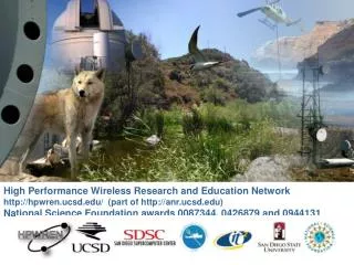
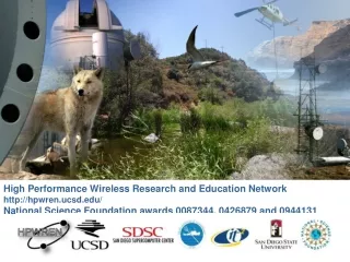
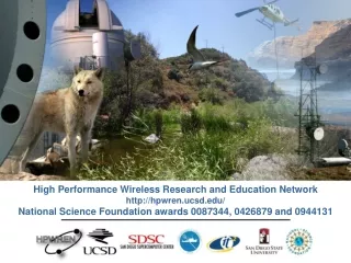
High Performance Wireless Research and Education Network An interdisciplinary collaboration University of California, San Diego http://hpwren.ucsd.edu/
HPWREN project objectives • focus on access networks for research and education applications • fixed or temporary installations • wide area wireless high performance access • emphasis on interdisciplinary collaboration • non-commercial prototype network to demonstrate feasibility • research to understand application performance requirements
Project participants and collaborators • Funded by the National Science Foundations Networking Division (ANIR) • Led by the UCSD’s San Diego Supercomputer Center and Scripps Institution of Oceanography • Science applications • Scripps Institution of Oceanography: • Geophysics -- earthquake sensors • San Diego State University, Astronomy department • Mt. Laguna Observatory • San Diego State University, Ecology • Ecology field stations (Santa Margarita and Sky Oaks) • Lawrence Berkeley National Laboratory and California Institute of Technology • Palomar Observatory • Education applications • Pala Indian Reservation and Pala Fire Station • La Jolla Indian Reservation • Rincon Indian Reservation • San Pasqual Indian Reservation • Hewlett Packard Digital Village award to the Southern California Tribal Chairmen’s Association • Collaborations with crisis management and other agencies
Network architecture • high performance backbone network • commercially available 45Mbps duplex point-to-point radios • backbone nodes at “quality” locations, including UPS • fairly large antennas (8’, 6’, or 4’) • network performance monitors at backbone sites • high speed access links • commercially available 802.11b radios • some 45Mbps access links • access nodes at individual sites • point-to-point or point-to-multipoint • small (~2’ X ~3’) grid antennas • some sites include local performance monitors • network statistics available at http://stat.hpwren.ucsd.edu/
ANZA Seismic Network (1981-present) 13 Broadband Stations 3 Borehole Strong Motion Arrays 5 Infrasound Stations 1 Bridge Monitoring System Kyrgyz Seismic Network (1991-present) 10 Broadband Stations IRIS PASSCAL Transportable Array (1997-Present) 15 - 60 Broadband and Short Period Stations IGPP Real-Time Systems
Continuous real-time telemetry 15-60 Stations Integrate with other real-time data sources Deployments 1997-8 Colorado 1998-9 South Africa 1999-2000 Montana-Wyoming 2001 - Parkfield, California IRIS PASSCAL WirelessTelemetry Array
HPWRENtopology--October 2001 Santa Margarita Ecological Reserve Palomar Observatory Pala Indian Reservation Rincon Indian Res. La Jolla Indian Reservation San Pasqual Indian Reservation Mt. Laguna Observatory UCSD Backbone node Science site Researcher location Education site Incident mgmt. site
North Peak High speed backboneplus MLO Stephenson Peak Mt Laguna Observatory Mt Woodson UCSD/SDSC
Salton Sea Toro Peak,8700’ Boyd Deep Canyon Pinyon Flats
Mt. Woodson Pala Learning Center UCSD/SDSC Initial PalaIndianReservationconnection Mt. Woodson
La JollaIndian Reservation connection Palomar Mountain relay site La Jolla learning center Mt. Woodson UCSD/SDSC
Researchers in the field • antenna mounted on tripod • connected to laptop PCMCIA card • no external power or equipment
Multi-agency crisis management demo28 August 2001 Inmarsat satellite Sharp Hospital relay site UCSD HPWREN Internet connection at SDSC network- controllable video camera 64kbps ISDN link DARPA ENCOMPASS Server at SSC mobile weather station Inmarsat ground station Inmarsat satellite antenna National Guard Armory SSC Deployable Communications Support Terminal
Tribal Digital Village project • Native American activity building up on HPWREN • Funded by Hewlett Packard • Awarded to the Southern California Tribal Chairmen’s Association • HPWREN is collaborator, and not the service provider • Objective of a utility architected and operated by Native Americans
San DiegoCountyNativeAmericanReservations Pala Pauma Los Coyotes La Jolla Rincon San Pasqual Mesa Grande Santa Ysabel Inaja Cosmit Captain Grande Barona Cuyapaipe Vieja Manzanita La Posta Campo Sycuan Jamul
San DiegoCountyIndianReservations----backbonenetwork Pala Los Coyotes Pauma La Jolla Cluster 2 Cluster 1 Rincon San Pasqual Santa Ysabel Mesa Grande Inaja Cosmit Cluster 3 Cuyapaipe Barona Captain Grande Vieja Manzanita Cluster 4 La Posta Campo Sycuan Jamul
ROADNetReal-time ObservatoriesApplications and Data managementNetwork San Diego Supercomputer Center Scripps Institution of Oceanography University of California at San Diego
Yosemite Snowpack Climate Coastal Studies Pollution Erosion Deep Ocean Climate Weather Ecological Reserves CO2 Monitoring Watershed Geophysical Monitoring GPS Seismic HPWREN Wireless telemetry Network Analysis Data Management Scalable Architecture for Real-Time Data sharing Personalized Virtual Sensor Networks Information Discovery System Project Research
Efficient, scalable sensor networks Wireless and high bandwidth technologies Network design flexibility XML based integration and dissemination of information Continuous archives Access control systems Information Technology Research Goals
Earthscope -USArray, PBO, SAFOD, InSar Virtual Seismic Network Planning Issues: Realtime telemetry Data Integration Processing Archiving