Download
1 / 19
190 likes | 316 Views
iSERVO and SERVOGrid: (International) Solid Earth Research Virtual Observatory Grid/Web Services and Portals Supporting Earthquake Science. June 8 2004 APAC Meeting Sydney Australia Geoffrey Fox Community Grids Lab, Pervasive Technologies Laboratories Indiana University.

E N D
iSERVO and SERVOGrid: (International) Solid Earth Research Virtual Observatory Grid/Web Services and Portals Supporting Earthquake Science June 8 2004 APAC Meeting Sydney Australia Geoffrey Fox Community Grids Lab, Pervasive Technologies Laboratories Indiana University
The Solid Earth Research Virtual Observatory A Web-based system for modeling multi-scale earthquake processes Andrea Donnellan, John Rundle, Geoffrey Fox, Marlon Pierce, Dennis McLeod, Jay Parker, Robert Granat, Terry Tullis, Lisa Grant
Solid Earth Science Questions • What is the nature of deformation at plate boundaries and what are the implications for earthquake hazards? • How do tectonics and climate interact to shape the Earth’s surface and create natural hazards? • What are the interactions among ice masses, oceans, and the solid Earth and their implications for sea level change? • How do magmatic systems evolve and under what conditions do volcanoes erupt? • What are the dynamics of the mantle and crust and how does the Earth’s surface respond? • What are the dynamics of the Earth’s magnetic field and its interactions with the Earth system? From NASA’s Solid Earth Science Working Group Report, Living on a Restless Planet, Nov. 2002
The Solid Earth is:Complex, Nonlinear, and Self-Organizing SESWG fed into NASA ESE Computational TechnologyRequirements Workshop, May 2002 Relevent questions that Computational technologies can help answer: • How can the study of strongly correlated solid earth systems be enabled by space-based data sets? • What can numerical simulations reveal about the physical processes that characterize these systems? • How do interactions in these systems lead to space-time correlations and patterns? • What are the important feedback loops that mode-lock the system behavior? • How do processes on a multiplicity of different scales interact to produce the emergent structures that are observed? • Do the strong correlations allow the capability to forecast the system behavior in any sense?
Characteristics of Computing for Solid Earth Science • Widely distributed heterogeneous datasets • Multiplicity of time and spatial scales • Decomposable problems requiring interoperability for linking full models • Distributed models and expertise Enabled by Grids and Networks
SERVO: Solid Earth Research Virtual Observatory • Web-services (portal) based Problem Solving Environment (PSE) • Couples data with simulation, pattern recognition software, and visualization software • Enable investigators to seamlessly merge multiple data sets and models, and create new queries. • Framework arose from May 2002 NASA Workshop on Earth Science Computational Technologies • Data • Space-based observational data • Ground-based sensor data (GPS, seismicity) • Simulation data • Published/historical fault measurements • Analysis Software • Earthquake fault • Lithospheric modeling • Pattern recognition software
SERVOGrid Requirements • Seamless Access to Data repositories and large scale computers • Integration of multiple data sources including sensors, databases, file systems with analysis system • Including filtered OGSA-DAI (Grid database access) • Rich meta-data generation and access with SERVOGrid specific Schema extending openGIS (Geography as a Web service) standards and using Semantic Grid • Portalswith component model for user interfaces and web control of all capabilities • Collaboration to support world-wide work • Basic Grid tools: workflow and notification • Notmetacomputing
SERVOGrid Application Descriptions • Codes range from simple “rough estimate” codes to parallel, high performance applications. • Disloc: handles multiple arbitrarily dipping dislocations (faults) in an elastic half-space. • Simplex: inverts surface geodetic displacements for fault parameters using simulated annealing downhill residual minimization. • GeoFEST: Three-dimensional viscoelastic finite element model for calculating nodal displacements and tractions. Allows for realistic fault geometry and characteristics, material properties, and body forces. • VirtualCalifornia: Program to simulate interactions between vertical strike-slip faults using an elastic layer over a viscoelastic half-space • RDAHMM: Time series analysis program based on Hidden Markov Modeling. Produces feature vectors and probabilities for transitioning from one class to another. • PARK: Boundary element program to calculate fault slip velocity history based on fault frictional properties.a model for unstable slip on a single earthquake fault. • Preprocessors, mesh generators • Visualization tools: RIVA, GMT
SERVOGrid Codes, Relationships (Workflow) Elastic Dislocation Inversion Viscoelastic FEM Viscoelastic Layered BEM Elastic Dislocation Pattern Recognizers Fault Model BEM
(i)SERVO Web (Grid) Services • Programs: All applications wrapped as Services using proxy strategy • Job Submission: supports remote batch and shell invocations • Used to execute simulation codes (VC suite, GeoFEST, etc.), mesh generation (Akira/Apollo) and visualization packages (RIVA, GMT). • File management: • Uploading, downloading, backend crossloading (i.e. move files between remote servers) • Remote copies, renames, etc. • Job monitoring • Workflow: Apache Ant-based remote service orchestration (NCSA) • For coupling related sequences of remote actions, such as RIVA movie generation. • Database services: support SQL queries • Data services: support interactions with XML-based fault and surface observation data. • For simulation generated faults (i.e. from Simplex) • XML data model being adopted for common formats with translation services to “legacy” formats. • Migrating to Geography Markup Language (GML) descriptions.
GML Schemas as Data Models for Services • Fault and GPS Schemas are based on GML-Feature object. • Seismicity Schema is based on GML-Observation object. • Working schema available from http://grids.ucs.indiana.edu/~gaydin/schemas/ • Work interfaced with openGIS Consortium who have well developed set of GIS Web services
Important Principles • Use OGCE Portal Architecture and portal services • Data, Compute, Collaboration services • Use Grids of Grids of Simple Services Architecture • Build Problem Solving Environment as message not method linked capabilities • Build a GIS (Geographical Information Systems) Grid spanning simulation/crisis management and different fields with openGIS compliance • Education Grid by transformations on research grid • Stream Management using NaradaBrokering • Initially testing on Space Shuttle applications • Would like to integrate with NASA’s ESMF (Earth System Modeling Framework) using ESMF for fine scale and Grid/Web Services for coarse scale capabilities
Field Trip Data ? GISGrid Discovery Services RepositoriesFederated Databases Streaming Data Sensors Database Database Sensor Grid Database Grid Research Education SERVOGrid Compute Grid Customization Services From Researchto Education Data FilterServices ResearchSimulations Analysis and VisualizationPortal EducationGrid Computer Farm Geoscience Research and Education Grids
Gas CIGrid Flood CIGrid … … Gas Servicesand Filters Flood Servicesand Filters Electricity CIGrid Portals Collaboration Grid Visualization Grid Sensor Grid GIS Grid Compute Grid Data Access/Storage Registry Metadata Core Grid Services Physical Network Security Notification Workflow Messaging Critical Infrastructure (CI) Grids built as Grids of Grids
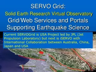
International iSERVO Resources • iSERVO is APEC activity involving Australia, China, Japan, USA • Next meeting July 9-14 2004 Beijing • http://www.aces-workshop-2004.ac.cn/ • USC, Indiana and JPL are current USA resources • University of Queensland • Host resources: Web/compute server • Finite Element Application, “Finley” • Australian Fault Map data from Geoscience Australia • University of Tokyo • Linux server for Web server hosting • Finite Element Application, “GeoFEM” and related tools.
iSERVO Example: Finley • Finley is a finite element code being developed by the QUAKES group at the University of Queensland. • Compatible with GeoFEST-style geometry models and mesh generation tools. • So we can reuse the services we wrapped for GeoFEST. • The Finley application itself is a separate service and also has a separate (simple) visualization service.
Setting Up Finley Simulation of Northridge Selected Fault Components Select Fault from USC database