Download
1 / 16
160 likes | 401 Views
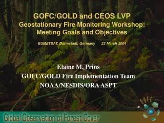
Overview of the GOES Wildfire ABBA, Applications, and Future Plans GOFC/GOLD Global Geostationary Fire Monitoring Applications Workshop EUMETSAT, Darmstadt, Germany 23 March 2004. Elaine M. Prins NOAA/NESDIS/ORA Advanced Satellite Products Team Madison, Wisconsin

E N D
Overview of the GOES Wildfire ABBA, Applications, and Future Plans GOFC/GOLD Global Geostationary Fire Monitoring Applications Workshop EUMETSAT, Darmstadt, Germany 23 March 2004 Elaine M. Prins NOAA/NESDIS/ORA Advanced Satellite Products Team Madison, Wisconsin elaine.prins@ssec.wisc.edu Joleen M. Feltz Christopher C. Schmidt UW-Madison Cooperative Institute for Meteorological Satellite Studies National Oceanic and Atmospheric Administration (NOAA) Advanced Satellite Products Team (ASPT) UW-Madison Cooperative Institute for Meteorological Satellite Studies (CIMSS) National Aeronautics and Space Administration
Overview • Brief overview of GOES Wildfire Automated Biomass Burning Algorithm (WF_ABBA) processing system • Examples of GOES WF_ABBA fire monitoring in the Western Hemisphere • Diurnal and geographic distribution of fires • Applications of the GOES WF_ABBA fire product - Land-cover/Land-use change - Global change- Emissions - Pollutant transport - Modeling • Future Plans
The GOES Wildfire Automated Biomass Burning Algorithm • (WF_ABBA) • Automatically locates and characterizes sub-pixel fires in GOES imagery • - The WF_ABBA uses GOES visible, 3.9 µm and 10.7 µm data and ancillary data to identify and characterize sub-pixel fires. - Contextual techniques are used to locate hot pixels that are statistically different from the background and assign fire pixel categories: (processed; saturated; cloudy; and high, medium and low probability fire pixels) • - Numerical techniques are used to determine instantaneous estimates of sub-pixel fire size and average temperature for the processed fire pixel category based on the Dozier technique. • Ancillary data used to augment the GOES data in finding and characterizing fires- These data help to screen for false alarms and correct for water vapor attenuation, surface emissivity, solar reflectivity, and semi-transparent clouds. • - The AVHRR-derived Global Land Cover Characteristics (GLCC) data base is used to assign surface emissivity values and helps screen for false alarms. - The Aviation Model total column precipitable water is utilized to correct for water vapor attenuation. • WF_ABBA fire product consists of:- ASCII text files, McIDAS MD and AREA files • - Alpha-blended composite imagery (http://cimss.ssec.wisc.edu/goes/burn/wfabba.html)
Overview of GOES WF_ABBA Processing System • WF_ABBA algorithm in McIDAS Environment - Automated (DELL 900 mhz dual proc., Linux, BASH scripts) • Part I: Identify and log all remotely possible fire pixels • - Input: • - GOES multiband (vis, 4 micron, 11 micron) McIDAS areas - Aviation model forecast in McIDAS grid format - Ecosystem McIDAS area (AVHRR GLCC) • - Transmittance offset lookup table ASCII file • - Output: • - Files (McIDAS MD and ASCII) documenting any remotely • possible fires: • lat., lon., T4, T11, Tb4, Tb11, ecosystem, other variables NESDIS Operations Part II: Screen/filter fire pixels, account for oversampling, temporal filtering, create output fire pixel images, and log results - Input: - Output ASCII file from Part I - GOES single band McIDAS areas - Output: - Files (McIDAS MD and ASCII) documenting processed, saturated, cloudy, and all possible fires lat., lon., T4, T11, Tb4, Tb11, estimates of fire size/temp, ecosystem type, and bookkeeping variables - McIDAS areas with fire pixels identified B. Generation of alpha-blended composite fire products - Automated (BASH scripts) - Series of McIDAS commands, programs, and scripts C. Dissemination of data and imagery via anonymous ftp and animations on the web - Automated
University of Wisconsin-Madison CIMSS/ASPT GOES-10/-12 Half-hourly Wildfire ABBA Web Distribution http://cimss.ssec.wisc.edu/goes/burn/wfabba.html Since September 2000 animations of Wildfire ABBA composite image products have been provided via anonymous ftp and the web every half-hour. Displays include three overviews and 35 regional views providing coverage of the entire Western Hemisphere. Examples of Regional View Sectors
Examples of the GOES Wildfire ABBA Monitoring System in the Western Hemisphere http://cimss.ssec.wisc.edu/goes/burn/wfabba.html
Fire Pixel Category Processed Saturated Cloudy High Possibility Medium Possibility GOES-8 Wildfire ABBA Summary Composite of Filtered Half-Hourly Fire Observations for the Western Hemisphere Time Period: September 1, 2001 to August 31, 2002 The composite shows the much higher incidence of burning in Central and South America, primarily associated with deforestation and agricultural management. Fire Pixel Distribution North America (30-70°N): 12% Central America (10-30°N): 11% South America (70°S-10°N): 77% The base map for this composite image is derived from the Global Land Cover Characteristics database provided by the USGS
GOES-8 Wildfire ABBA Filtered Fire Pixel Difference Composite For the Western Hemisphere Yellow indicates fire pixels only detected in the first year: September 2000 – August 2001 Red indicates fire pixels only detected in the second year: September 2001 – August 2002 NOAA/NESDIS/ORA ASPT UW-Madison CIMSS
Satellite Coverage (%) GOES Eclipse & Keep-out Zone Fire Pixel Category High Possibility Processed Year 1 (Excluding Low Possibility) Saturated Medium Possibility Year 2 (Excluding Low Possibility) Low Possibility Cloudy Diurnal Distribution of GOES-8 WF_ABBA Filtered Fire Pixel Product for the Western Hemisphere Dates: 1 September 2001 – 31 August 31 2002 Geographical Distribution of the GOES-8 WF_ABBA Filtered Fire Pixel Product for the Western Hemisphere Dates: 1 September 2001 – 31 August 31 2002
WF_ABBA Fire Pixel Category Processed Saturated Cloudy High Possibility Medium Possibility GOES-8 WF_ABBA Fire Product Date: 1 June – 31 October 2002 Time: All half-hourly fire products The base map for this composite image is derived from the Global Land Cover Characteristics database provided by the USGS
GOES South American ABBA Fire Products Used in Land Use Land Cover Change, Climate Change, and Pollutant Transport Studies Universities, research institutes, and government planning agencies are using the GOES ABBA fire product as an indicator of land-use and land-cover change and carbon dynamics along the borders between Brazil, Peru, and Bolivia. Air pollution transport models and climate change modeling studies are using the GOES fire products to identify and “quantify” emissions due to biomass burning. Instruments such as EOS MOPITT are identifying enhanced pollution associated with biomass burning. GOES-8 Wildfire ABBA Composite Fire Product for Western Amazonia in Acre, Brazil Date: June – October, 2002 The MOPITT carbon monoxide composite is courtesy of the MOPITT team: John Gille (NCAR), James Drummond (University of Toronto), and David Edwards (NCAR)
Comparison between WF_ABBA Fire Observations and MOPITT CO ProductPacific Northwest United States MOPITT Total Column CO: 25–27 August 2000 Smoke and cumulus from large fires MOPITT CO Max. NorthDakota Montana Idaho GOES-10 WF_ABBA Detected Fires: 20–27 August 2000 MOPITT carbon monoxide composite is courtesy of J. Warner (NCAR) and the MOPITT Science team
Applications of the GOES Wildfire ABBA in Modeling Programs Real-time Assimilation into the Naval Research Laboratory Navy Aerosol Analysis and Prediction System (NAAPS) Real-time Assimilation at the University of Sao Paulo and CPTEC/INPE into the RAMS model RAMS CO Product RAMS PM2.5 Product GOES-8 WF_ABBA Fire Product GOES WF_ABBA Fire Product 22 August 2003 at 17:45 UTC NAAPS Smoke Optical Depth 22 August 2003 at 18:00 UTC Point Sources for 13 August 2002 GOES-8 ABBA Fire and MACADA Cloud Products Used in Study to Model and Predict Future Fire Activity at UNH Collaboration with Univ. of New Hampshire Inst. for Study of Earth, Oceans, and Space • Other Modeling Efforts and Collaborations • Climate Modeling at NASA/GSFC: Assimilation into the GOCART model • Real-time Air Quality Modeling at NASA/Langley:Real-time assimilation into the RAQMS model as part of IDEA (Infusing satellite Data into Environmental Applications) • Fire Emissions and Regional Air Quality Modeling at NCAR: Assimilation into the U.S. EPA Community Multiscale Air Quality model in support of the 2002 SMOCC campaign in Brazil Intermediate Deforestation Scenario Predicted increase in future regional fire activity: 22% Number of Fire Pixels Complete Deforestation Scenario Predicted increase in future regional fire activity: 123% Collaborations result in submission/publication of 3-peer reviewed publications in FY03
Rodeo/Chediski Complex in Arizona 2303 UTC 2307 UTC 2315 UTC 2320 UTC Fire Detection Using Rapid Scan Imagery Case Studies in the Western U.S. During the 2002 Fire Season Using rapid scan GOES-11 data, the WF_ABBA was able to identify several wildfires in imagery near/at the initial reported start times during the 2002 fire season in the Western U.S. Rodeo/Chediski Complex: Largest Wildfire in Arizona’s Recorded History Size: > 480,000 acres Cost: > $170 million Start Date of Rodeo Fire: 18 June 2002 Official report time by suspected arsonist: 23:11 UTC Initial detect in post-processed GOES-11 image: 23:07 UTC UW-Madison/CIMSS/ASPT
International Global Geostationary Active Fire Monitoring:Geographical Coverage 80 120 160 -160 -120 -80 -40 0 40 80 GOES-W GOES-E MSG MTSAT 60 Satellite View Angle 80° 65° 40 20 0 -20 -40 -60 -80 322
Overview • The GOES WF_ABBA processing system has been providing half-hourly fire products for the Western Hemisphere since September 2000. Made operational in NESDIS OSDPD/SSD in August 2002. • In the Western Hemisphere GOES WF_ABBA fire products are providing new insights into diurnal, spatial, seasonal and interannual biomass burning activity. • User community includes: hazards, global change, land-use land-cover change, aerosol/pollutant monitoring and modeling, carbon cycle studies, socio-economic and health, educational institutions, policy makers, and the general web community • Future plans - Implement a Rapid Scan WF_ABBA for hazards applications, with products available within 5 minutes - Adapt GOES WF_ABBA to GOES-9 - Adapt GOES WF_ABBA to MSG - Adapt GOES WF_ABBA to MTSAT-1R - Transfer global WF_ABBA to NESDIS Operations - Participate in multi-sensor validation and intercomparison studies - Get ready for the next generation geostationary platform (ABI)