Download

1 / 36
360 likes | 511 Views
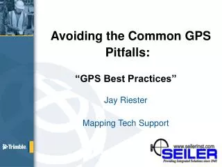
Avoiding the GPS Pitfalls Indiana GIS Conference. Avoiding the Common GPS Pitfalls: “GPS Best Practices” Lanny Schnipper Mapping Sales Manager http://seilermapsupport.wordpress.com/. Equipment Setup. Current OS and GPS Firmware installed. Current Date and Time on the data collector.

E N D
Avoiding the Common GPS Pitfalls: “GPS Best Practices” Lanny Schnipper Mapping Sales Manager http://seilermapsupport.wordpress.com/
Equipment Setup • Current OS and GPS Firmware installed. • Current Date and Time on the data collector. • Data collector is fully charged. • Software Installed, compatible and working?
Equipment Setup • Turn off WiFI and Bluetooth to conserve battery. • Automobile charger and serial clip for charging. • External battery pack or spare battery
Current 2008 WM6.1Geo OS and GPS FWStart/Settings/System/System Information
Current Geo 6000 WM6.5 OS and GPS FWStart/Settings/System/System Information/GNSS
Best Practices: In the field • Horizontal/Vertical and In the Field/Post Processed accuracy settings. • Post Processing Distance from Base. • Estimated Accuracy icon on the status bar (click on it to display) TerraSync and GPS Correct.
Best Practices: In the field • 1 second logging – “Averaging”
Multipath • Occasionally multipath errors occur • GPS Signal is being delayed/disrupted. • “Chain Link Fences, Automobiles, Metal & Glass buildings and bodies of water.” • Estimated error may not always include • multipath. • Multipath tends to cancel out when you collect • GPS measurements while moving. • External Antenna’s have better multipath • rejection (Stealth technology).
Collect good GPS measurements between features • Collect good quality data before and after you collect your feature (maintain GPS/Initialization - lock). • In theory, you don’t have to collect too many positions in a point feature, once the accuracy indicator readings are good enough. • But if you collect for about 20 to 30 seconds, you increase the chance of acquiring more satellites or cancelling out short-term multipath errors. • If the accuracy indicator readings are poor, you should log more positions or cancel and start again.
Log Now or Later • Log Now – start a feature and simultaneously start collecting GPS position. • Log Later – start a feature, enter attributes and start collecting GPS positions later. Use this for lines and areas too.
Pause GPS logging before entering attribute information: • Allows you to concentrate on positioning: • Holding the antenna over the location to be measured. • Holding the antenna horizontal with a good view of the sky. • It is not easy to do this while concentrating on entering attribute information.
Planning Sky plot View “DOPS” and future satellite constellation, including trajectories and trails. Use time in the field more efficiently Increase productivity In Field Planning
Trimble Planning Online http://www.trimble.com/GNSSPlanningOnline
Best Practices: In the field • Avoid blocking satellites with your own body use an external antenna. • The majority of satellites are between you and the equator (GPS only). • Be aware of surrounding Obstacles. Christchurch, New Zealand Frankfurt, Germany Denver, USA
Be Mindful of Buildings or other obstructions • Wait for stable GPS Initialization and Carrier lock. • Use offset measurements or Laser Rangefinder.
Heavy Canopy Light Canopy Trees and canopy • Use an external antenna on a pole for greater GPS gain and stability. • Wait for a stable lock before entering canopy environments. • Collect data before and after entering canopy environments (carrier data that is free of cycle slips). • Use offset measurements or Laser Rangefinder.
GPS and Glonass (GNSS) • GPS – Global Positioning System • Glonass – GLObal Navigation Satellite System • GNSS – Global Navigation Satellite System – multiple GPS Satellite Systems: Europe and China are building their own now. • If you are using a GPS unit that can track and record GPS and Glonass you can increase your productivity tougher GNSS conditions. • Use a RTN/VRS. • Post Process against a GNSS base station!!!!
http://incors.in.gov/default.aspx http://incors.in.gov/map.html
Cellular VRS Connection • Must have cellular DATA service in your work area: • Verizon, AT&T, US Cellular,T-Mobile or Sprint etc. • Data Plan is needed (differs from a voice plan) • A simple cell phone with a data plan is work best. Avoid Blackberry and Iphone. • Make sure “Tethering” or “PAM” is enabled for Bluetooth • Carry external battery pack to charge phone or bring a spare battery. Car charger for GPS Unit and phone. • A Bluetooth cell phone uses less battery then a MiFi, Droid WiFI etc.
Datum Shift • Know your correction source. • WAAS and Beacon are different! WGS84 vs. CORS96 • Confirm your base station if post-processing. • Find one base station that works and stick with it for post processing. • Compare certified known control monument(s) before starting a project
Datums • Choosing the wrong datum can greatly shift your data! • NAD27 to NAD83 could mean 50 feet or more Horizontal. • “NAD83” has different versions: • NAD83 (86) • NAD83 (91) • NAD83 (97) • NAD83 (CORS 96) • IGS08 (epoch 2005) NAD83 (CORS96) I’m in “NAD83”
Estimated Accuracies • Based on: • - Receiver type • - DOP value • SNR’s • Number of satellites • - Satellite elevation angle • Carrier lock time / initialization (ProXRT and GeoXH) • Correction source (WAAS, Beacon or VRS) • In the Field vs. Post Processed estimates - baseline
Test on a known control point • Find a NGS Control via Critigen for Android Ap: • http://www.critigen.com/mobile/findacontrol/ • NGS Data Sheet via DS World/Google Earth: • http://www.ngs.noaa.gov/PC_PROD/PARTNERS/index.shtml • NGS Data Sheet online: • http://www.ngs.noaa.gov/cgi-bin/datasheet.prl
Other Resources: • Trimble Knowledge Network: http://www.trimble.com/tkn/ • GPS-The-First-Global-Satellite-Navigation-System-by-Trimble. Great book on the History and GPS terms: • http://ebookbrowse.com/gps-the-first-global-satellite-navigation-system-by-trimble-pdf-d230204802 • Seiler Mapping Support Blog: http://seilermapsupport.wordpress.com/
Questions? Jay Riester Mapping Tech Support jriester@seilerinst.com http://solutions.seilerinst.com