Download
1 / 41
490 likes | 973 Views
Subsidence and Soils. Chapter 8. Learning Objectives. Know what a soil is and the processes that form and maintain soils Understand the causes an effects of subsidence and volume changes in the soil Know the geographic regions at risk for subsidence and volume changes in the soil

E N D
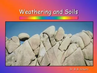
Subsidence and Soils Chapter 8
Learning Objectives Know what a soil is and the processes that form and maintain soils Understand the causes an effects of subsidence and volume changes in the soil Know the geographic regions at risk for subsidence and volume changes in the soil Understand the hazards associated with karst regions Recognize linkages between subsidence, soil expansion and contraction, and other hazards, as will as natural service function of karst Understand how humans interact with subsidence and soil hazards Know what can be done to minimize the hazard from subsidence and volume changes in the soil
Soil and Hazards Soil is often defined in different ways To soil scientists – soil is solid earth material that is altered bye physical, chemical and organic processes To engineers – soil is any solid earth material that can be moved without blasting Both definitions are important in earth science Studying soil helps in the evaluation of many natural hazards including: floods, landslides, and earthquakes Examining soils can also help to delineate natural floodplains, by differentiating between floodplain soils and upland soils Evaluating the ages of soil in landslides can help in determining the frequency of the landslides and thus assist in minimizing future impacts Studying soils has also be a tool in establishing the chronology of the earth material deformed by faulting, which helps in better calculations of recurrence intervals of earthquakes
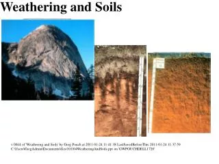
Soil and Hazards The development of a soil from inorganic and organic material is a complex process Weathering: the physical and chemical breakdown of rocks, is the first step in the development of soil Weathered rock is further modified by the activity of soil organisms into soil which is called either residual or transported, depending on where and when it has been modified- If the soil essentially stays in place and is modified to form a residual soil If the soil is picked by wind or water and then is modified it is a transported soil Soil is considered an open system that interacts with other components of the geological cycle Characteristics of a particular soil are a function of climate, topography, parent material (rock with the soil is formed), time (age of the soil), and organic processes (activity of soil organisms)
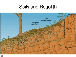
Soil Horizons O. Horizon is composed mostly of organic materials, including decomposed or decomposing leaves. Color of the horizon is often dark brown or black A. Horizon is composed of both mineral and organic materials. The color is often light black to brown. Leaching, defined as the process of dissolving, washing, or draining earth materials by percolation of groundwater or other liquids, occurs in the A horizon and moves clay and other material such as iron and calcium to the B horizon E. Horizon is composed of light-colored materials resulting from leaching of clay, calcium, magnesium, and iron to lower horizons. The A and E horizons together comprise the zone of leaching B.Horizon is enriched in clay, iron oxides, silica, carbonate or other material leached from overlying horizons. This horizon is know as the zone of accumulation C. Horizon is composed of partially altered (weathered) parent material; rock as shown here but the material could also be stained red with iron oxides R.Unweathered (unaltered) parent material • Soil Horizons are the vertical and horizontal movements of the materials in a soil system • These movements create layers or zones in the soil called the soil profile
Soil Color and Texture Color is one of the first things we notice about soil O and A horizons end to be dark because of their abundant organic material The E horizon, if present may be almost white owing to the leaching of iron and aluminum oxides The B horizon show the most dramatic differences in color, varying from yellow-brown to light red-brown to dark red, depending upon the presence of clay minerals and iron oxides Soil Color may be an important indicator of how well drained a soil is Well-drained soils are well aerated and iron oxidizes to a red color Poorly drained soils are wet, and iron is reduced rather than oxidized, leaving a yellow color This distinction is important because poorly drained soils are associated with environmental problems such as lower slope stability and inability to be utilized as a disposal medium for household sewage (septic tank or leach field)
Soil Color and Texture Soil Texture The texture of a soil depends upon the relative portions of sand, silt, and clay size particles Clay particles are less than .0004 mm in diameter Silt particles range from .0004 to .074mm in diameter Sand particles range from .074mm to 2.0 mm in diameter Those particles larger than 2.0 mm in diameter are called gravel, cobbles, or boulders. Depending on their size
Relative Soil Profile Development Geologists do not usually need to make a detailed soil description and analysis of soil data It is, however, important to recognize the differences among soil relative profile development. These are: A weakly developed soil profile is generally characterized by an A horizon directly over a C horizon, which may be oxidized, with no B horizon or it is weakly developed. These soils are usually only a few hundred years old but could be several thousand years old A moderately developed soil profile may consist of an A horizon overlying an argillic Bt horizon that overlies a C horizon. A carbonate Bk horizon may also be present but is not necessary for a soil to be considered moderately developed soils. These soils often date from at least the Pleistocene era (10,000 years ago) A well–developed soil profile is characterized by redder colors in the Bt horizon, more translocation of clay to the Bk horizon, and stronger structure. Well-developed soils very widely in age, with typical ranges between 40,000 and several hundred thousand year and older
Water in Soils When you analyze a block of soil, you will find it is composed of bits of solid mineral and organic matter with pore spaces between them. The spaces are filled with either air or liquids (mostly water). If all this spaces are filled with water it is said to be in a saturated condition, if not it is unsaturated Swampy areas are saturatedall year round, where in arid areas (like Utah) the soil is only saturated occasionally. The amount of water is called the water content or its moisture content. This is important in determining its engineering properties such as the strength of a soiland its potential to shrink and swell Water in soils may flow laterally or vertically through soil pores, which are the void spaces between grains, or in fractures produced as a result of soil structure. The flow is termed saturated flowif all the pores are filled with water and unsaturated flow when, as is more common, only part of the pores are filled
Soil Classification There are two types of soil classifications, those developed by soil scientist and those developed by engineers Scientific classification is called as Soil Taxonomy. This is based on the physical and chemical profile properties. This is set in an sixfold hierarchy: Orders Suborders Great Groups Subgroups Families Series
Soil Hierarchy Soil Orders around the Country
Soil Classification Engineers’ classification is called the Unified Soil Classification System. This classification is based on the makeup of soils and their connection to the hazards they may cause. This classification is: Coarse-Grained-Soils -- Mixtures of coarse particles (gravel and sand) Fine-Grained-Soils – Mixtures of fine particles (silt and clay) Organic Soils -- Organic Material (organic material)
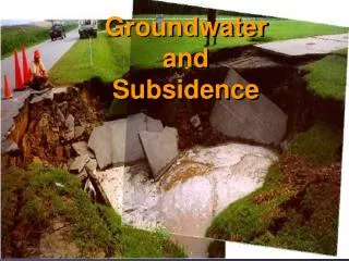
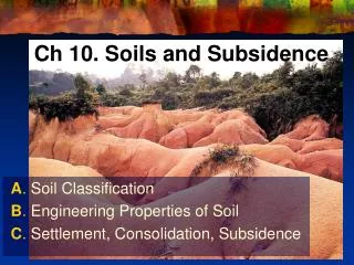
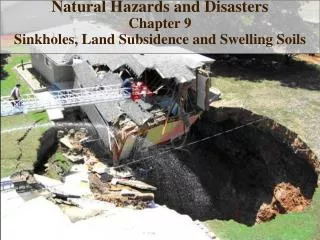
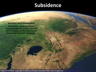
Subsidence and Soil Volume Change Subsidence is a type of ground failure characterized by earth materials It often produces circular surface pits, but if may produce linear or irregular patterns of failure Subsidence is commonly associated with the dissolution of soluble rocks, such as limestone, beneath the surface The resultant landscape has closed depressions and is known as karst topography Other major causes of subsidence includes the thawing of frozen ground and compaction of recently deposited sediment To a lesser degree, earthquakes and underground drainage of magma are also responsible for causing subsidence
Karst Karst is the name of a common landscape rock found in the United States, although not many people know its name. Areas of Texas, Alabama, Tennessee, and Missouri are built on karst land In this type of topography subsidence results from the dissolutionof rocks beneath the land surface. Dissolution occurs as percolating surface water or groundwater moves through rock that is easily dissolved. There are four common sedimentary rocks and one metamorphic rock which are easily dissolved. Rock salt, rock gypsum, limestone, dolostone and marble are easily dissolved Sink holes can be a result of this dissolution
Karst Karst is the name of a common landscape rock found in the United States, although not many people know its name. Areas of Texas, Alabama, Tennessee, and Missouri are built on karst land In this type of topography subsidence results from the dissolutionof rocks beneath the land surface. Dissolution occurs as percolating surface water or groundwater moves through rock that is easily dissolved. There are four common sedimentary rocks and one metamorphic rock which are easily dissolved. Rock salt, rock gypsum, limestone, dolostone and marble are easily dissolved Sinkholes can be a result of this dissolution
Karst Sinkholes may exist individually or develop in large numbers to form a pockmarked surface known as a karst plain Karst areas have other features developed by the chemical weathering of bedrock. In humid temperate climates, karst landscapes are characterized by beautiful rolling hills alternating with areas of subsidence and undisturbed land There are areas of large natural caves referred to as caverns Cave openings can be the site of disappearing streams where surface water goes underground, or where ground water comes out at the surface to for springs
Sinkholes In karst areas, sinkholes vary in size from on to several hundred meters in diameter and can open up extremely rapidly There are two types of sinkholes Solutional sinkholes -- formed by dissolution on the top of a buried bedrock surface and are the most common type of sinkhole Collapse sinkholes – develop by the collapse of surface or near-surface material into an underground cavern Same sinkholes have openings into subterranean passages that allow water to escape during a rainstorm Most however are filled with rubble that blocks any underground passages. Blocked sinkholes usually fill up with water forming small lakes
Sinkholes Formation of sinkholes Initial dissolution of soluble bedrock takes place along vertical and horizontal fractures, and some fractures become small caves Over geologic time, dissolution continues to enlarge fractures and some caves become caverns with roofs partly supported by groundwater Subsequent lowering of the ground water table removes the cavern roof support, and it falls into the cave to form a collapsed sinkhole. Collapse may occur only a few years after the groundwater table has lowered. The heavily fractured area of bedrock is dissolved to create a Solutional sinkhole
Cave Systems, Tower Karst, Thermokarst Cave Systems – As solutional pits enlarge and water moves downward through limestone, a series of caves or larger caverns may be produced – cave systems Mammoth Cave, Kentucky and Carlsbad Caverns, New Mexico Tower Karst – Large, steep limestone “towers” rising above the surrounding landscape are know as tower karsts. Most common in humid tropical regions, karst towers are residual landforms of a highly eroded karst Thermokarst – In polar regions or at high altitude, much of the soil and sediment is frozen year round, this is called permafrost. In these regions, if this permafrost begins to melt, the land under the sediment and soil can begin to subside. This is called a Thermokarst. Some of the warming of the world climate has melted large areas of the Arctic permafrost have melted and formed large areas of thermokarst.
Soil Volume Change Sediment and soil compaction Rapidly deposited fine sediment, soil and sediment cemented with soluble minerals, and organic-rich soil are all susceptible to subsidence. Fine sediment – with time, the amount of water between the particles is reduced and the sediment compacts. This is often found in river deltas. The subsidence of this sediment can amplified if the sedimentation is slowed Collapsible Soils – windblown dust deposits, referred to as loess, and stream deposits in arid regions are loosely bound with clay particles and water-soluble minerals. When these dry out rapidly, they stay dry, but if water ponds form on these soils the water will percolate down weakening the soil and collapse. This is called collapsible soil. Organic Soils – Some wetland soils formed in marshes, bog, and swamps contain large amounts of organic matter. These organic soils act as sponges and soak up water. When they dry out, they have a tendency to collapse
Loess Plateau Loess
Earthquakes and Underground Drainage of Magma Earthquakes: although we have looked at earthquakes and how they are associated with uplift, they can also cause subsidence. These subsidence episodes have happened all over the world. During a subduction earthquake like those with the North American plate, a strain builds up along the zone. During this strain, the ground on the plate actually “wrinkles” (or there is subsidence along the zone). When an earthquake happens the strain is released and the wrinkle snaps back up, leaving an area below that can subside. Underground Drainage of Magma- Subsidence can happen after an volcanic explosion. As the volcano erupts, the magma chamber is emptied. When the explosion is over, the empty magma chamber can collapse causing a subsidence of land
Expansive Soils and Frost Susceptible Soils Expansive Soils – changes in moisture conditions can produce substantial movement in some clay-rich soils. These soils shrink significantly during dry periods and expand or sell during wet periods. Clay, shale, and clay-rich soil contain smectite, a chemical that can cause the soil to expand or shrink The expansion and shrinking of the soil can cause structural damage to buildings built on the soil by breaking or cracking foundations Factors that can affect the moisture content are climate, vegetation, topography, and drainage. Frost-susceptible Soils – Freezing temperature of a long period of time can produce a great deal of expansion in silty soil. Silt soils that expand when frozen are called frost-susceptible soils When they freeze, they tend to heave or rise, causing cracks in foundations also
Effects of Subsidence and Soil Volume Change Expansive Soils – changes in moisture conditions can produce substantial movement in some clay-rich soils. These soils shrink significantly during dry periods and expand or sell during wet periods. Clay, shale, and clay-rich soil contain smectite, a chemical that can cause the soil to expand or shrink The expansion and shrinking of the soil can cause structural damage to buildings built on the soil by breaking or cracking foundations Factors that can affect the moisture content are climate, vegetation, topography, and drainage. Frost-susceptible Soils – Freezing temperature of a long period of time can produce a great deal of expansion in silty soil. Silt soils that expand when frozen are called frost-susceptible soils When they freeze, they tend to heave or rise, causing cracks in foundations also
Effects of Subsidence and Soil Volume Change Effects of Subsidence and Soil Volume Change Both karst formation and soil expansion and contraction cause significant economic damage each year. Karst regions are home to a host of problems such as sinkhole formation, groundwater pollution, and variable water supply Heaving in expansive and frost-susceptible soils often damage highways, building, and other structures
Effects of Subsidence and Soil Volume Change Sinkhole Formation Cause damage to highways, homes, sewage facilities and other structures Groundwater Conditions Karst development creates a geologic environment in which groundwater is intensively used by humans and wildlife and easily polluted Damage Caused by Melting Permafrost Thawing of the permafrost has caused roads to cave in, airport runways to fracture and so on Coastal Flooding and loss of Wetlands Flooding of coastal areas and destruction of wetlands are two major effects of subsidence in marine deltas and bays Damage caused by Soil Volume Change Expansive and frost-susceptible soils cause significant environmental problems
Linkages Between Subsidence, Soil Volume Change, and Other Natural Hazards As I mentioned before, subsidence can be a side effect of earthquakes, volcanoes, and climate change But, subsidence can cause other natural hazards. Some of these linkages are: Subsidence and flooding Soil expansion and contraction are tied to increased rates of mass wasting Rapid subsidence in areas where overpumping of ground water, flooding can be expected On sloping land surfaces, frost heaving and shrinking and swelling of clay interact with mass wasting, such as creep or uneven land surface Subsidence has direct linkages to climate change As we look around, subsidence is linked to many natural hazards
Natural Service Functions of Subsidence and Soil Volume Chance Although, subsidence and soil volume change cause many environmental and economic problems, there are also benefits from these processes.These are: Water supply: karst regions contain the worlds most abundant groundwater supply thus providing a critical world resource. About 25% of the world’s population either lives on or gets its drinking water from karst formations. Aesthetic and Scientific Resources: rolling hills, extensive cave systems, and beautiful formations of tower karst are among the aesthetic resources found in karst areas. Karst regions also provide scientists with a natural laboratory in which to study the record of climate change contained in cave formations Unique Ecosystems: caves are home to rare creatures especially adapted to live in the karst environment. Karst-dependent species know as troglobites have evolved to live in the total darkness of caves. Karst areas generally support a diverse cross section of species: preserving these areas, and hence these organisms for the future
Human Interaction with Subsidence and Soil Volume Change As we discussed, subsidence can both cause problems and provide benefits. When humans live in areas underlain with karst, compacting sediment and soil, permafrost, and expansive or frost-susceptible soil, previously existing problems are exacerbated and new problems arise. Humans contribute to these problem by: Withdrawing Subsurface Fluids: oil associated with natural gas and water, groundwater and mixtures of steam and water for geothermal power cause subsidence Underground Mining: Serious subsidence events have been associated with underground mining of coal and salt. Melting Permafrost: Humans contribute too the thawing of permafrost through global warming and poor building practices Restricting Deltaic Sedimentation: Marine deltas require continual addition of sediment to remain at or above sea level Altering Surface Drainage: Humans have altered surface drainage for agriculture and settlement for centuries, adding or subtracting water from the soil Poor Landscaping Practices: The shrinking and swelling of expansive soils are amplified by poor landscaping practices
Minimizing Subsidence and Soil Volume Change How can people understand and minimize the hazards related to subsidence and soil volume change. These steps will help people to understand and to minimize the effects: Artificial Fluid Withdrawal: the problems with subsidence when it comes to either underground mining of solid bedrock or the depletion of groundwater can be helped by more regulations on these activities. This has been tried, with little success Regulating mining: There are now laws in place around the world regulating subsurface mining, but there is still worry about old mines, which could still collapse Prevention of Damage from Thawing Permafrost: There needs to be better education about the fact that permafrost will melt if precautions are not taking when building upon it. Reducing Damage from Deltaic Subsidence: In areas of deltas where people live, levees and pumps must be used to stabilize the surface, but in undeveloped areas, levees should be breached to revitalize the water supply to the deltas and allow the deltas to begin to grow again. Managing Drainage of Organic and Collapsible Soils: By restoring proper water management of existing drainage to marshes and swamps, future subsidence can be minimized. For collapsible soils, it is especially important to limit irrigation and modify the land surface so that water doesn’t pond near buildings Prevention of Damage from Expansive Soils: Proper design of subsurface drains, rain gutters, and reinforce foundations can minimize the damage that expansive soil can do.
Perception of and Adjustment to Subsidence and Soil Volume Change Perception of Subsidence and Soil Volume Change: Because subsidence, expansion, and contraction of soil are natural hazards that don’t get a lot of press, few people are really concerned about them. But those who are directly affected by these occurrences, understand the hazards. Adjustment to Subsidence and Soil Volume Change: The best way too adjust to these hazards is to avoid building in areas prone to these hazards. That is not always possible, but if high risk areas are identified, prohibited, or limited to use, the hazards could be limited. Unfortunately, it is often hard to predict where and when one of the occurrences may happen.
Perception of and Adjustment to Subsidence and Soil Volume Change These are some ways we can investigate the geology to help understand where these hazards may exist. Geologic and Soil Mapping: Detailed geologic and oil maps can be made to identify the hazards present Surface Features: In areas underlain by limestone, surface features such as cracking of the land surface should be noted. These may note the collapse of a sinkhole is imminent Subsurface Surveys: when planning to build, there should be a subsurface exploration made with a ground penetrating radar and boreholes drilled to examine the geological structure. This will allow for the proper foundations to be designed.