Download
1 / 37
370 likes | 509 Views
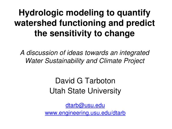
Hydrologic modeling to quantify watershed functioning and predict the sensitivity to change A discussion of ideas towards an integrated Water Sustainability and Climate Project. David G Tarboton Utah State University dtarb@usu.edu www.engineering.usu.edu/dtarb. Outline. Some philosophy

E N D
Hydrologic modeling to quantify watershed functioning and predict the sensitivity to change A discussion of ideas towards an integrated Water Sustainability and Climate Project David G Tarboton Utah State University dtarb@usu.edu www.engineering.usu.edu/dtarb
Outline • Some philosophy • Question driven • Appropriate simplification • An example • A framework for thinking about water balance and change • Concluding thoughts
My Research Focus Advancing the capability for hydrologic prediction by developing models that take advantage of new information and process understanding enabled by new technology. • Hydrologic Information System • Terrain Analysis Using Digital Elevation Models • Climate Change Impacts on Hydrology and Stream Ecology • Snow melt modeling • Modeling the impacts of land cover change on streamflow • The Great Salt Lake • Trends in Streamflow
The questions that we ask as scientists shape everything that follows. They can lead us to see the world in new ways, or mundane ones. They can spur the development of new approaches, or the recyclingof established ones. They can focus our attention in useful directions, or leave us wandering aimlessly.
WATERS Network: How can we protect ecosystems and better manage and predict water availability and quality for future generations, given changes to the water cycle caused by human activities and climate trends? http://www.watersnet.org/docs/WATERS_Network_SciencePlan_2009May15.pdf
Protect ecosystems and better manage and predict water availability and quality Grand Challenges Engineering: Integration of built environment water system Social Sciences: People, institutions, and their water decisions Hydrologic Sciences: Closing the water balance WATERS Network science questions How is fresh water availability changing, and how can we understand and predict these changes? How can we engineer water infrastructure to be reliable, resilient and sustainable? How will human behavior, policy design and institutional decisions affect and be affected by changes in water? Resources needed to answer these questions and transform water science to address the Grand Challenges Measurement of stores, fluxes, flow paths and residence times Synoptic scale surveys of human behaviors and decisions Water quality data for water throughout natural and built environment Observatories, Experimental Facilities, Cyberinfrastructure http://www.watersnet.org/docs/WATERS_Network_SciencePlan_2009May15.pdf
From the Preface: • I explore and evaluate the biophysical relationship between ambient climate and the form and function of the associated vegetation • Land surface atmosphere boundary conditions are “interactive” • Theoretical generation of these atmospheric boundary conditions which are necessarily highly idealized • Monteith (1981) “progress can be made only if the number of variables is held to a minimum” • Many details neglected • XXX may find approach naïve and be offended • YYY may welcome the reduction of an intricate multidisciplinary problem to a small set of simple, albeit approximate rules • In multidisciplinary endeavors, all the rich scientific detail of each contributing field can’t be retained in their joining, lest the resulting complexity negate the utility of the result
We need to strike a tractable balance in the representation of process complexity (from different disciplines) • Building an integrated model (and associated data/information system): • is a way to encode and encapsulate knowledge and test hypotheses • is a way to formalize communication across disciplines • is a journey in research • is a process of discovery • should involve frequent iteration and adaption
Example: A distributed catchment-scale water resources planning model The Water Resources Inventory Area 1 (WRIA 1) Nooksack hydrologic model for decision support
Integrated model of Hydrologic, Water Management and Consumption processes at each “catchment” • Competition for water resources among users • Human activities can alter water balance having effects on stream ecosystems and water quality • Simulation modeling used to quantify the likely impacts of water management choices
Rainfall – Runoff Transformation • Enhanced TOPMODEL (Beven and Kirkby, 1979 and later) applied to each subwatershed model element. • Kinematic wave routing of • subwatershed inputs through • stream channel network. • Vegetation based • interception component. • Modified soil zone • Infiltration excess • GIS parameterization
q1 ,, q2 , &yf f & K … Soil derived parameters Zone Code Polygon Layer Depth weighted average Soil Grid Layers Joined to Polygon Layer Exponential decrease with depth Soil parameter look up by zone code Table of Soil Hydraulic Properties – Clapp Hornberger 1978
Historic (pre-settlement) Vegetation derived parameters Existing
Distributed Energy Balance Snowmelt Model Luce, C. H. and D. G. Tarboton, (2004), "The Application of Depletion Curves for Parameterization of Subgrid Variability of Snow," Hydrological Processes, 18: 1409-1422, DOI: 10.1002/hyp.1420.
Water Management • Uses • Irrigation • Soil moisture demand driven • Non Irrigation • Per capita driven • Diversions • Sources • Reservoir • Groundwater • Stream • Withdrawal limited by availability and right priority Agriculture Urban Stream Reservoir Groundwater
The impact on streamflow of present land use Figure 4. Ratio of simulated existing streamflow with no water management to simulated historic streamflow, 30 year average over the years 1961-2005 at each node of the WRIA 1 surface water quantity model.
The impact on streamflow of present water management and use Figure 19. Ratio of simulated streamflow under existing conditions to simulated streamflow under existing conditions without water management.
Figure 24. Streamflow at ProjnodeID=164, Drainage 87, Deer Creek. Figure 25. Existing conditions simulation of user withdrawals from Deer Creek Drainage (Drainage 87)
Existing and Full Build Out scenario simulations of Lake Whatcom active storage. Discharge from Lake Whatcom (Node 246).
Figure 35. Simulated Historic, Existing and Full Build Out Bertrand Creek Streamflow (ProjNodeID=515)
Figure 12. Flow duration curves for October and March in Bertrand Creek
Impact on Water Balance Deer Creek cumulative water balance components simulated under Historic and Existing conditions without water management.
Impact of a trans-basin diversion Streamflow at ProjnodeID=185, Drainage 109, location of Middle Fork Diversion Streamflow at ProjnodeID=519, Drainage 163, location where Middle Fork Diversion discharges into Anderson Creek.
The impact on streamflow of future development Ratio of mean streamflow simulated under Full Buildout conditions to mean streamflow simulated under existing conditions.
We need to understand the overall functioning of coupled natural and human system water systems
E=R Energy limited upper bound E=P Water limited upper bound Q/P Humid Arid Energy Limited Water Limited A general framework for thinking about the overall water balance and change impactsS=P-Q-E P=Q+E E/P 1 Evaporative Fraction R/P Dryness (Available Energy /Precip) Following Budyko, M. I., (1974), Climate and Life, Academic, San Diego, 508 p.
Retention or Residence time E/P E = R : energy limited upper bound large medium small E = P : water limited upper bound 1 Evapotranspiration fraction R/P arid humid energy limited water limited Dryness (available energy /precip) Budyko [1974] partitioning of input water P into the evapotranspiration fraction, E/P, the residual of which is discharge Q. Dryness or aridity is quantified in terms of R/P. As dryness increases, the evapotranspiration fraction increases. For the same R/P the evaporative fraction is greater when retention is greater as retained water has more opportunity to evaporate or transpire.
Milly/Budyko Model – Framework for predictions and hypothesis testing Q/P Increasing variability in soil capacity or areas of imperviousness Increasing Retention/Soil capacity Increasing variability in P – both seasonally and with storm events Precise observations of Precipitation, Runoff, Soil Moisture, Energy Balance, Water Storage required to discriminate among these hypotheses Milly, P.C.D. and K.A. Dunne, 2002, Macroscale water fluxes 2: water and energy supply control of their interannual variability, Water Resour. Res., 38(10).
Uncalibrated Runoff Ratio Low • Explains 88% of geographic variance • Remaining 12% difference is consistent with uncertainty in model input and observed runoff High Milly, P. C. D., (1994), "Climate, Soil Water Storage, and the Average Annual Water Balance," Water Resources Research, 30(7): 2143-2156.
Some suggestions for working together to solve regional water problems • Pick a place. Synergy from multiple studies in a common location. • Compelling Science. • Societal importance. • Shared data systems. • Long term commitment.
B E A R R Bear BEAR R W E B E R R O J R Weber D A N West Desert R Jordan/Provo Solar Radiation Development, Growth, Water Resources Management Air Temperature GSL System Precipitation Air Humidity Mountain Snow pack Land Cover Land Use Lake Evaporation GSL Level, Volume, & Area Streamflow Surface Salinity & Temperature Watershed Evapotranspiration Pumping Soil Moisture And Groundwater GSL Salt Load
Summary thoughts on stimulating interdisciplinary water science collaboration • Communication • Enabling Technology • Putting data in the system should make an individual researchers job easier • Enhance sharing by enabling analysis otherwise not available • Maps and Geographic Information Systems are important for synthesis • Advancement of water science is critically dependent on integration of waterinformation