Download
1 / 28
330 likes | 736 Views
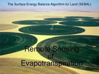
E STIMATION OF EVAPOTRANSPIRATION BY SATELLITE REMOTE SENSING BY SURFACE ENERGY BALANCE . Er. V.GOWRI M.E., Ph.D., ASSISTANT ENGINEER WATER RESOURCES ORGANISATION PUBLIC WORKS DEPARTMENT TAMILNADU INDIA. Email : gowrisenthilkumar@gmail.com. ET estimation by Surface Energy Balance.

E N D
ESTIMATION OF EVAPOTRANSPIRATION BY SATELLITE REMOTE SENSING BY SURFACE ENERGY BALANCE Er. V.GOWRI M.E., Ph.D., ASSISTANT ENGINEER WATER RESOURCES ORGANISATION PUBLIC WORKS DEPARTMENT TAMILNADU INDIA. Email : gowrisenthilkumar@gmail.com MAPINDIA 2008
ET estimation by Surface Energy Balance Overview ………. • Evapotranspiration • Energy Balance • Process of SEBAL • Limitations MAPINDIA 2008
Evapotranspiration = Evaporation + Transpiration Knowledge of ET Is critical for irrigation management Effective utilisation of water Manage the scarce resource Water Balance coomputations Performance Studies WHAT IS EVAPOTRANSPIRATION? MAPINDIA 2008
METHODS TO ESTIMATE ET • Potential /Reference ET • Temperature based methods • Radiation Based Methods • Combination • Pan Measurement • Actual ET • Water Balance Approach • Energy Balance Approach MAPINDIA 2008
Why Satellites? • Conventional method for ET: • Meteorological data are gathered from point measurements • ET calculations assumed to extrapolate over large areas • Data collection might be difficult or impossible • Satellite imagery: • energy balance is applied at each “pixel” to map spatial variation of ET • little or no ground data are required • Indirect estimates of required data MAPINDIA 2008
Surface Energy Balance Algorithm for Land (SEBAL) • Developed by Dr. Wim Bastiaanssen, WaterWatch, a scientific advisory firm, Wageningen, The Netherlands • Calculates energy exchanges between land and atmosphere using remote sensing and physical models. • The key input data: • spectral radiance in the visible, • near-infrared and • thermal infrared • Output: The actual (ETact) • SEBAL computes a complete radiation and energy balance along with the resistances for momentum, heat and water vapour transport for every individual pixel. MAPINDIA 2008
WHY USE SEBAL • ET via Satellite using SEBAL can provide dependable (i.e. accurate) information • ET can be determined remotely • ET can be determined over large spatial scales • ET can be aggregated over space and time MAPINDIA 2008
Satellite Compatibility • SEBAL needs both visible and thermal bands • SEBAL can use images from: • Landsat (30 m, each 8 or 16 days) • NOAA-AVHRR(Advanced Very High Resolution Radiometer) (1 km, daily) • MODIS(Moderate Resolution Imaging Spectroradiometer) (500 m, daily) • ASTER (Advanced Spaceborne Thermal Emission and Reflection Radiometer) (15 m, 8 days) MAPINDIA 2008
ET Estimation applied in Periyar Vaigai System with LANDSAT 7 ETM+ for the date 15, May 2001 Data Used MAPINDIA 2008
Image Processing ERDAS Imagine used to process Landsat images • SEBAL equations programmed and edited in Model Maker function MAPINDIA 2008
R H n ET ET = R - G - H n G Energy Balance for ET ET is calculated as a “residual” of the energy balance Basic Truth: Evaporation consumes Energy The energy balance includes all major sources (Rn) and consumers (ET, G, H) of energy MAPINDIA 2008
LE LE = Rn - G - H Rn Where, Rn = Net radiation G = Soil heat flux LE = Latent heat flux H = Sensible heat flux H G • Energy conservation (Incoming Energy = Outgoing Energy) • Only vertical fluxes considered • Minor energy components ignored MAPINDIA 2008
Satellite Image Landsat 7 ETM+ Radiation Balance for the Land Surface NDVI Heat Balance for the Land Surface Net Radiation Soil Heat Flux Sensible Heat Flux Evapotranspiration Flow Chart of SEBAL MAPINDIA 2008
Net Radiation Balance Shortwave Radiation Longwave Radiation RL (1-eo)RL (Incident longwave) (reflected longwave) aRS RL RS (emitted longwave) (Reflected shortwave) (Incident shortwave) VegetationSurface Net Surface Radiation =Gains–Losses MAPINDIA 2008
Net Surface Radiation Model MAPINDIA 2008
Input to determine Surface Net Radiation Surface Albedo NDVI Surface Emmisivities Surface Temperaure Surface Albedo image NDVI Image MAPINDIA 2008
Net Radiation Surface Temperature image Net Radiation image MAPINDIA 2008
Soil Heat Flux Soil Heat Flux is rate of heat storage into soil and vegetation due to conduction Soil heat flux: empirically calculated as a G/Rn fraction, using: • Ts Surface Temperature • Surface Albedo • Vegetation Indices MAPINDIA 2008
Soil Heat Flux Model MAPINDIA 2008
Soil Heat Flux Soil Heat Flux image MAPINDIA 2008
H rah Sensible Heat Flux • Sensible Heat Flux is rate of heat loss to the air by convection and conduction due to temperature difference • dT= the near surface temperature difference. • rah = the aerodynamic resistance to heat transport z2 dT z1 MAPINDIA 2008
Iterative Process for H MAPINDIA 2008
Sensible Heat Flux MAPINDIA 2008
Sensible Heat Flux Sensible Heat Flux image MAPINDIA 2008
ET Image ET Instantaneous image MAPINDIA 2008
Conclusions • ET Estimation essential for crop water consumption • Irrigated crop performance can be estimated from evapotranspiration • 3. One has to be aware, however, with the accuracy of the retrieved parameter and the limitations of the methods. MAPINDIA 2008
Limitations of SEBAL • Spatial and temporal resolution • Availability of cloud-free images • Presence of extreme Ts pixels (hot and cold pixel) in the imagery • Information for validation • Data processing time– ET map should be delivered within hours (real time)… MAPINDIA 2008
THANK YOU MAPINDIA 2008