Download
1 / 31
350 likes | 768 Views
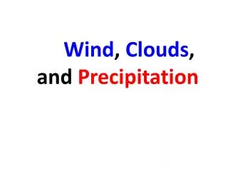
Rain, clouds and wind. This week . 1. How do we get rain? 2. What are the clouds called (and what might we expect when we see them?) 3. How can we tell how windy it is without an anemometer?. You remember we talked about the water cycle?. The water cycle. When it is very hot and damp

E N D
This week .. • 1. How do we get rain? • 2. What are the clouds called (and what might we expect when we see them?) • 3. How can we tell how windy it is without an anemometer?
When it is very hot and damp – like in the Amazon rainforest every day – and just occasionally in the UK, when the weather is REALLY hot there is rainfall in the afternoon after a sunny first part to the day. Why? Sun warms the soil, and water evaporates The air above warms and rises with the water vapour As the air rises, it cools Convectional rainfall
Cool air can hold less water vapour than warm air Some of the water vapour turns into drops of water and these group together as clouds More and more drops of water join together into big drops which fall back to earth as they are too heavy to float in the air Often there is thunder and lightening too Convection rainfall In the Amazon, this happens nearly every afternoon at about 4 o'clock
This what convection rainfall looks like This is a cumulonimbus cloud See later
Formation of Relief Rainfall Occurs in the mountains on the west coast of Britain Evaporation of water from the ocean
Formation of Relief Rainfall Occurs in the mountains on the west coast of Britain Onshore moisture laden winds Evaporation of water from the ocean
Formation of Relief Rainfall Occurs in the mountains on the west coast of Britain Air cools down Onshore moisture laden winds Mountains on the west coast of Britain forces the air to rise Evaporation of water from the ocean
Formation of Relief Rainfall Water vapour Condenses to form clouds Further cooling leads to precipitation Air cools down Onshore moisture laden winds Mountains on the west coast of Britain forces the air to rise Evaporation of water from the ocean
Formation of Relief Rainfall Water vapour Condenses to form clouds Air cools down Onshore moisture laden winds Air moving down the mountain, gets warmer and so reabsorbs any remaining water vapour. NO MORE RAIN Evaporation of water from the ocean
Relief Rainfall • Air is forced to rise and cools by 1°C per 100m. • As the water vapour in the air condenses, it forms clouds and rains. • The air starts to descend and begins to warm up again. • As air warms up, it can hold more water vapour - clouds disappear and rain stops. This side is known as a RAINSHADOW. Relief rain is formed when air is forced to cool as it rises over relief (height) features in the landscape (hills or mountains).
2400 2000 1600 1200 800 400 1200 800 400 Rain shadow map Grampian Mountains Dundee Fort William
2400 2000 1600 1200 800 400 1600 1200 800 400 1200 1200 800 800 400 400 Rain shadow map Grampian Mountains Dundee Fort William Pennines Buxton Lincoln
2400 2000 1600 1200 800 400 1600 1600 1200 1200 800 800 400 400 1200 1200 1200 800 800 800 400 400 400 Rain shadow map Grampian Mountains Dundee Fort William Pennines Buxton Lincoln Eastbourne Ashburton Dartmoor
This method of cloud classification was proposed by Luke Howard (1803) who named the clouds based on their form: • Cirrus - curl • Stratus - layer • Cumulus - heap • Nimbus - rain • and on their height:
Cirrus & cirrostratus • The most common form of high-level clouds are thin and often wispy cirrus clouds. • Typically found at heights greater than 6,000 meters, • Cirrus clouds are composed of ice crystals that originate from the freezing of supercooled water droplets. • Cirrus generally occur in fair weather and point in the direction of air movement at their elevation.
Altocumulus • Altocumulus may appear as parallel bands or rounded masses. • Typically a portion of an altocumulus cloud is shaded, a characteristic which makes them distinguishable from the high-level cirrocumulus. • They are often come before a cold front which usually carries rain with it. • Or altocumulus clouds on a warm and humid summer morning is commonly followed by thunderstorms later in the day.
Nimbo-stratus • Nimbostratus are dark, low-level clouds at a height of 2,000 meters • Nimbo meaning rain and stratus meaning layer gives continuous not-very-heavy rain • However, when temperatures are cold enough, these clouds may also contain ice particles and snow.
Stratocumulus • Stratus is a layer and cumulus means heap • So the clouds form a layer of heaps, and can give quite heavy showers, but they do not usally last too long • They vary in colour from dark grey to light grey and may appear as rounded masses, rolls, etc., with breaks of clear sky in between.
Fog • Fog is the lowest cloud of all!
Fair weather Cumulus • These are know as fair weather cumulus ( heaps) small white like cotton wool balls • They have flat bottoms which are quite low down and a smallish heap of white cloud above
You may sometimes see one of thesecumulonimbus • The bottom is flat and black, often with the rain already falling out of it in huge drops. • Quite often there is thunder and lightening • The ‘heap’ part reaches high into the sky – often to the level of the cirrus clouds
What am I thinking of? • There is a layer of light grey lowish cloud. I cannot see the sun but at least it is not raining • It is a lovely warm sunny morning but there are small blobs of cotton wool clouds in the sky. What are they called? What might happen later on? • There are little wispy strands high in the sky – what are they called? • Oh dear! There is a huge mountain of a cloud going right up into the sky. It has a VERY dark grey base. What is it called? What might happen soon?
The Beaufort scale was thought up in 1805 by sir Francis Beaufort. It is still used today. These three versions of it were taken from three web sites: ‘Castle Kites’, ‘Macfarlane Wind Turbines’ and the ‘US Search and Rescue Task Force’. • Questions: • Which of these versions do you prefer and why? • Why did these three websites have pictures of the Beaufort scale? • What other groups of people would be interested in the Beaufort scale? • According to the Beaufort scale, what is the wind speed today?
Homework: it says • Record the cloud types and the wind over 5 days • [We have another delayed homework – I do not need it until Monday] • Cloud type: I have left space for a small drawing in Paint or you may like to take a picture and paste it in VERY small – if so you may need to email as it might not upload. (You do not have to do either)